End of week system poses flooding threat to mid-Missouri
Just last weekend, northern portions of mid-Missouri picked up nearly 4” of rain from rounds of severe storms that pushed through the area. To close out this week, we’re looking at yet another set up that will be bringing several rounds of storms and widespread rainfall to the viewing area.

Before last weekend, most of mid-Missouri was in need of rain as we had been in a rain deficit. Now, portions along and north of I-70 have broken even with climatic norms, while southern areas of mid-Missouri are still nearly 2” short of the amount of average accumulated rainfall for the end of June.
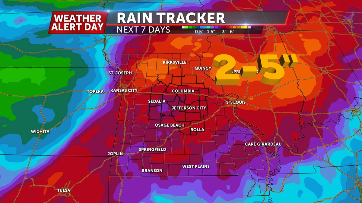
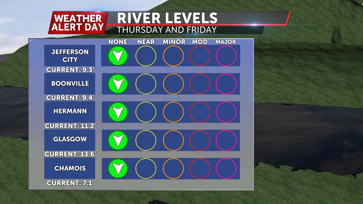
With plenty of moisture on hand as this system approaches, we’re expecting anywhere from 2-5” of rain across the area within the next week. The bulk of this precipitation will fall by the end of the weekend. We currently have no rivers near flood stage, and the National Weather Service hydrologic outlook is not calling for any river flooding. That being said, some minor waterways are expected to be overwhelmed, leading to flash flooding.
Rain will stick around until the end of the weekend as that frontal boundary stalls just to our south. Avoid low lying waterways this weekend, and always turn around and don't drown.
