
QUESTION OF THE DAY: Will the coming heat wave alter your behavior?
Things are about to get pretty hot in Mid-Missouri.
Continue Reading Things are about to get pretty hot in Mid-Missouri.
Continue Reading
We’re coming off a stormy spring across Mid-Missouri ahead of another expected warmer than average summer. Monthly average temperatures this past spring were anywhere from 2-5 degrees warmer than normal, and we finally busted out of the drought area-wide with near average rainfall. Severe weather reports were much more frequent than normal, with 92 reports
Continue Reading
TONIGHT: Mostly clear and cool with lows in the mid-50s. TOMORROW: Mostly sunny and beautiful with highs near 80. EXTENDED: Northwest upper flow keeps us cool through tomorrow with highs just under our seasonal average, but upper high pressure building out west will move in our direction by mid-week, allowing temperatures to increase as winds
Continue Reading
Tuesday will be bright yet again with a high UV index, as sunburn time will be around 20 minutes. Pollen levels increase midweek as winds pick up from the south.
Continue Reading
THIS MORNING: Mostly clear and cool starting in the mid-upper 50s. Patchy fog is possible to the south where the heaviest rain fell over the weekend. TODAY: Mostly sunny and comfortable with low humidity and highs in the upper 70s. The UV index reaches very high levels that can cause sunburn in under a half
Continue Reading
TONIGHT: Mostly clear and cool with areas of patchy fog. Lows in the mid-upper 50s. TOMORROW: Mostly sunny and comfortable with low humidity and highs in the upper 70s. EXTENDED: After a wet Saturday night, we have cleared out completely across Mid-Missouri with northwest upper flow continuing into the first part of next week. That
Continue Reading
The UV index will be high to start the week with plenty of sunshine on Monday. Pollen levels will be steady all week with grasses as the primary allergen.
Continue Reading
TODAY: Showers linger behind storms that developed overnight. Showers will be widespread south of I-70 through the morning, and then taper by late morning, leaving most dry and clearing by noon. TONIGHT: After a viewable sunset, we’ll be mostly clear overnight, with temperatures falling into the 50s with a light north breeze. EXTENDED: Humidity will
Continue Reading
BLOG: The ABC 17 Stormtrack Weather Team has issued a Weather Alert Day for the potential of severe storms tonight. Storms have begun to form, and there is a severe thunderstorm watch in effect until 1 a.m. for our southern counties. These will continue to move east and gradually south throughout the rest of the
Continue Reading
TONIGHT: I’m tracking increasing strong to severe storm potential to the south of Highway 50 after 5 pm. This is why an ABC 17 Stormtrack Weather Alert Day has been issued from 5 pm tonight to 6 am tomorrow morning. Large hail and damaging winds will be the main concern throughout the evening hours, although
Continue Reading
After rainfall and cloud cover exit the region in the morning, a mostly sunny afternoon is expected throughout mid-MO. This means a UV Index of 9 is expected, and indicates that it will only take 20 minutes to receive a sunburn without proper protection. Pollen levels will be medium for the next couple of days.
Continue Reading
TODAY: Showers from passing thunderstorms linger early this morning, but generally drier time ensues by 9 a.m. Then, spotty showers will be possible through the rest of the morning and early afternoon. By late afternoon, we’re tracking a better chance for thunderstorms. We’ll be warm and humid with temperatures in the mid-80s feeling more like
Continue Reading
Saturday sees a UV index level 3 with scattered showers and storms.
Continue Reading
TONIGHT: Overnight lows cool to the mid-60s as showers and storms roll through during the late overnight hours closer to 2 AM. Isolated strong winds and hail remain the primary threats with moderate downpours. TOMORROW: Saturday morning continues to see showers and storms passing through with a little bit of dry time throughout the late
Continue Reading
With a heat dome taking full force over the west, some areas are seeing more impacts than others. This is because of something known as the “Urban Heat Island Effect.” Urban Heat Islands are metropolitan places that are hotter than their outlying areas, and the impacts are most felt during summer months. This is because
Continue Reading
TODAY: I’m tracking a mostly sunny afternoon with temperatures reaching into the upper 80s. Clouds will increase throughout the later afternoon and evening as a decaying storm system approaches from the west. These storms will have a low severe threat, with wind gusts up to 60 mph and hail stones up to 1″ in diameter
Continue Reading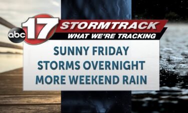
TODAY: Sunshine and and west to southwest winds will have us warmer today, in the upper 80s. TONIGHT: Clouds increase this evening, ahead of showers and storms. Some showers and weak thunderstorms may develop as soon as 6-7 p.m. in the west. This moves in on the nose of some strong low level winds that
Continue Reading
TONIGHT: Mostly clear and comfortable with lows in the upper 50s. TOMORROW: Mostly sunny and warm with highs in the mid-80s. Storms roll in from the north after sunset. EXTENDED: Low humidity continues through Friday with westerly winds, but it will be a warm afternoon as highs get up into the mid-80s thanks to a
Continue Reading
Mid-Missouri has seen sunny skies and near average temperatures the past 24 hours caused by a overhead high pressure. The same can not be said for portions of the southwestern United States as dangerous heat as taken a hold. Things look quiet thanks to a high pressure system keeping moisture away from the region as
Continue Reading
The UV index will be high yet again on Friday with lots of sunshine in the forecast. Tree and grass pollens will be high Friday and again by the end of the week.
Continue Reading