WINTER WEATHER SPECIAL: Tracking a warmer and drier winter ahead
The first blast of cold air has visited Mid-Missouri, setting the stage for the winter ahead.
We're coming off a warm winter 2023-24 with less snow than normal. Columbia recorded about 8.5 inches of snow and we tied for the least snowy February on record. Despite the warm and less snowy winter, spring and summer featured plenty of active weather with dozens of tornadoes across the state and periods of flooding.
The stormier pattern can be attributed to El Nino, a global pattern marked by warmer-than-normal ocean temperatures that typically gives us warmer and wetter winters. This year, there's a high chance the pattern will shift to La Nina, as cooler ocean temperatures settle in and disrupt the global air flow. That said, the La Nina is expected to be weak, meaning the ocean temperature departure from baseline won't be drastic.
With La Nina, the polar jet stream typically aligns with the Pacific jet, bringing more moisture and active weather to the Pacific Northwest and the Ohio Valley. Temperatures and precipitation tend to be more variable in our area versus warmer and drier across the South.

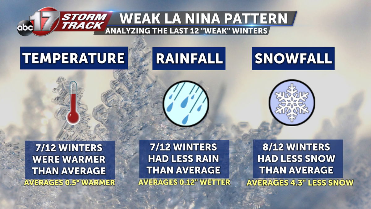
I took a look at the last 12 weak La Nina events. Our most recent weak La Nina was the winter of 2022-23, and that ended up 6 degrees warmer than normal with less than 5 inches of snow. That's about 10 inches below our seasonal average for December through February. Those weak La Nina events tended to be warmer than average with less snow than normal. Seven out of 12 of those years featured less than average rain, too.
Along with the pattern shift, we're also keeping an eye on the polar vortex. It has been unusually weak since October, a sign that we could potentially see impacts into the coming months. Snow across Siberia can contribute to a weaker polar vortex, and we're already seeing good coverage around the Arctic Circle as of mid-November.


A strong polar vortex will stay circular and centered around the north pole, whereas a weaker polar vortex will appear more wavy. A disrupted polar vortex could send some of those cold air intrusions our way, giving us short stints of frigid temperatures.
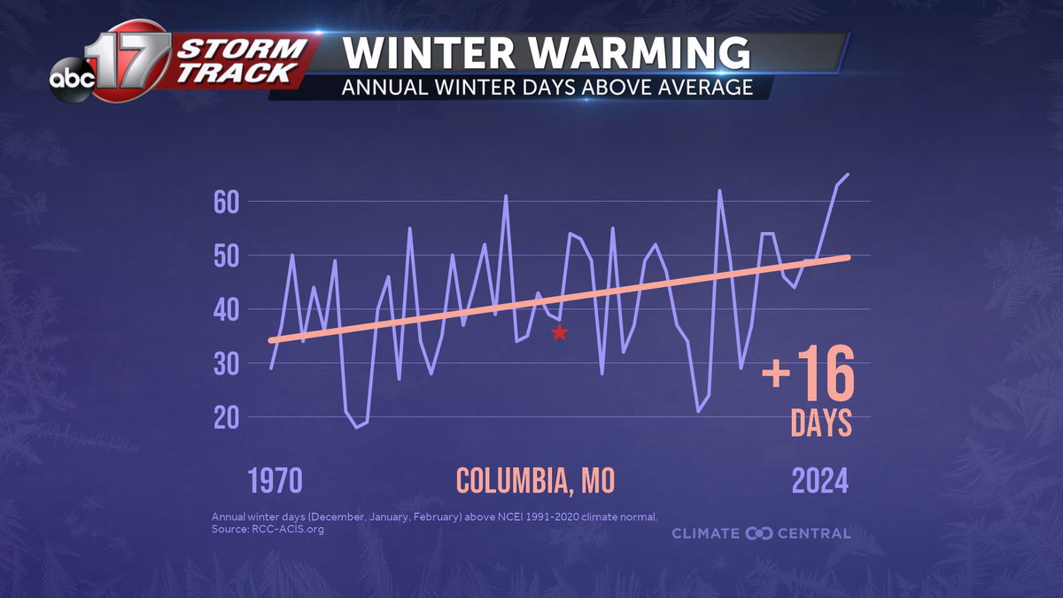
Mid-Missouri usually averages around 15 inches of snow with an average temperature of 32 degrees over those three months. Over the last several decades, winter has become the fastest warming season with an increase of 16 more days above average since 1970. The average winter temperature in Columbia has increased 5.5 degrees in that same time frame.
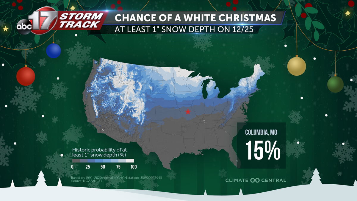
The 12 days of Christmas from Dec. 25 through Jan. 5 have warmed more than 6 degrees in 50 years, and Columbia typically has a 15% chance of seeing a white Christmas.
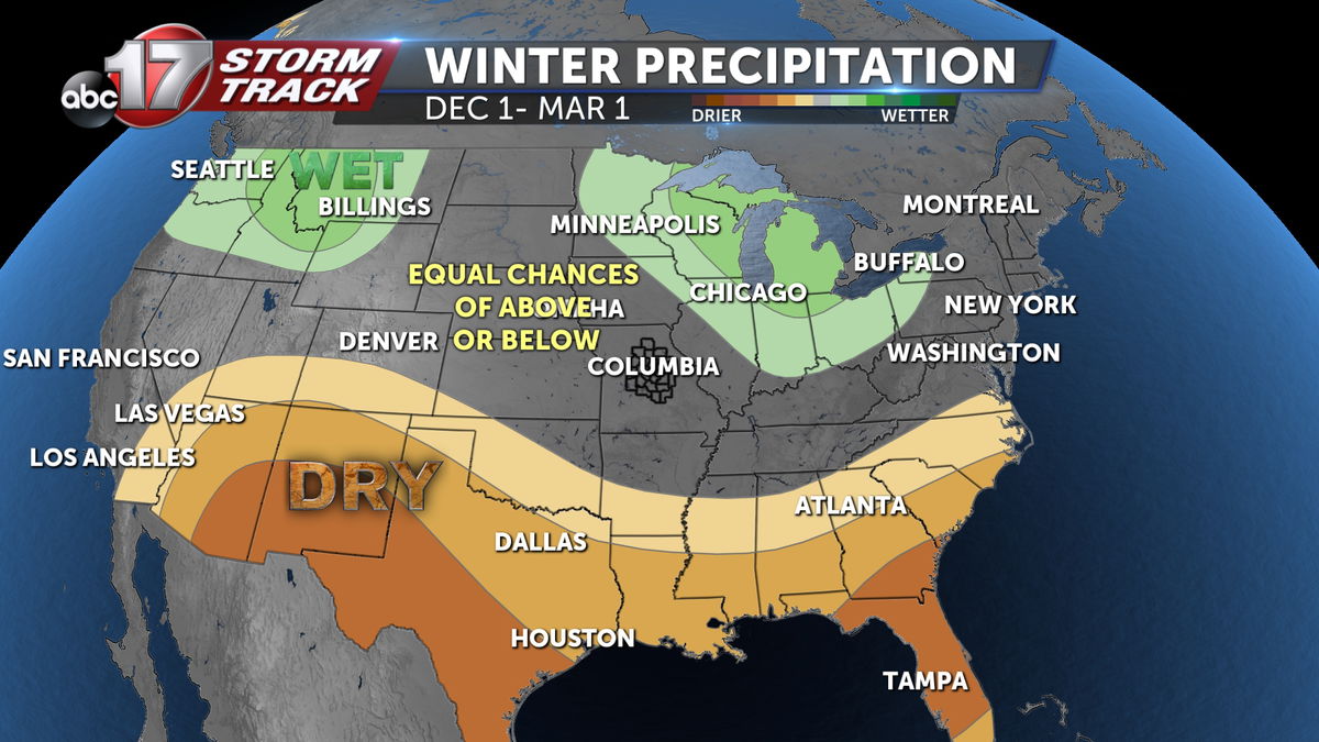
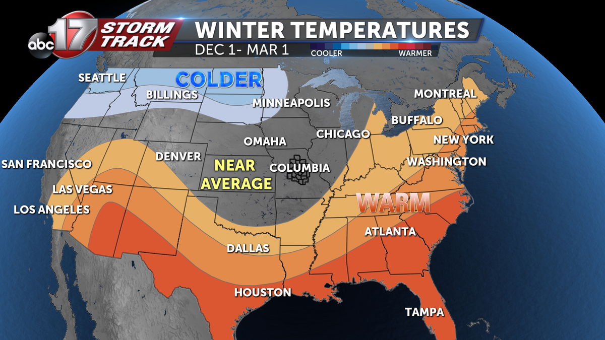
NOAA is predicting equal chances of above or below-average temperatures for the upcoming winter, with wetter-than-average conditions just to our northeast across the Great Lakes. Despite making up for some rain deficit in November, drought conditions look to stick around through winter.
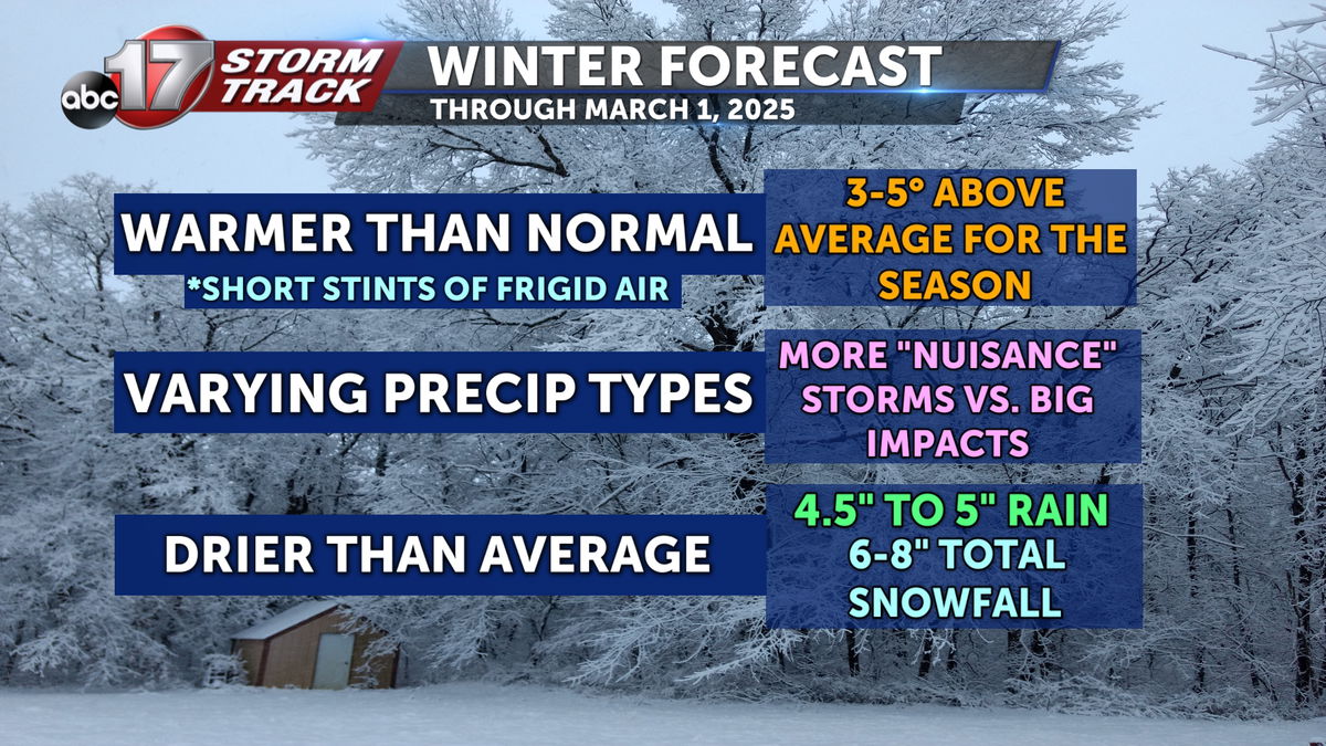
I'm tracking warmer than normal temperatures through February with about a 3-5 degree temperature increase from normal. We'll probably have a few short stints of frigid wind chills due to the weak polar vortex. Expect nuisance storms with low snow totals or mixed precipitation types and less snow than average. I'm thinking a range between 6-8 inches is most likely.
Be sure you're prepared for the winter ahead with the ABC 17 Stormtrack weather app. There you'll find all of our forecast videos, blogs, radar, and up to the minute alerts as they're issued.
