Extreme drought expands in parts of Missouri as autumn colors fade

The newest Drought Monitor, released Thursday, doesn't look good for fall foliage. After a brief round of mid-month rain, drought only receded slightly, and even increased in some places.
The U.S. Drought Monitor is released every Thursday and includes data through the preceding Tuesday. That means if rain falls on a Tuesday or Wednesday, it isn't reflected until the following week, more than 7 days later.
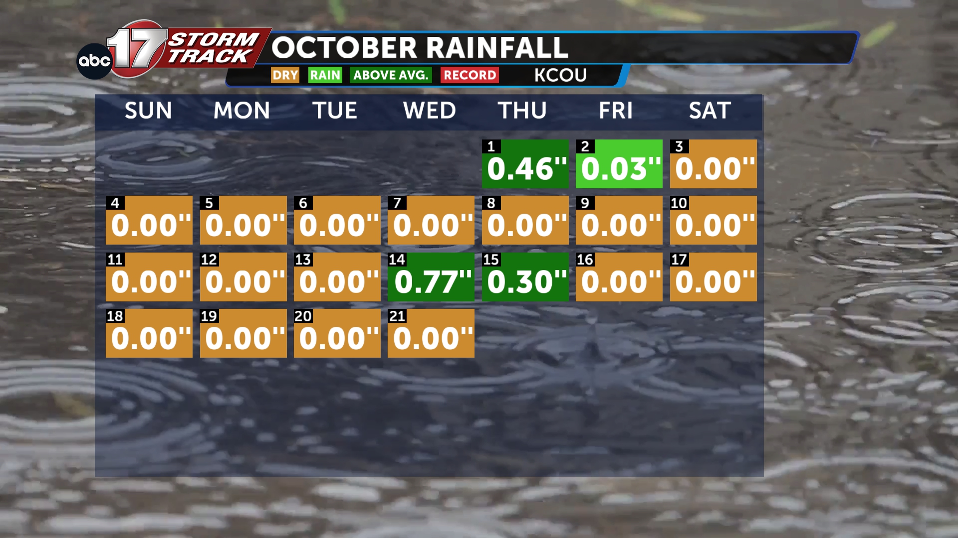
Last week was a great example. Over three-quarters of an inch of rain (0.77") was recorded in Columbia on the 14th, a Wednesday, with another 0.3" on the 15th. However, the Drought Monitor released on the 15th only represented conditions through Tuesday the 13th, before any rain fell.
So forecasters were eager for this week's release, which would include the rain. But the picture didn't change much.
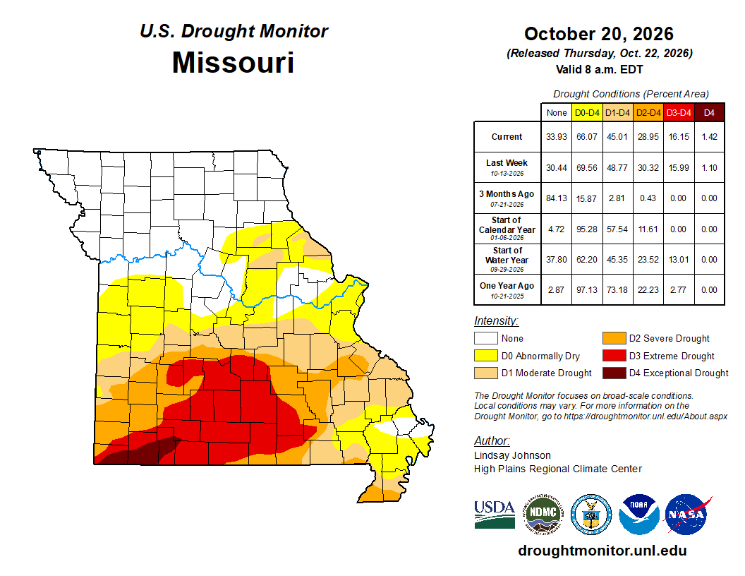
The latest U.S. Drought Monitor, released on the 22nd with data through the 20th, showed a slight drop in drought coverage across the state, though the improvement was small considering the healthy dose of rain last week.
About 66% of Missouri is currently drier than normal, down from 69.5% the week prior. The moderate and severe drought categories both fell by a similar amount, dropping to 45% and 28.9% respectively.
But extreme drought expanded over the past week, growing to over 16% of the state's land area. Exceptional drought, the worst category on the scale, covers 1.4% of the Show-Me State.
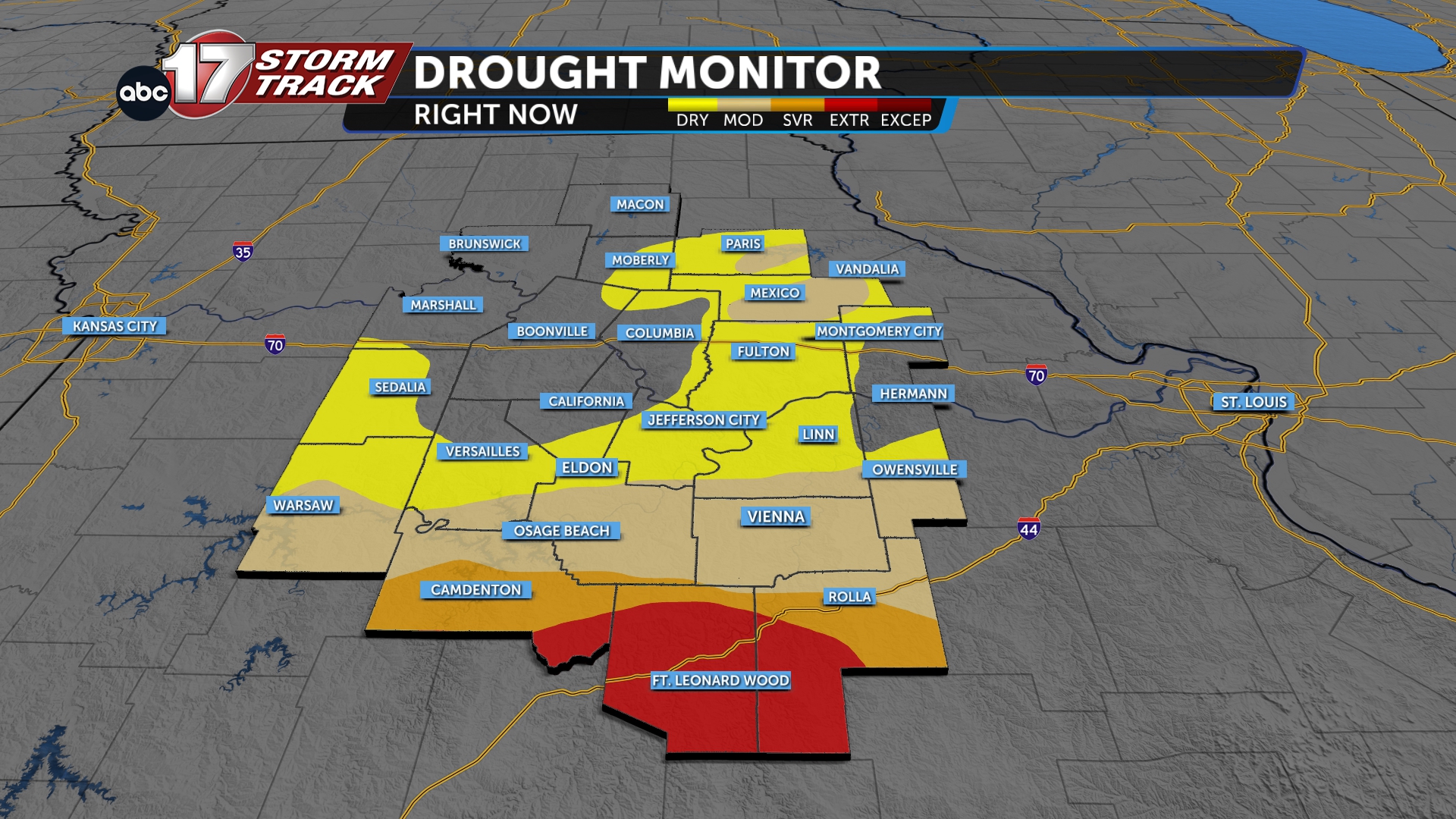
In Mid-Missouri, drought conditions can be found in Audrain and Monroe counties, where pockets of moderate drought have persisted for weeks. The situation is much worse in our I-44 counties. Pulaski, Phelps, and Camden counties are all experiencing severe to extreme drought. A large majority of Pulaski County, over 77%, is in extreme drought.
Drought is a fall foliage killer, causing trees to turn brown and drop their leaves early. This can be seen across Mid-MO right now, as hickories, elms, walnuts, and dogwoods are quickly turning bare. Peak foliage in Mid-MO typically arrives in early November.
The forecast ahead doesn't look any better. Stubbornly high temperatures and low rainfall are a bad recipe for foliage, and both are likely in the coming weeks. Columbia is currently flirting with a top-10 warmest October on record, and the southern half of the area has received less than half of its normal rainfall for the month so far.
Some drought years have brought surprises, like the vibrant foliage seen in 2012 during one of the state's worst droughts ever. This year, however, it doesn't look like we'll be as lucky.
