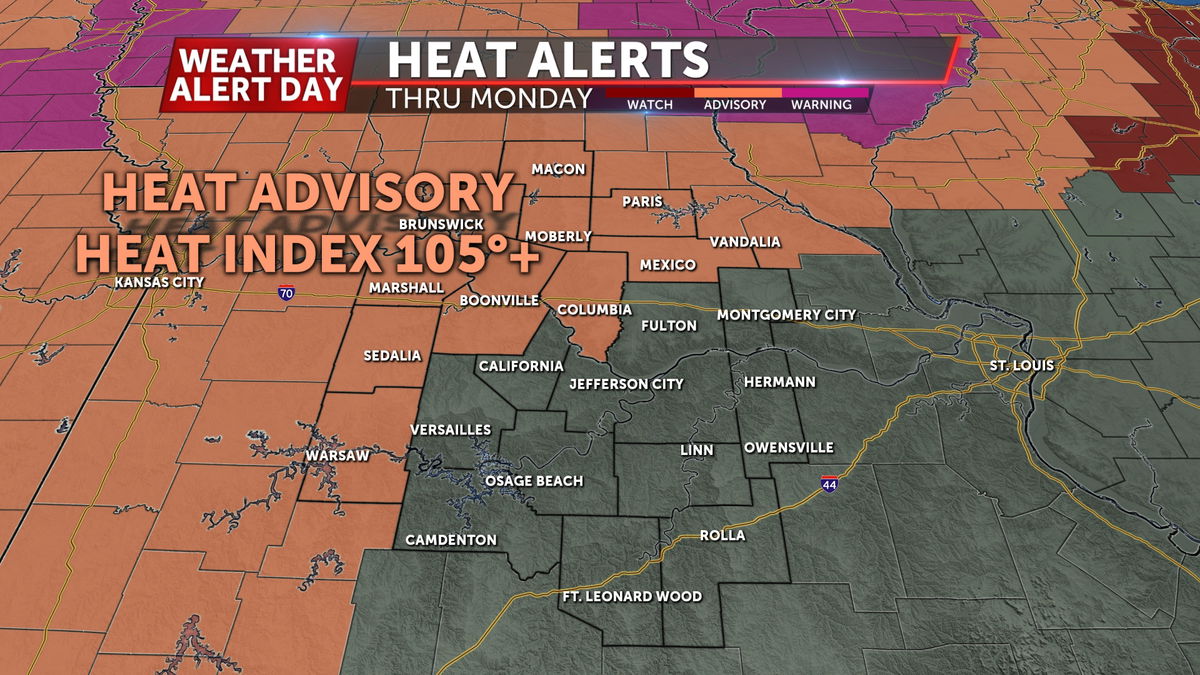
Weather Alert Day: Dangerous heat settles in Monday and Tuesday
An ABC 17 Stormtrack Weather Alert Day has been issued for Monday and Tuesday with the heat index soaring to above 105 degrees both days. The worst heat will be positioned over northern Missouri through midweek.
SETUP
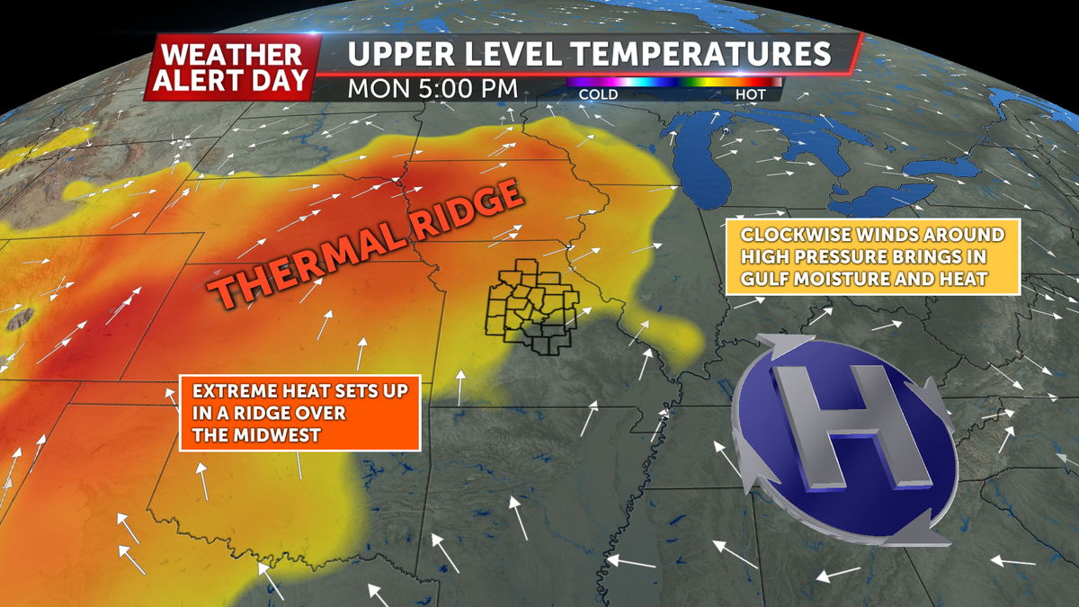
Southerly winds have ushered in high heat and moisture and a thermal ridge forms across the Midwest early this week. This ridge of hot air will lead to dangerous heat at the surface combined with excessive humidity.
FUTURETRACK
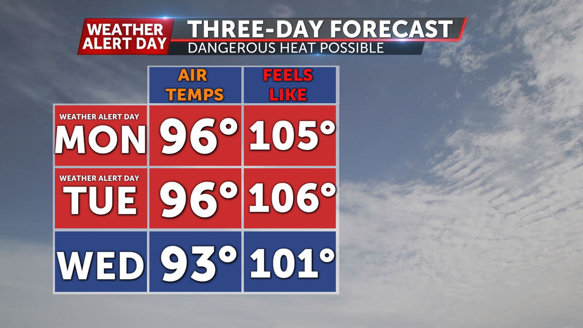
Heat becomes dangerous by late morning on Monday and Tuesday as the heat index will be in the upper 90s before noon. The feels-like could reach nearly 110 degrees if the hottest forecast pans out across northern Missouri.
While storms are in the forecast from Wednesday onward there is uncertainty on how quickly this will bring relief.
IMPACTS
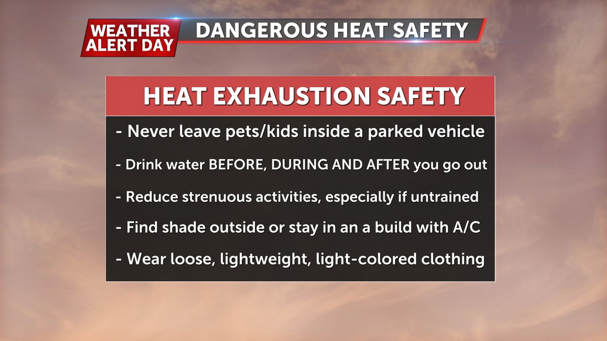
The dangerous heat in the afternoons should be avoided if at all possible. Dehydration and heat exhaustion are much easier on hot and humid days in the triple digits. Get outdoor work done in the morning or evening and take pets on walks before the pavement is too hot. If you have to get out in the sun, take frequent breaks to cool down and remain hydrated.
