Climate Matters: What to expect through the end of this year
Our changing climate has had impacts nationwide and right here in Mid-Missouri as we feel the effects of warmer temperatures, prolonged droughts and intense natural disasters. The ABC 17 Stormtrack Weather Team is diving into trends and how those changes could make impacts more noticeable or troublesome for our ways of life.
October started out about 15 degrees warmer than normal on Sunday, coming off a September that ended up about 2 degrees warmer than normal, and more than 3 inches behind on rainfall.
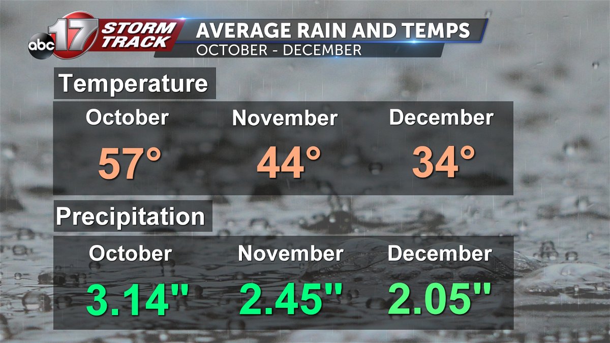
Typically, we see about 3 inches of rain in October with an average temperature of just under 60 degrees. By December, we’re down to about 34 degrees for an average temperature and about 2 inches of precipitation. The earliest snow ever recorded in Columbia fell on Oct. 23, 1917, but you’ll remember Halloween 2019 when we had just under a half-inch of snow and around the same amount on Oct. 26 the next year.
Typically, we don’t see measurable snow in October, but we normally record about 2 inches in November and 4.5 inches in December.
Mid-to-late fall in Mid-Missouri has been warming for the past 50 years, with a 2.3-degree jump in average temperature in Columbia since 1970. We’ve added seven more days above average in the fall, and you’ll see nationwide the trend is similar. It’s especially dramatic across the Rockies where the average fall temperature has increased at least 3.5 degrees in the last 50 years.
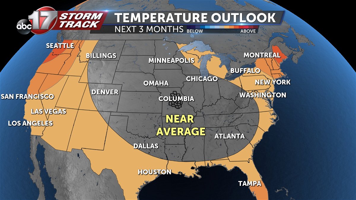
Through the rest of the year, we can expect temperatures to come out near average with some swings in either direction. However, October is looking to finish above average with temperatures in the 70s.
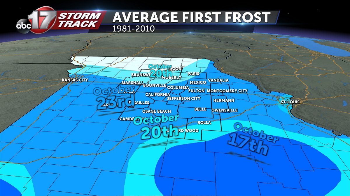
The average first frost for much of Mid-Missouri is around the week of Oct. 23, with frost potential closer to Oct. 20 for areas north of Highway 24 and along I-44.
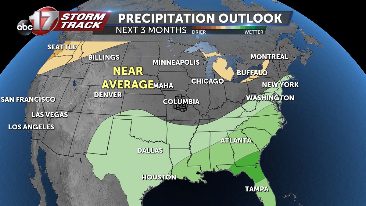
Precipitation amounts look to end up near our average amount, with periods of dry time along with fall storms that bring higher rain totals. The Southeast will have the best shot at seeing above-average rainfall through the end of the year.
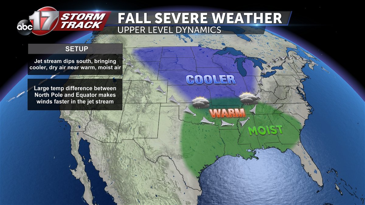
The ABC 17 Stormtrack Weather Team is always keeping a close eye on the potential for severe weather, but we usually have to watch for a few severe storm events between October and December as our pattern tries to transition from a summer jet stream pattern to a more variable winter pattern. As this shift takes place, the jet stream dips farther south, bringing cooler, dry air near warm, more humid air. The big temperature difference between the North Pole and the equator makes winds faster in the jet stream and can make storms more intense.
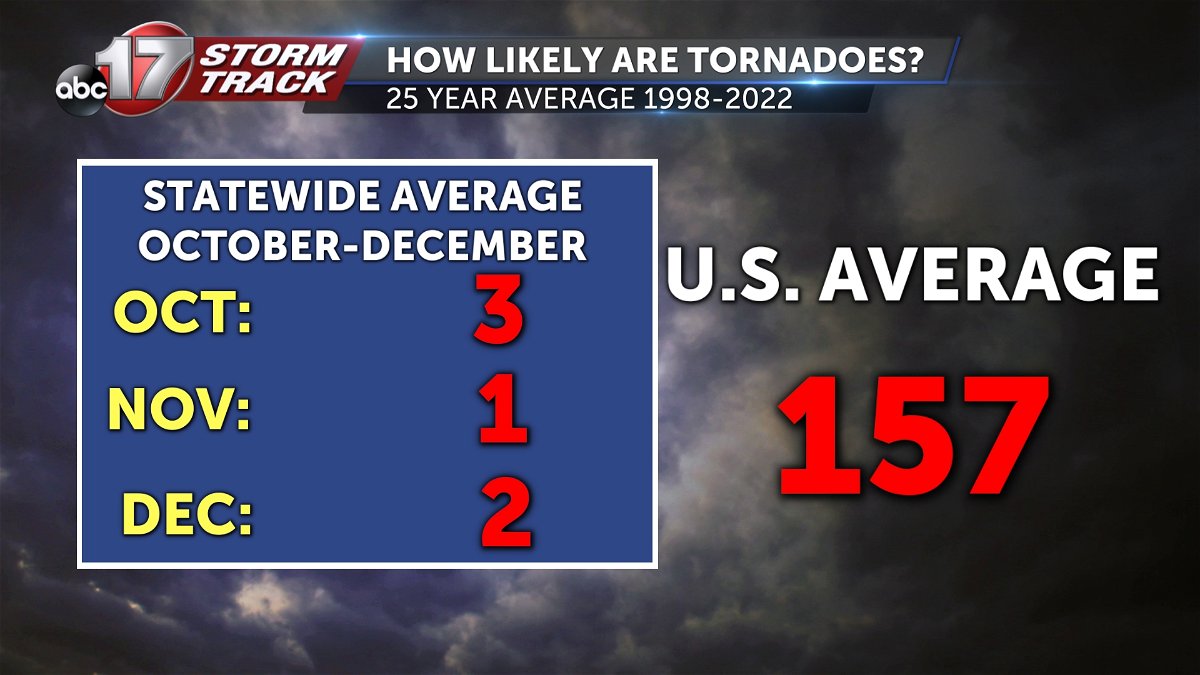
Across Missouri, there have been an average of three tornadoes in October, one in November and two in December since 1998. We have seen an uptick in severe weather reports over the last 10 years, with 48 October tornadoes in the decade between 2012 and 2022. During that same time frame, 12 tornadoes were recorded in November and 17 in December. The most recent December tornado outbreak in 2021 killed one person in Defiance, Missouri, when an EF-3 tornado plowed through on the 10th. That same storm went on to produce another EF-3 that killed six people at an Amazon warehouse in Edwardsville, Illinois, that night.
We’re coming off a dry year in 2022, and unfortunately, the situation looks very similar this fall. Last year at this time, much of Mid-Missouri was either in severe or moderate drought, and the latest drought monitor has even more of the region in extremely dry conditions as of last week. Luckily, over the next three months we can expect persisting but gradually improving drought as precipitation starts to pick up a little bit with fall and winter low-pressure systems.
To recap, we can expect near-average seasonal temperatures with highs in the 60s and 70s through late October, 50s in November and 40s in December. Precipitation, liquid or frozen, should end up near normal through the end of the year. We’ll watch for a few rounds of severe weather between now and the end of the year and hope that upcoming rain events will ease drought conditions around the Midwest.
The ABC 17 Stormtrack Weather team is already working on the forecast for the entire winter, including if we can expect a white Christmas and how much snow to expect through February. You can catch that long-range outlook in the ABC 17 Stormtrack Winter Weather Special airing on Nov. 17.
