Winter forecast: La Niña pattern will influence our weather again this year
It's been anything but an ordinary fall so far after a warm and wet October wrapped up with a severe weather outbreak that brought three tornadoes to Mid-Missouri on Oct. 24. We ended up with two EF-0 tornadoes in Pettis County and one EF-1 reported in Camden County that evening.
We kicked off November more than 10 degrees cooler than average with snow reported in Kansas City on Nov. 1, and our first widespread frost within days of Halloween.
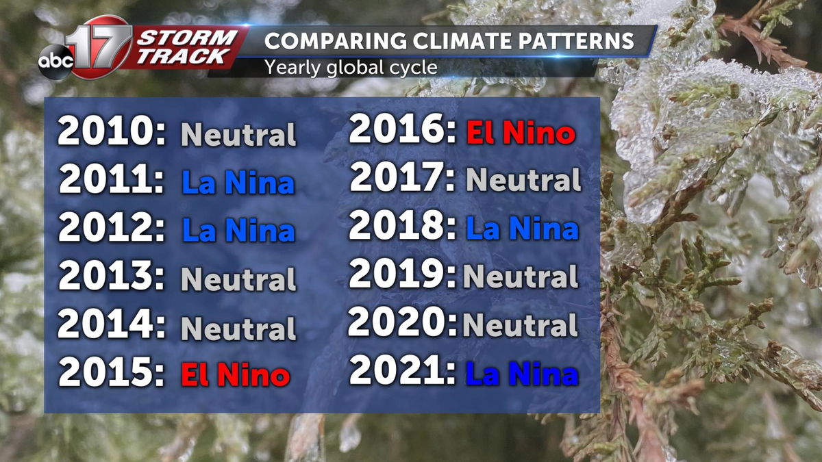
We can thank the global pattern La Niña for the wild weather as we progress closer to winter. There's almost a 90% chance of La Niña continuing to influence our weather through March.
What does this mean for the next three months across Mid-Missouri and the country?
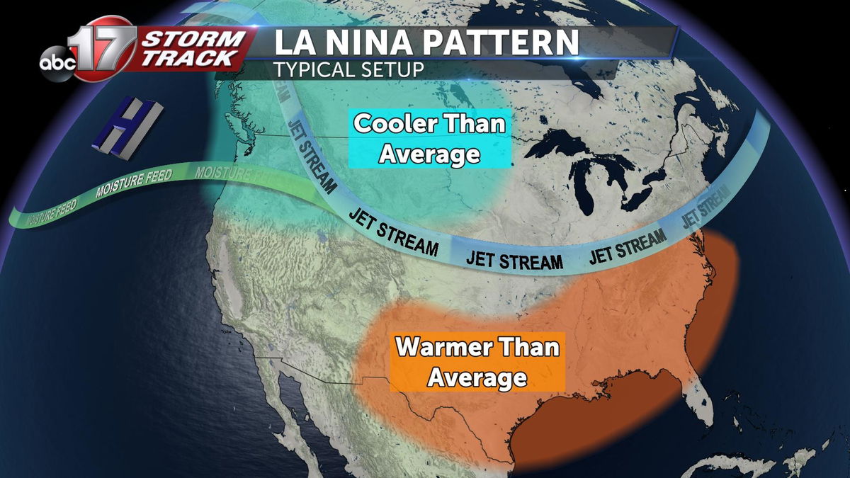
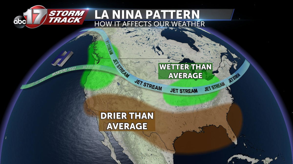
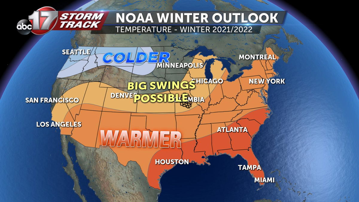
The polar jet stream tends to align with the Pacific jet, bringing more moisture and forcing more active weather from the Pacific Northwest and the Midwest to the Ohio Valley. Temperatures tend to be more variable in the Midwest versus warmer and drier in the southern states.
We were in a similar situation last winter with a slightly less impactful La Niña in place.
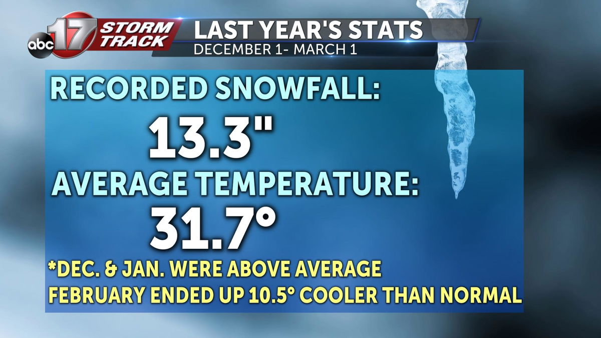
The interesting thing about being in a La Niña in Mid-Missouri is that each winter can be vastly difference since we're so close to the upper level storm track. Last year we ended up below average on snowfall with a little more than 13 inches, but the average temperature came in cooler than normal thanks to a frigid February. Several stretches of single-digit temperatures cooled us 10.5 degrees below the monthly average.
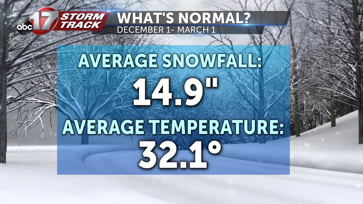
A typical winter in Mid-Missouri gives us about 15 inches of snow with an average temperature around freezing.
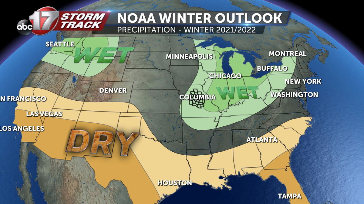
This year, the Climate Prediction Center is forecasting above-average precipitation and temperatures for Mid-Missouri, whereas last year we were close to normal. Thanks to a stronger signal for La Niña this winter, we can expect several stretches of mild temperatures along with some bitterly cold snaps. Given our proximity to the jet stream, there's a good chance we could end up with a little more snow, rain or ice than average, too.
Our average first measurable snow is usually around the end of November, but the earliest reported snowfall has happened in late October in years past. The chance of having a white Christmas is 22%, and the last time we saw snow on the ground for Santa's arrival was back in 2017.

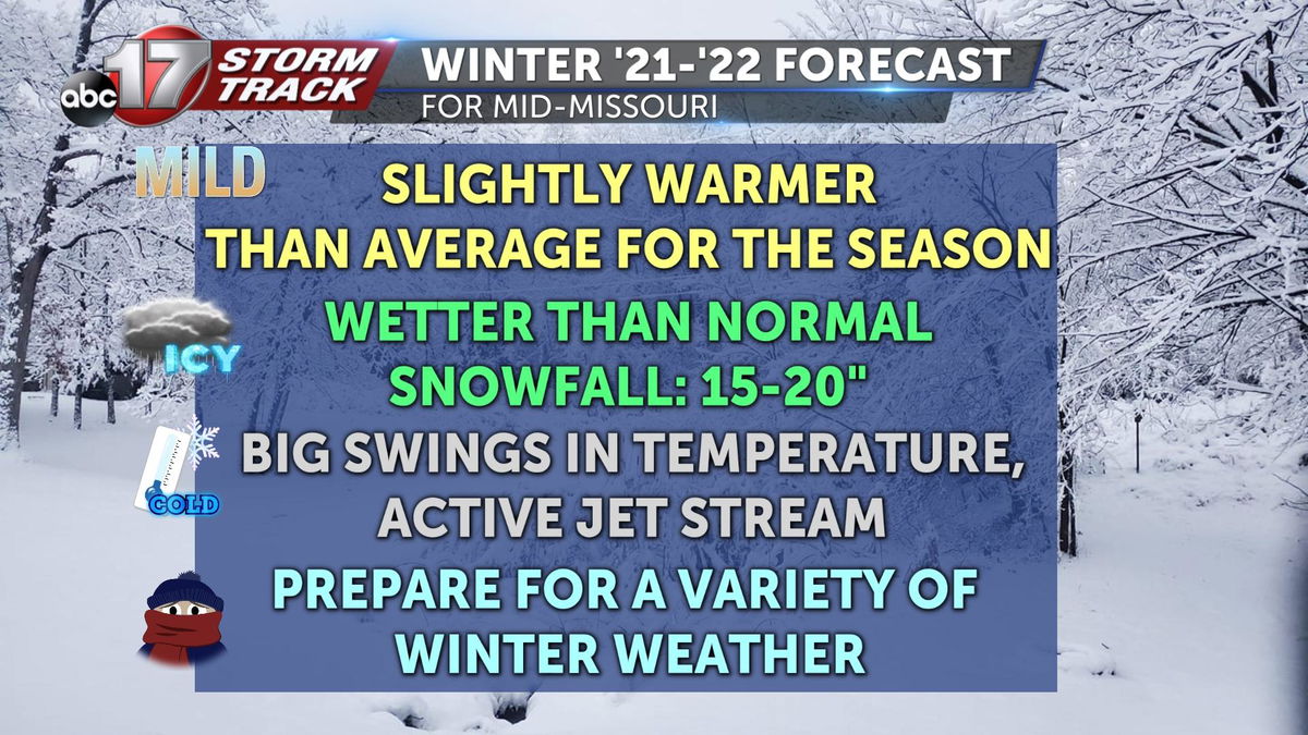
For the winter ahead, keep some of your lighter clothes handy with your winter parka. There could be some warm days where you'll just want a light layer. Make sure your home and car are winterized because we'll have some cold stretches that bring a mix of rain, snow and ice. We all want to forget about the ice storm in early January 2020, but it could certainly happen again this winter. Snowfall amounts are expected to be slightly above average, in the 15-to-20-inch range.
Always stay prepared by keeping up with the Stormtrack Weather Team and our posts on Facebook, Twitter, and the Insider Blog on abc17news.com, and keep your NOAA weather radio charged up even during the winter months as severe weather has been reported in every month of the year.
