Re-tracking the tornado: Radar analysis 6 months after the storm


It was a very different day 6 months ago in mid-Missouri.
We knew the atmosphere was primed for destructive weather, but no one could have predicted what would strike the capital city just before midnight on May 22nd.
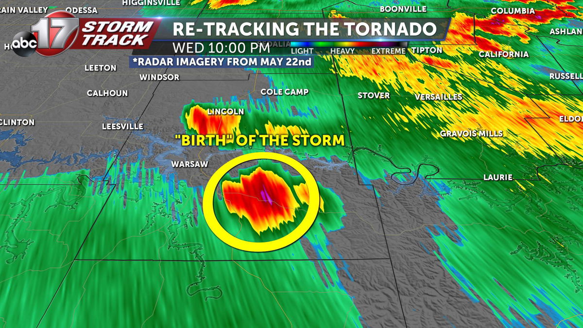
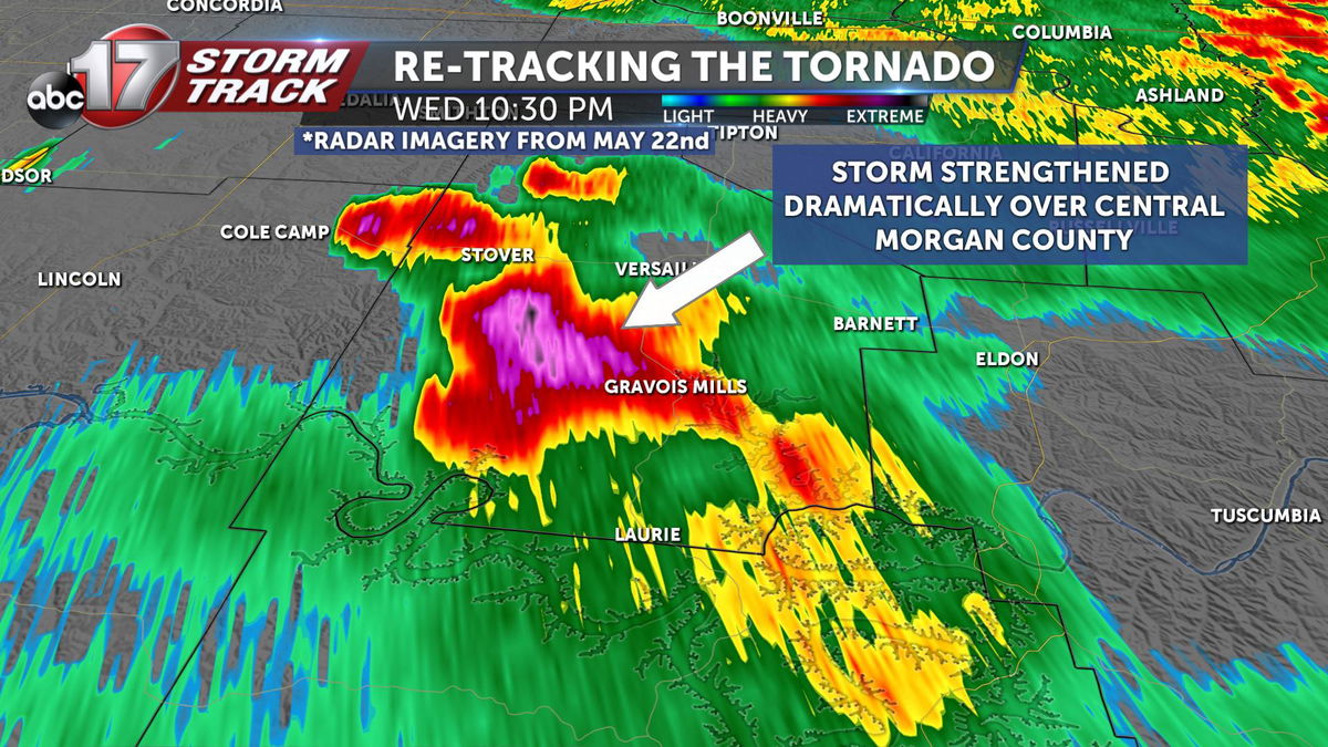
The storm began as a small cell near Warsaw, Missouri. As the storm passed over the Osage river into Morgan county, it quickly strengthened into a severe thunderstorm, with the potential for large hail and damaging winds.
26 minutes later, the updraft of the thunderstorm began rotating, producing a tornado which caused damage in Eldon, MO. Thankfully the storm in the beginning stages of producing rotation, allowing damage to be limited.

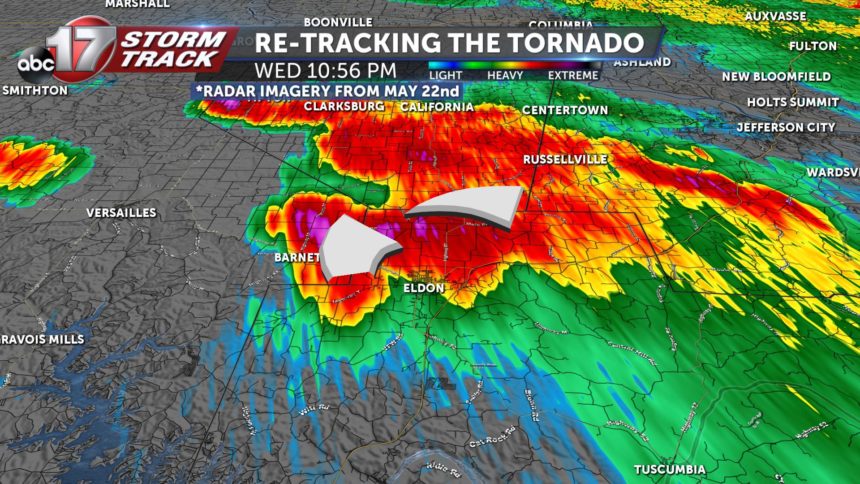
The storm continued its rapid intensification as it cross into southwestern Cole county. Radar and velocity imagery was clear that there was a tornado on the ground hugging the HWY 54 corridor.
This storm was still some 20-30 minutes from striking Jefferson City, but we knew if this storm held together, which it likely would, a tornado could hit Jefferson City within the hour. Tornado warnings kept getting extended throughout Cole County as the storm approached the capital city.
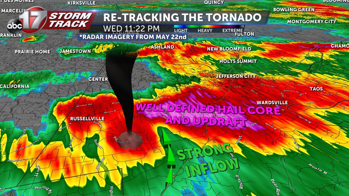
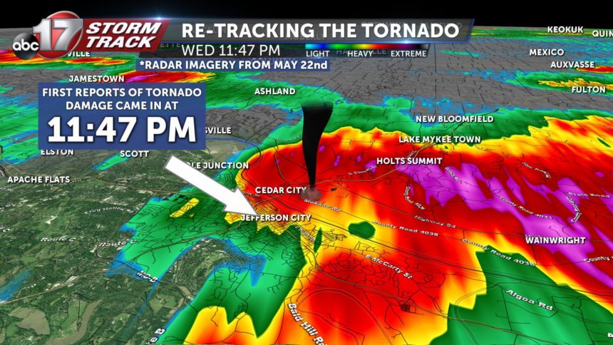
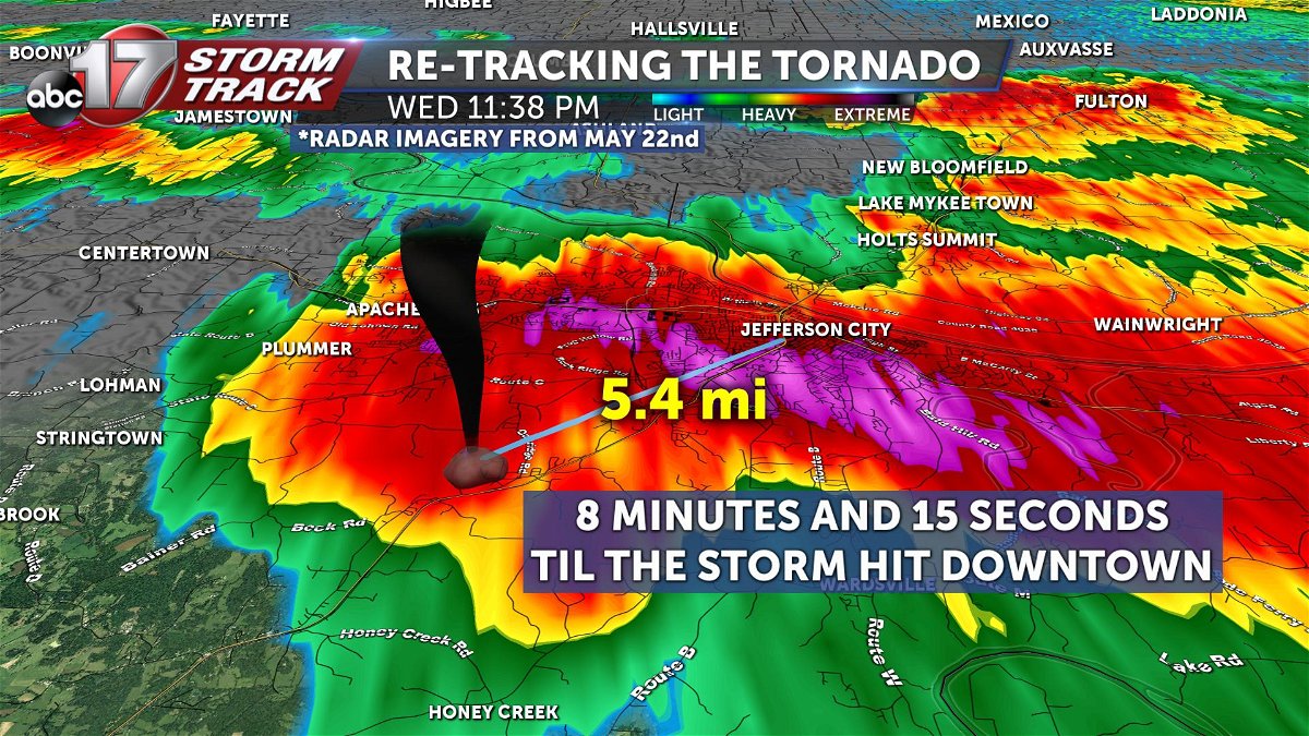
At 11:38 pm, the National Weather Service office in St. Louis, Missouri issued a tornado emergency-- this effectively re-issued the tornado warning for Jefferson City, prompting emergency managers to sound outdoor sirens a second time. At this time, the storm was 5.4 miles from downtown Jefferson City, giving the city 8 minutes and 15 seconds to find shelter from the storm.
Emergency managers to this day applaud this decision, and say the nearly 10 minutes of warning is one of the main reasons there were no fatalities as a result of this storm.
At 11:47 pm, the first reports of tornado damage in Jefferson City started pouring in.

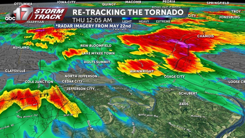
By 12:05 am, on May 23rd, the storm had lost it's tornadic characteristics as it cross into Callaway county as it slowly weakened along HWY 94-- this was over 2 hours after the storm spawned in southern Benton county.

It's hard to believe this event was already half of a year ago, and we've tracked several weather events since. We're still stunned, as meteorologists, that a storm like this came through our viewing area. Storms like these are more common in places like Oklahoma and Texas.
At ABC 17, the StormTrack Weather Team emphasizes tracking on purpose. We believe it's the most important aspect to keep you and your family safe from the wide range of weather Missouri offers.
We track these storms to let you know exactly WHEN and WHERE weather will impact you.
You can watch our full news special on this tornado event here.
-Luke
