INSIDER BLOG: Tracking light snow Thursday night into early Friday, minor accumulation possible
After a stretch of frigid temperatures, we'll cap off a wintry week with another round of light snow between late Thursday and mid-afternoon Friday.
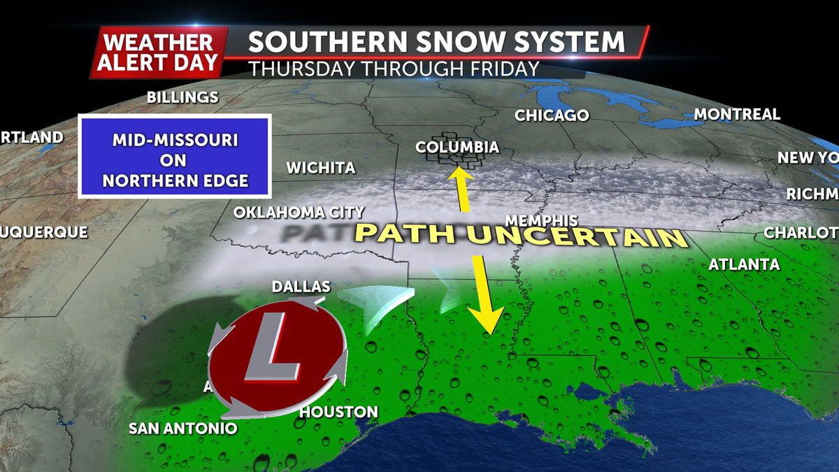
Low pressure stays well to our south this time, meaning the impact from this system will be much less significant compared to our most recent storm. The track of the low will be across portions of Texas, Louisiana, and Mississippi through late week, but we could end up on the northern side of that system with cold air in place.
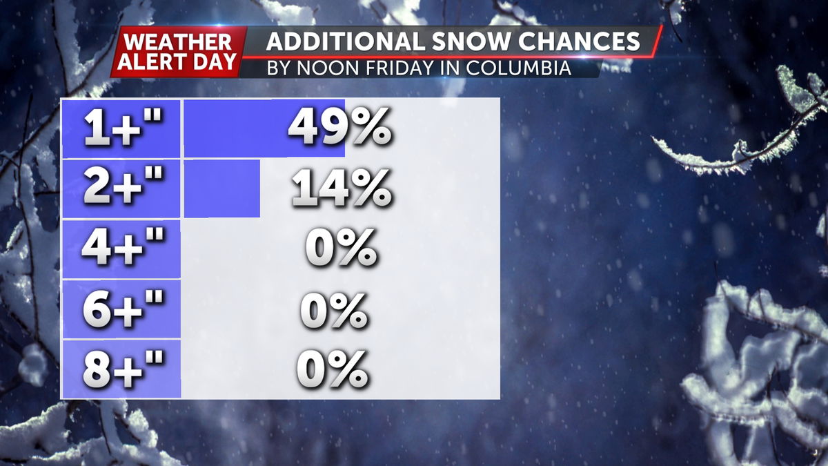
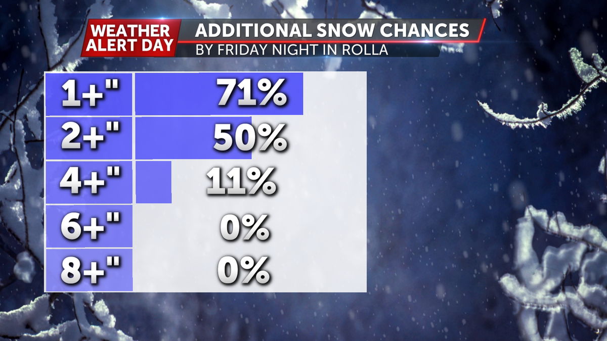
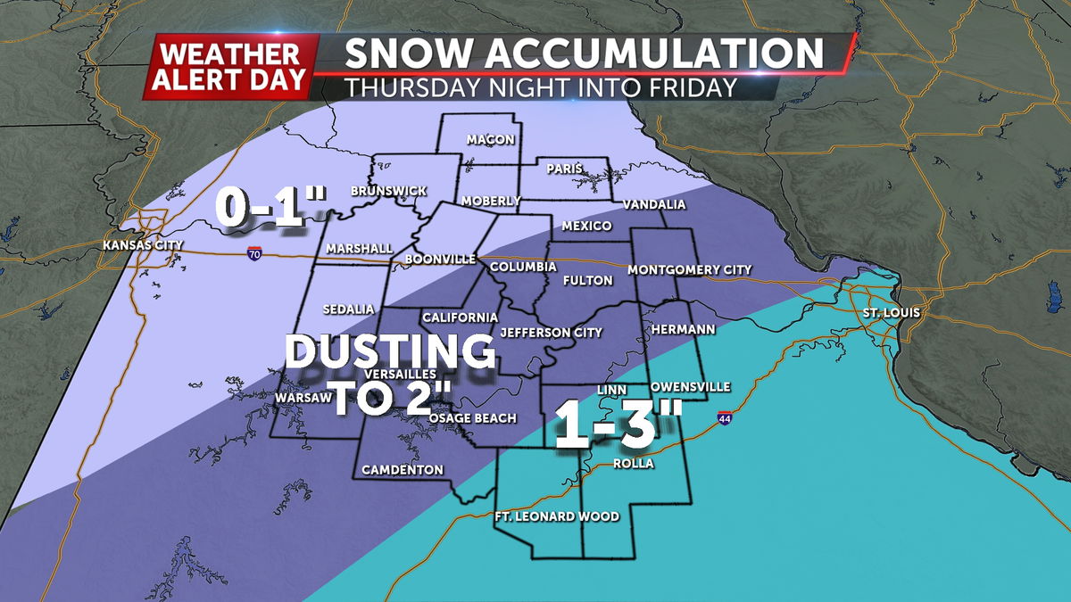
The northern extent of snowfall with this system will get up to about the Highway 24 corridor, with our southern tier of counties near the Lake of the Ozarks and I-44 seeing a higher potential of accumulation greater than 1".
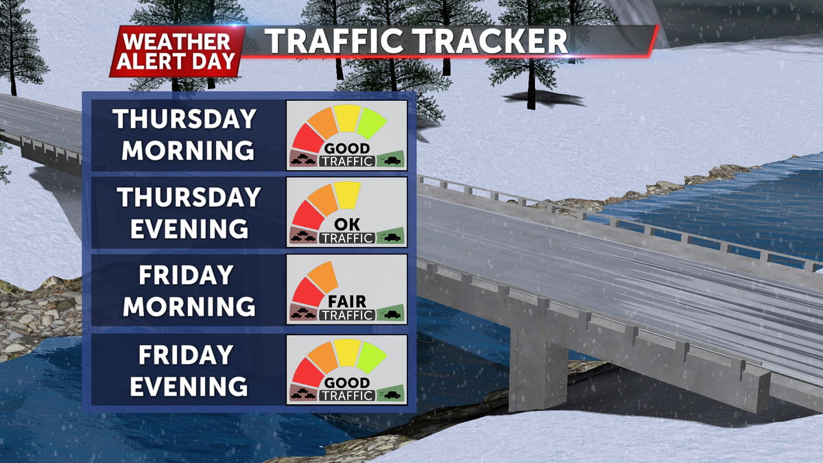
Impacts to road conditions are expected to be minor, but current snow pack likely won't melt much between now and then with temperatures below freezing through the first half of the weekend. Slick spots will be possible in untreated areas.
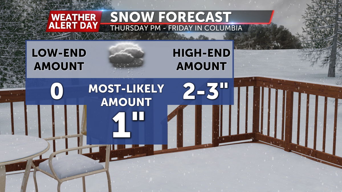
Much of Mid-Missouri will see a dusting to 1" of total accumulation, while our southern counties and southern Missouri could pick up around 2-3" depending on the storm's track. If it stays farther south, that would cut down on snow totals, while a more northerly shift could give us slightly more accumulation.
Snow showers are expected to start up after sunset on Thursday and wrap up to the east by mid-late afternoon on Friday.
Make sure you have the ABC 17 Stormtrack Weather app if you have any travel planned to stay updated on the snow forecast.
