Spring 2024 will bring more variable weather, but still warmer than average
After a rare three years in a La Nina global pattern, we saw a complete flip in the jet stream pattern this past winter, leading to warmer and drier weather.
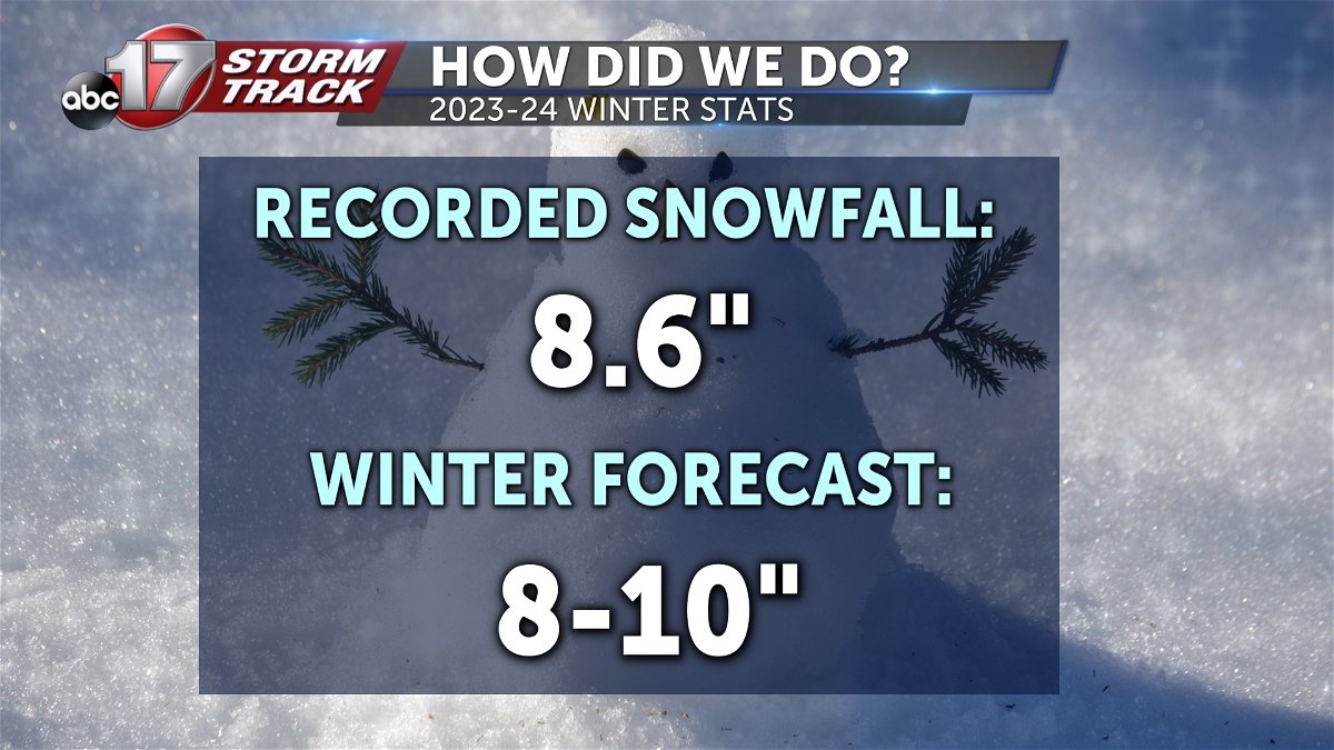
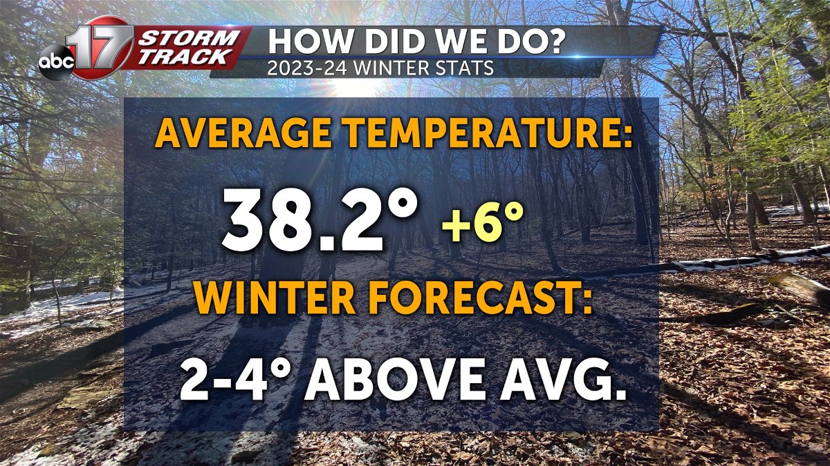
The ABC 17 Stormtrack Weather Team forecast 8-10” of snow, and we ended up with 8.6.” We were thinking the winter would be quite AS warm with a forecast of 2-4 degrees above average. This winter season ended up 6 degrees above average in Columbia with an average temperature of 38 degrees.
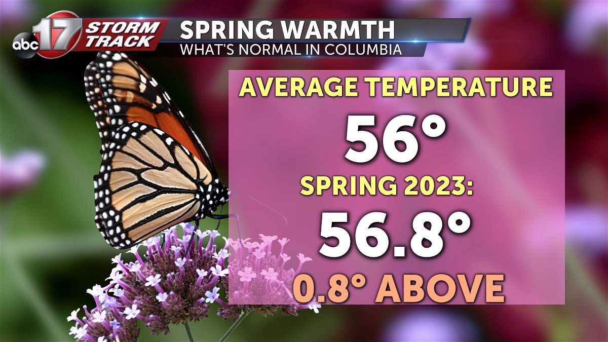
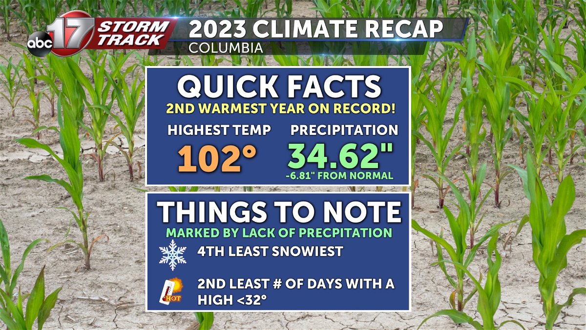
2023 was the 2nd warmest year on record in Columbia, and the 4th least snowiest. Heading into the spring months, we can expect temperatures to average out to about 56 degrees for the 3 month period. Last season we were slightly warmer than that.
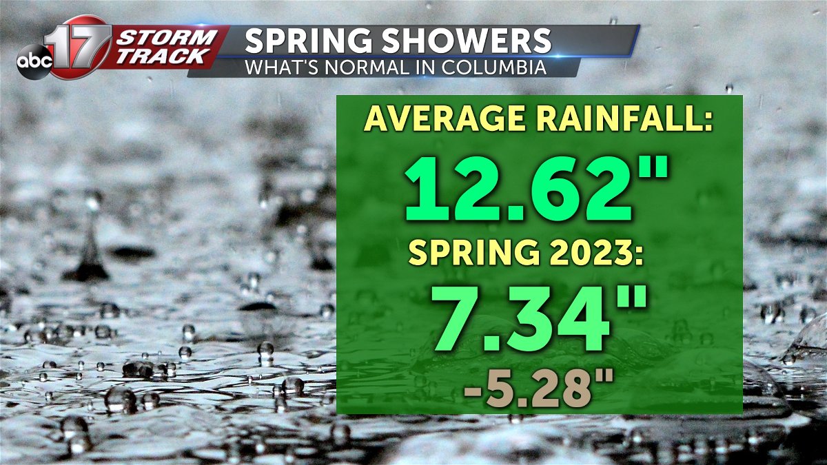
Last spring really ramped up the severe drought conditions in Mid-Missouri as we ended May more than 5 inches below normal on rainfall.
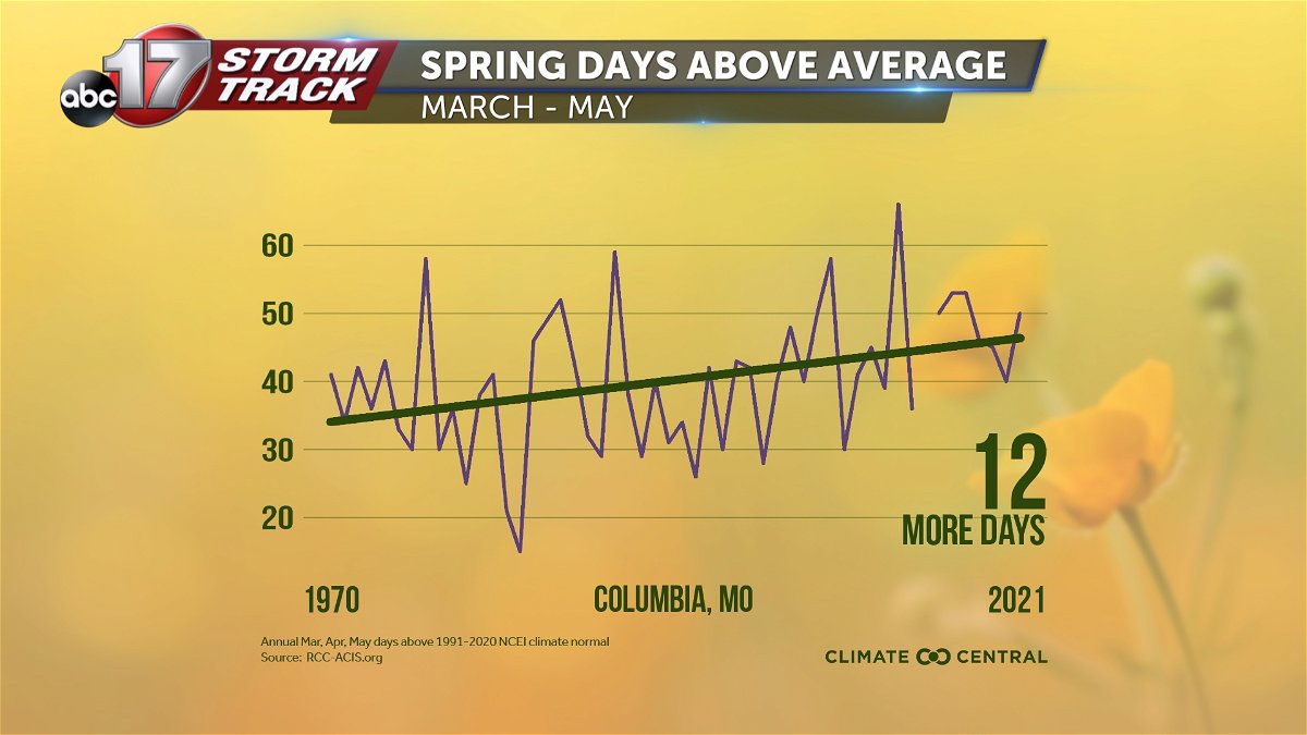
We continue to see more spring days coming in above average, with an increase of 12 days above normal temperatures since 1970.
The strong El Nino pattern we had in place for the winter is expected to wane, with neutral conditions taking over as we get into April and through the summer before La Nina takes hold again this fall.
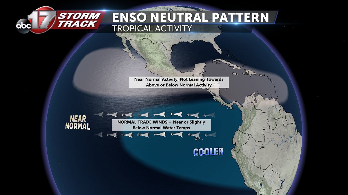
That means ocean temperatures will be closer to average, and the jet stream over the Midwest will likely be more variable. That also makes forecasting for the months ahead a bit more tricky with equal chances of stormy weather and dry, hot stretches.
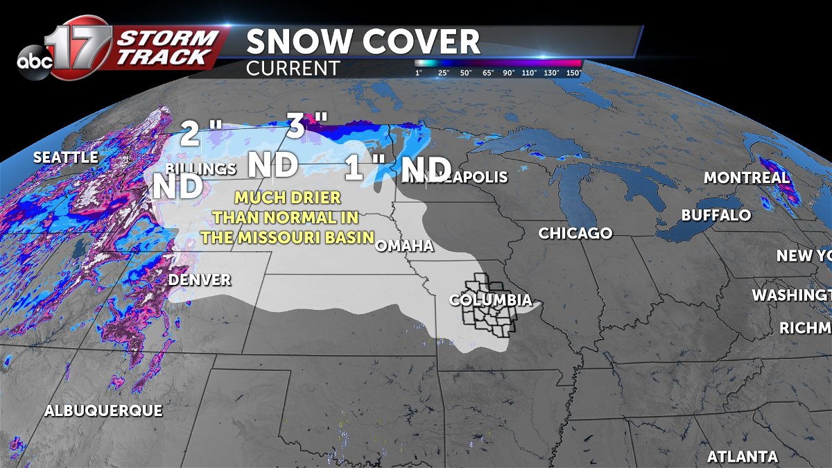
One thing we do know, is that the river flooding threat is going to be low. The Missouri basin is lacking snow cover, the least amount of snow pack in several years. That will limit any downstream flooding from melting.
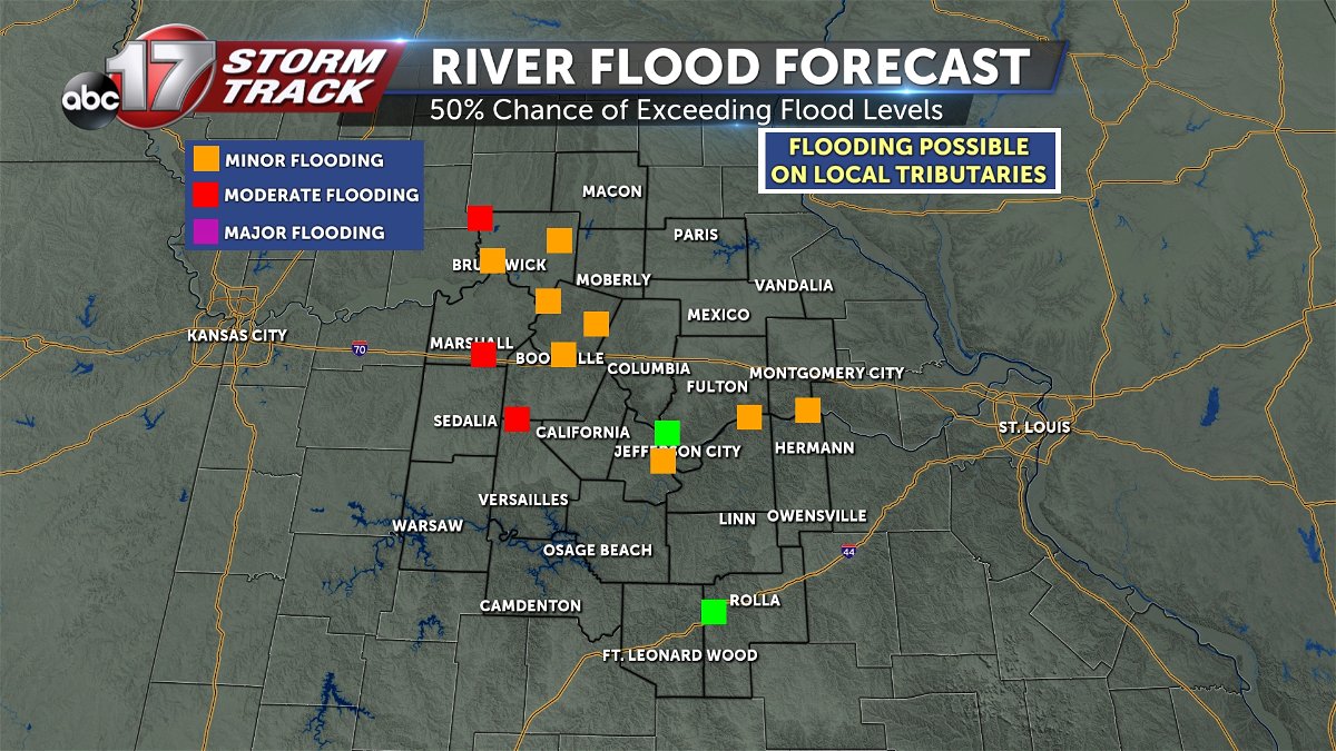
This map on the right shows the potential for reaching specific flood levels on larger rivers across Mid-Missouri. The orange boxes indicate a 50% chance of exceeding minor flood stage, for example. Local tributaries and smaller rivers have a better chance of minor flooding with spring and summer storms that bring heavy rain.
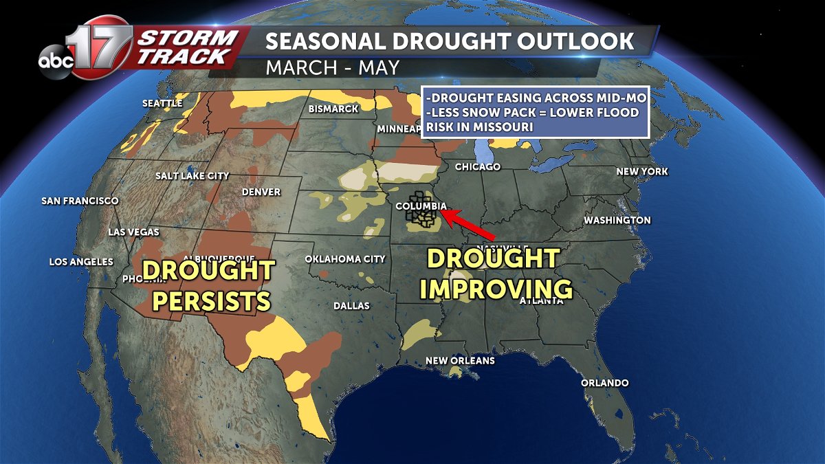
The drought forecast shows some improvement in Mid-Missouri with slightly higher precipitation than average through May. The upper Missouri Basin is looking drier, meaning there could end up being some barge traffic impacts upstream.
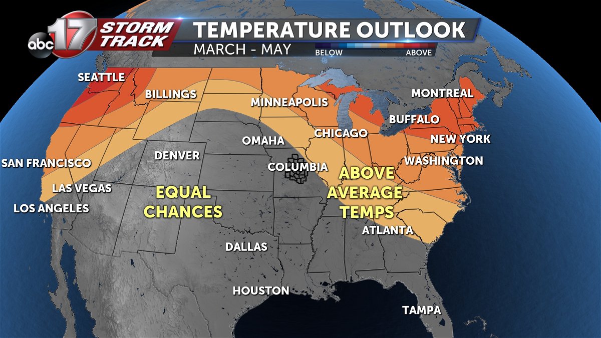
The Climate Prediction Center shows equal chances of above or below average temperatures for Missouri, but we have not been below average for a spring since 2020, our last spring in a neutral pattern when the temperature was about 1 degree cooler than normal.
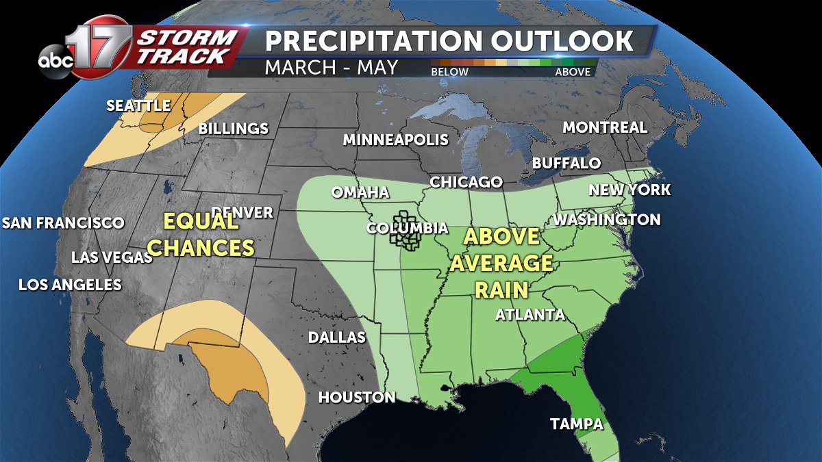
The precipitation outlook is promising, with the green shading showing above average precipitation through May. Above average rain could help out the drought situation as almost all of Missouri ranges from abnormally to severely dry.
So what can we expect for the next few months?
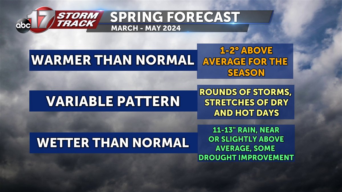
The ABC 17 Stormtrack Weather Team is expecting this spring to be 1-2 degrees warmer than normal with rounds of storms, severe weather with isolated flooding, and stretches of dry, hotter than average days. 11-13” of rain is expected, which would be near or slightly above average for Columbia. If that happens, we could hopefully see gradual drought improvement by the summer.
