Insider Blog: Record warm temperatures, fire danger, storms, and snow possible through Wednesday morning
UPDATE:
MONDAY MORNING UPDATE
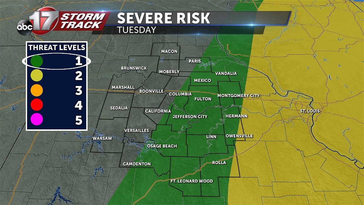
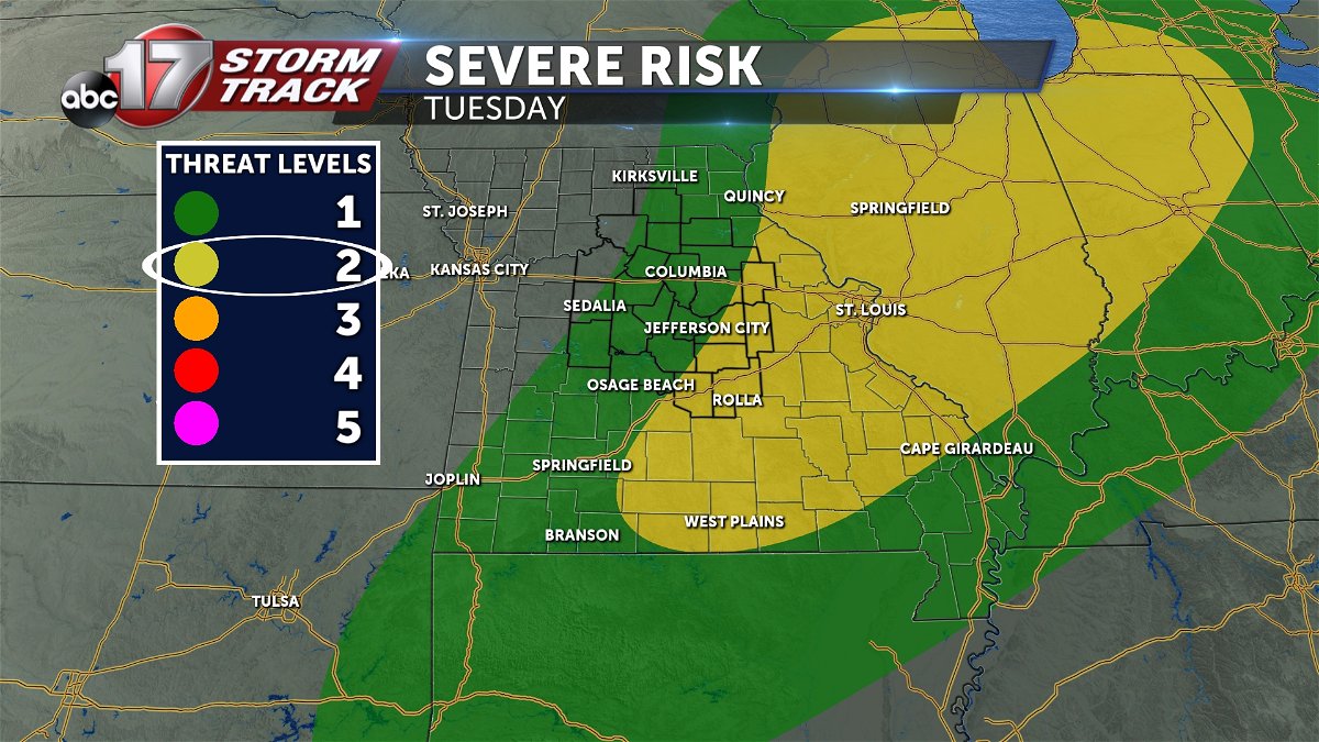
As of Monday morning, uncertainty is still high surrounding Tuesday night's storms. If there's any more certainty in the forecast, it is that the threat has shifted east, yet again. This likely means our "cap" is strong enough to prevent any storms ahead of the front. With this morning's data, it's looking increasingly likely that the cold front may not encounter good enough moisture for storm development until it pushes east of mid-Missouri.
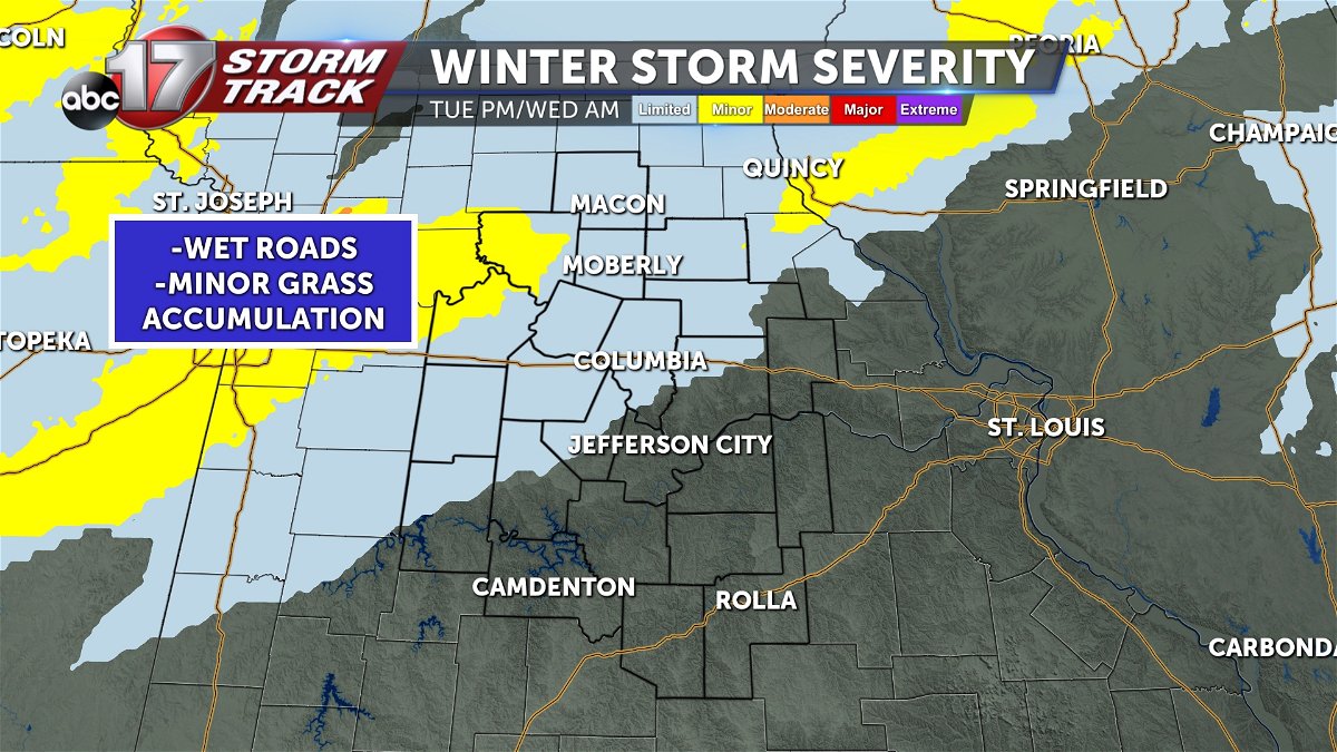
A slightly higher confidence exists in post frontal showers and snow. Still, only minor accumulations are expected, near a trace.
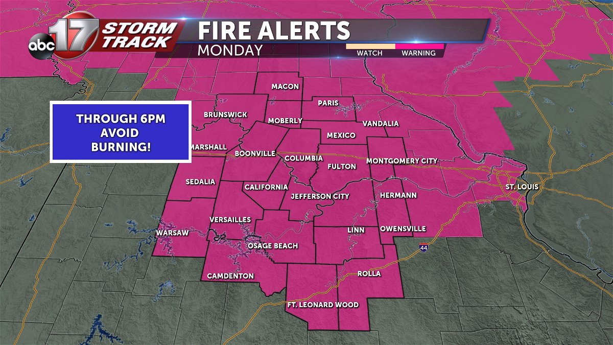
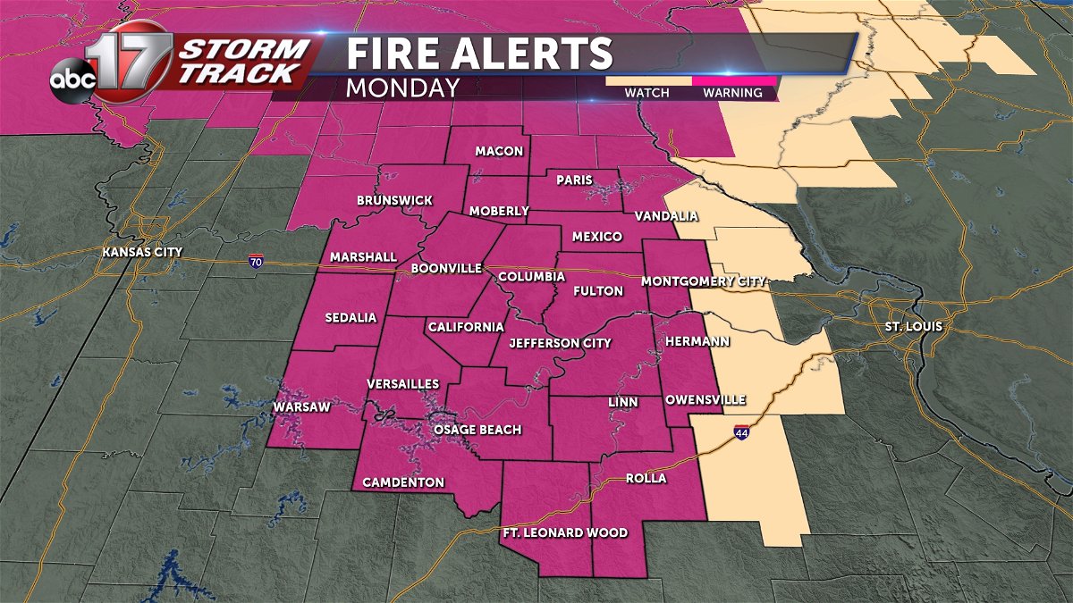
Additionally, our Red Flag Warning continues through 6 PM Monday.
BLOG:
Missouri will show how fickle it is when it comes to the weather for the upcoming week, as we can expect a mixed bag before the pattern starts to mellow out at the end of the week.
Strong upper level southwest wind flow sets in on Monday, sending temperatures into the mid-upper 70s during the day. There will be an increased risk for fire danger due to the lack of precipitation, low relative humidity, and gusty winds up to 35 mph.
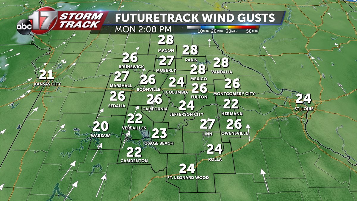
A Red Flag Warning will be in effect for all of Mid-Missouri through the entire day, so open burning is highly discouraged. The record high in Columbia on Monday is 77 degrees.
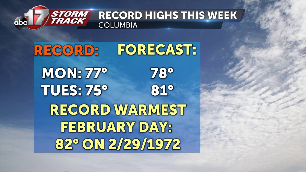
Tuesday will be even warmer as highs get to near 80 degrees, and we'll start the day off with sunshine. A cold front moving into the area will bring a chance for a couple storms by late afternoon, but the best moisture rich environment to sustain severe weather looks to be just to our east.
We'll see a slightly better shot at precipitation on Tuesday evening after the front passes, with showers developing around sunset. As cold air quickly moves in, we'll drop into the upper 40s by around 7-8:00 p.m.
Precipitation could change over to snow as bitterly cold air moves in, but little to no accumulation is expected through Wednesday morning. Winds will still be strong up to 20-25 mph on Wednesday, dropping wind chills into the upper teens in the morning.
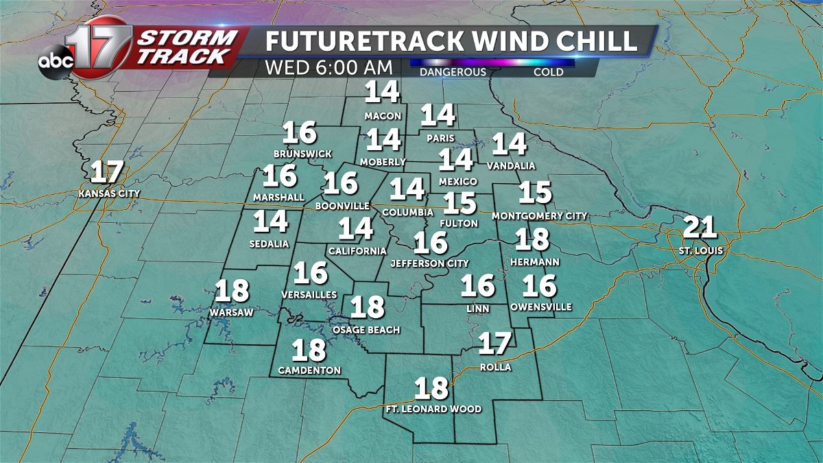
High temperatures Wednesday only reach the upper 30s, more than 40 degrees cooler than Tuesday afternoon!
We'll rebound back to around 50 on Thursday before temperatures warm into the 60s Friday.
