INSIDER BLOG: Tracking rain and snow Tuesday night into Thursday
WHAT WE'RE TRACKING:
A large trough of low pressure has become a cutoff low in the upper atmosphere. These types of systems are notorious for slowing down and meandering, so to speak.
That's exactly what it's doing as it sits atop the Midwest. As it wobbles overhead, it's sending waves of disturbances our way. Each one, taking advantage of some cooler air on the back side of the parent low to bring us some cold rain mixing with snow!
TIMING:
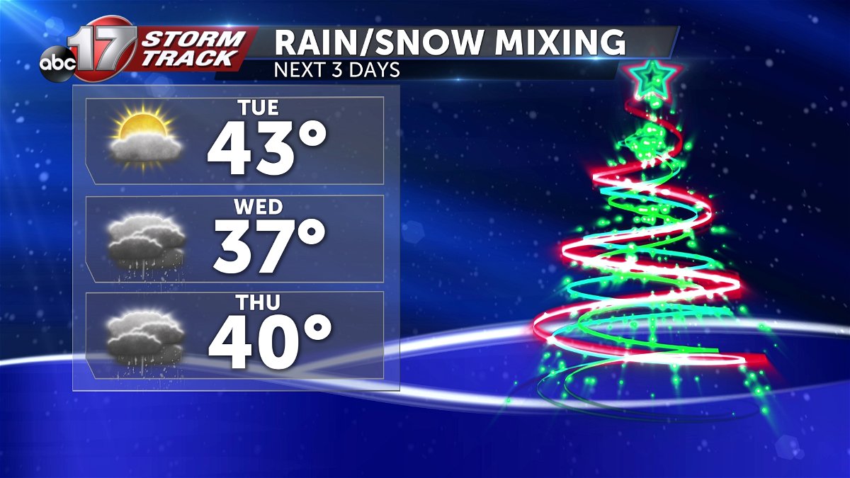
Beginning Tuesday night, clouds will increase from the west. We'll be primarily dry through the dinner hour, with the exception of our western most communities. Sedalia, Marshall, Warsaw will all have a shot at light rain by the 6 p.m. Wind from the south ahead of tonight's precipitation will have warmed us enough to allow the early precipitation to fall as rain. However, as temperatures fall, the precipitation that spreads across the region will slowly transition to snow.
This may take most of the night, and we may still get rain to Columbia and Jefferson city before it switches to snow, but that isn't a guarantee. However, by 3-7 a.m. Wednesday morning, most will have made the transition to snow. Temperatures are currently forecast to stick in the mid-30s through the day on Wednesday, meaning it could very well be snow that falls, but any snow is melting on it's way down, and won't be able to accumulate, save for any instances in which snow falls fast enough to accumulate on top of itself as it slowly melts.
IMPACTS:
It's mostly likely that we get a slushy accumulation on grass and elevated surfaces. Roads are less likely to see accumulations until Wednesday night in to Thursday, as temperatures fall again.
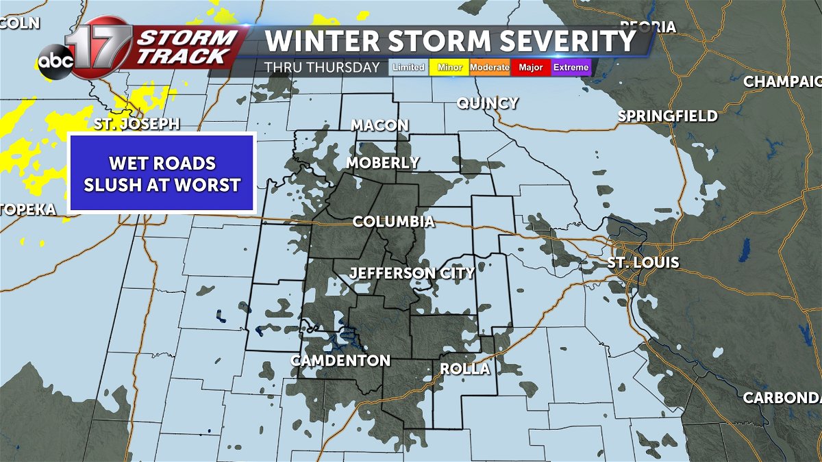
Still, accumulations are questionable, as we'll then be expecting precipitation to begin winding down. It's uncertain how long we'll see precipitation on the back side of this system, but should we hold onto it into Thursday morning or longer into the day, there could be a better chance at accumulations of more significance.
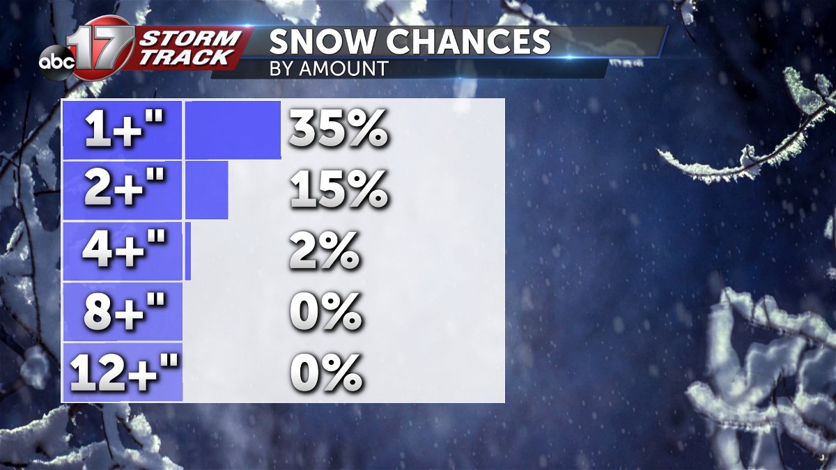
Overall, the current forecast is for grassy accumulations and minimal accumulations on elevated surfaces like decks, well insulated roofs, and bridges. Roads will likely be able to remain warm enough to keep serious accumulations at bay, with a slush expected with periods of heavy snowfall. With that said, there is some potential for greater, albeit unlikely accumulations.
UNCERTAINTY:
Gray area in the forecast largely surrounds temperatures. There's a spread in statistical data that spans nearly 5 degrees on Wednesday morning, Wednesday afternoon, Thursday morning, and Thursday afternoon that could seriously wreck the snowfall forecast. Since our forecasts are for temperatures that are so close to the freezing mark, small changes could largely increase what we expect in terms of accumulation.
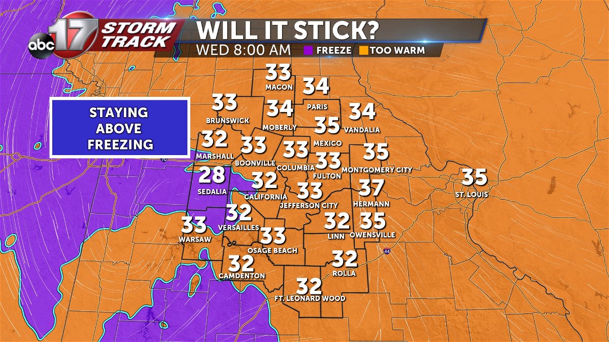
This is what is keeping the forecast largely a rain/snow mix through the entirety of the event. This will also complicate accumulations, as rain on top of any minor accumulations will likely speed up the melting process.
