2023-2024 winter forecast: Warmer and wetter than average in Mid-Missouri
Fall looks to close out warmer than average after coming off a toastier September and October, despite that short cold snap that ended the growing season around Halloween.
This winter into next spring could look different for Mid-Missouri as our global pattern has essentially flipped completely from last year from La Nina to El Nino.
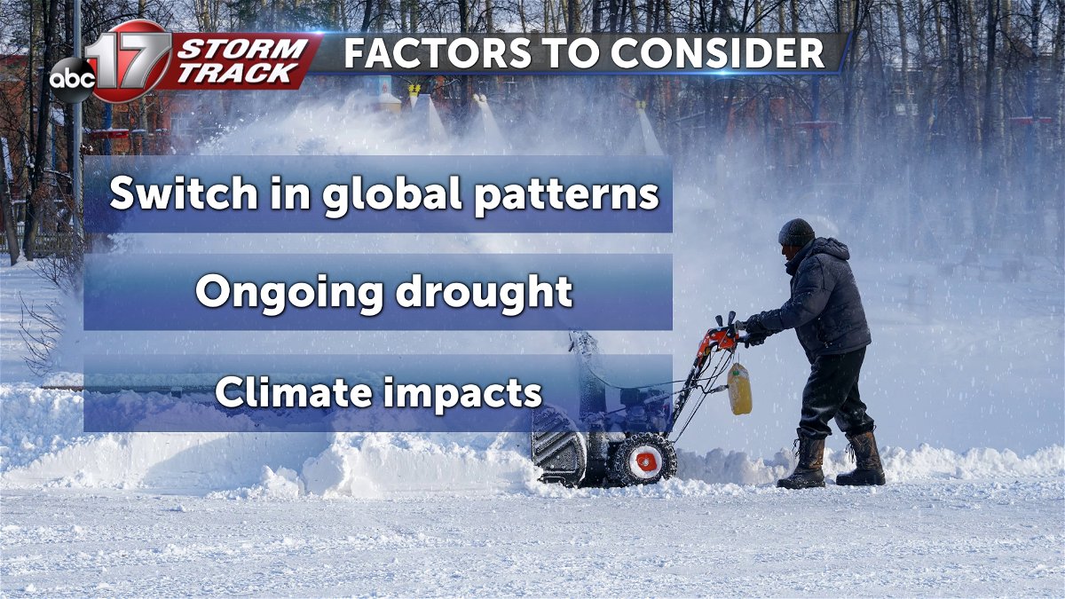
When looking at what’s to come for the upcoming winter, we’ll take into consideration this pattern change, another year of ongoing drought, and climate impacts across Mid-Missouri and nationwide.
What's normal?
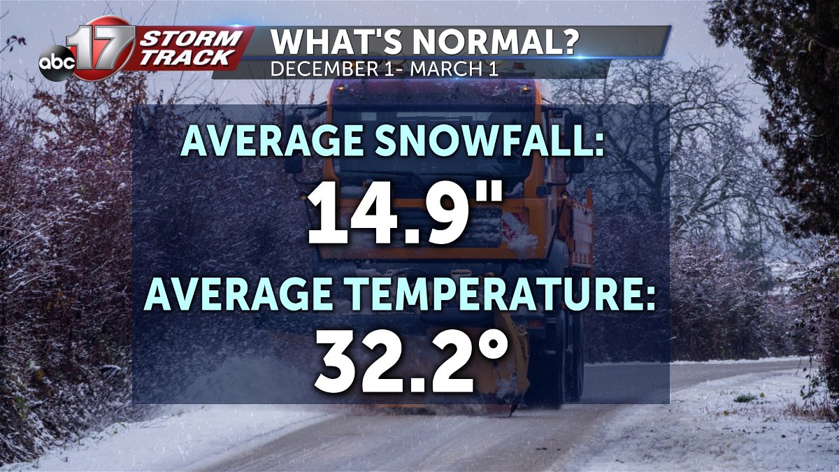
Last year, we ended up with about 10” less snowfall than our seasonal average, and about 6 degrees warmer than normal thanks to a variable jet stream that mainly stayed to our north. The seasonal average in Columbia is around 15” of snow and an average temperature right around the freezing mark.
Fifty years of climate data has shown that every season is warming, but winter is warming at a faster rate. Nationwide, cold snaps in the winter months are getting shorter, with about eleven fewer days cooler than average in a consecutive stretch in Columbia, and around 5 in Jefferson City.
Changing global pattern, warming ocean
Globally, ocean temperatures have been warmer than average for months, and the benchmark to declare a “strong” El Nino has been reached since September. Climate experts predict an 80% chance of a strong El Nino through the winter that could spill over into spring.
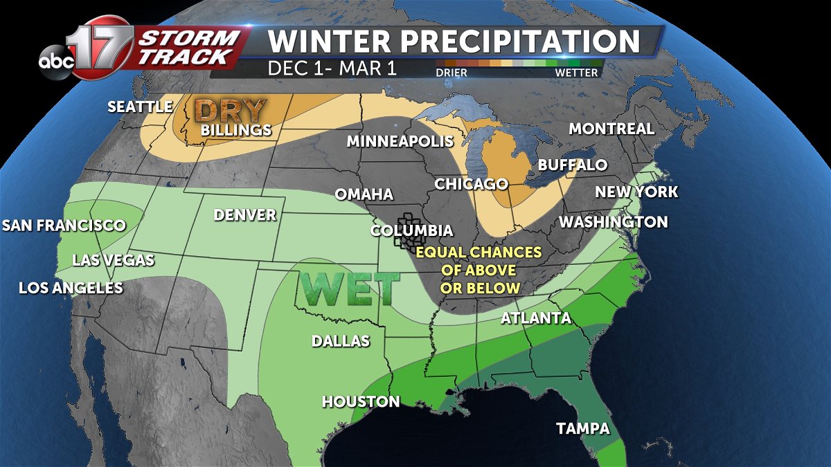
El Nino is marked by above average sea surface temperatures in the central pacific and eastern tropics. Warmer waters in the Pacific Ocean can push the jet stream south from neutral, allowing the northern us to become warmer and drier in the winter. In turn, the south is usually wetter and stormier than usual.
The most recent strong El Nino in 2016 produced above average rain, less than normal snowfall, and was about five degrees warmer than average while the most recent weak El Nino in winter 2019 brought above average snow and rain and slightly warmer than normal temperatures.
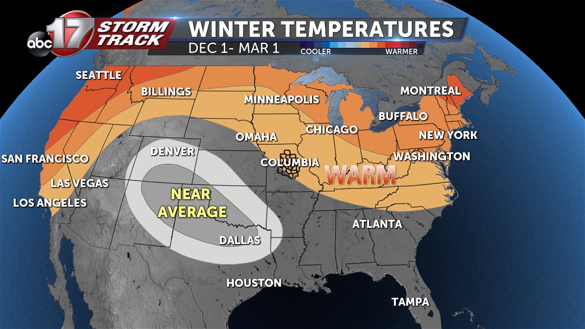
This season a classic El Nino forecast will set up, with warmer than average temperatures across the northern part of the country including here in Missouri, and wet conditions in the south. Of note, the upper Missouri basin is looking to come in drier than normal, that could limit snow pack and flooding potential later next spring.
Drought lingering, but slowly improving
Last year at this time, more than 90% of Missouri was in drought. This year, about 75% has been experiencing drier than normal conditions with slow improvement expected through this winter in our area.
What about the holidays?
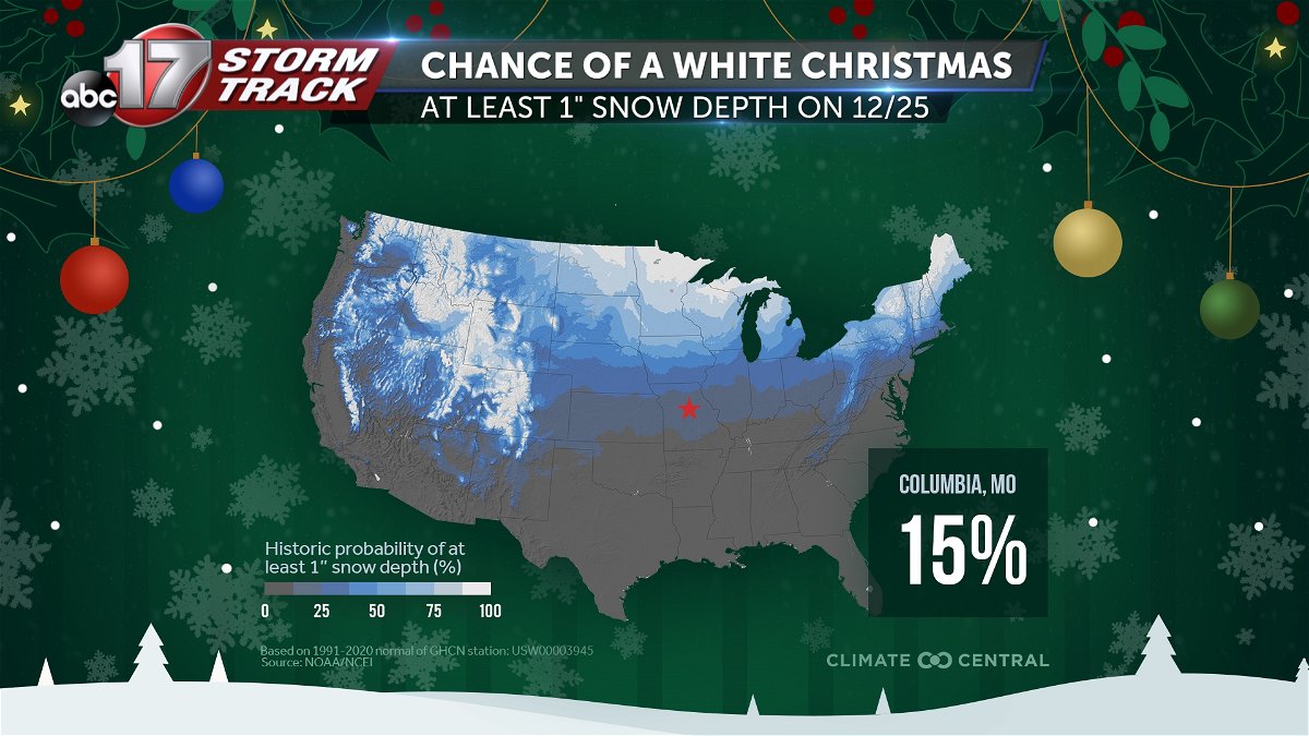
Christmas 2022 brought some bitterly cold air with wind chills nearly 30 degrees below zero leading up to the holiday, with an inch of snow on the ground on Christmas Day. Columbia typically has a 15 percent chance of seeing a white Christmas. The twelve days of Christmas have become more mild, with about a 6 degree increase in temperatures over that time frame in the last 50 years.
Mild winter, less snow
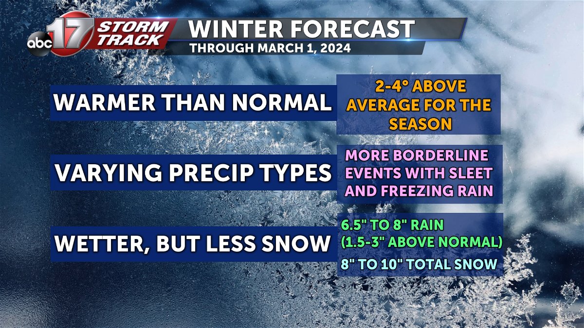
The average winter temperature will likely be 2-4 degrees warmer than normal, with a few cold snaps possible. With the polar jet to our north, any disturbances will be more borderline with rain and mixed precipitation types. Total precipitation should end up between 6.5” to 8” with 8 to 10” of snow possible this winter.
