Weather Alert Day: Severe storms with hail, wind and tornadoes possible Friday; tornado watch in effect
Mid-Missouri is now under a tornado watch through 8 p.m. Click here for more details.
Watch live severe weather coverage
FRIDAY MORNING UPDATE:
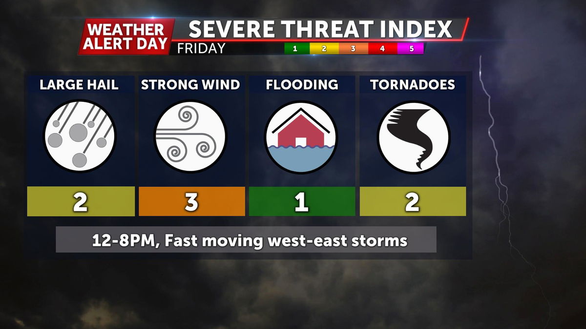
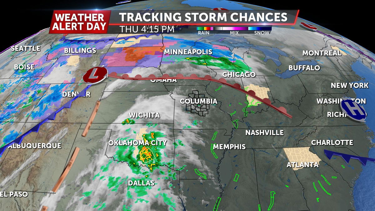
As of Friday morning, our severe threat remains on track with minor modification. It appears that showers and/or storms will arrive in our western most counties by late morning, and march east from there. It's looking like there will be enough energy for storms to strengthen as the progress east. Chances for severe weather will increase with distance east, with overall best chances for hail, wind, and tornadoes coming east of a line from Brunswick to Rolla. Severe risk continues to increase towards St. Louis, with these storms arriving in late afternoon at peak heating time.
There will likely be two rounds in mid-MO. Round one will be ahead of the front, and have better access to shear that may help organize storms in favor of tornadoes. Round two will come along the front where there is still plenty of lift to generate storms with damaging winds and hail, but less spin for tornadoes. This round is later in the afternoon. All of this appears to push out of mid-MO by 6 p.m.
THURSDAY EVENING UPDATE:
The Storm Prediction Center has released the latest update to their outlook for Friday. This highlights areas to the north and south where there is a locally higher risk for damaging winds strong tornadoes, and large hail (Iowa & NE Missouri especially with regards to hail). Mid-Missouri remains in a severe risk, but to a lesser extent than our neighbors north and south. For example, the tornado risk locally still exists, but its more likely that any tornadoes in mid-MO form along a line of storms creating a better chance for spin-up tornadoes that tend to be weaker and have a shorter life span compared to the stronger and longer track tornadoes that are more likely in the environments to our north and south. This is thanks to better lift to create storms to our north, and better storm energy to our south. While it currently appears that we may avoid the worst, there is still a local threat for all types of severe weather.
As of Thursday evening, it's becoming more clear that we will be able to realize the available instability early in the day on Friday. Early morning rain and clouds could still act as suppressant for storm energy later in the day. Still, given the possibility of a severe outcome on the other end of the spectrum, Friday is a day we want you to be weather aware, and paying attention to the forecast. For this reason, our Weather Alert Day stands.
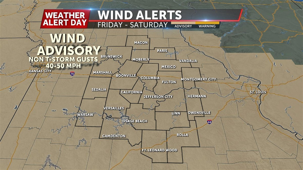
Lastly, even outside of the severe risk, non-thunderstorm winds will be strong to gusty. Expect Sustained winds from 20-30 mph, to gusts as high as 50+ mph at times. A Wind Advisory goes into effect early Friday afternoon through midday Saturday.
BLOG:
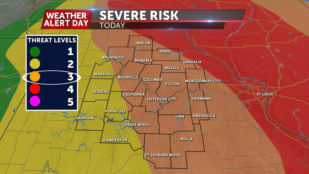
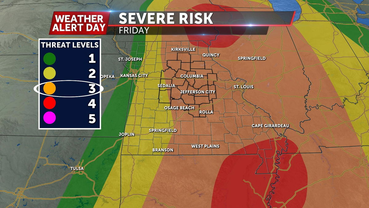
The ABC 17 Stormtrack Weather Team has issued a Weather Alert Day that will go into effect at noon on Friday and last through early evening for the potential of severe storms. The Storm Prediction Center has much of the region in a level 3 out of 5 severe risk on Friday.

SETUP:
A warm front has lifted to our north, bringing in warmer air this afternoon, setting the stage for a favorable environment for severe weather on Friday ahead of a cold front. Expect morning cloud cover and perhaps a few lingering showers to start the day, but morning temperatures on Friday should fall to about 60 degrees by sunrise.
As temperatures rise, instability will increase over the area, especially if clouds break up and rain dissipates early. Thunderstorms are expected to develop along and ahead of the approaching cold front from the west by early afternoon, moving into areas along Highway 65 between about noon and 2:00 p.m.
TIMING:
Storms will quickly race east, exiting Mid-Missouri between 6-8:00 p.m. This means issued warnings will likely not have as much lead time, so plan to head to safety as soon as a warning is issued for your area.
Storms could start off fairly isolated, but carry the potential of large hail and tornadoes. We're expecting storms to develop into a squall line with the possibility of damaging winds, hail, and tornadoes as the afternoon progresses.
PREPARE:
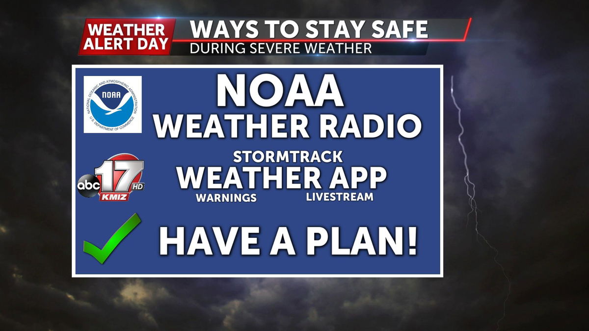
Make sure you have a way to receive warnings as soon as they are issued. You can get those by downloading the ABC 17 Stormtrack Weather App, and making sure your NOAA Weather Radio is plugged in with backup batteries. Stay with the ABC 17 Stormtrack Weather team as the forecast timing could shift as we get closer to Friday morning.
