Insider Blog: Tracking how a warming climate could impact rainfall intensity
When we think of late spring and much of last summer, weeks of drought come to mind.
The summer and fall months brought a drought nearly as impactful as 2012, with almost 7 inches less rain than average for both seasons combined.
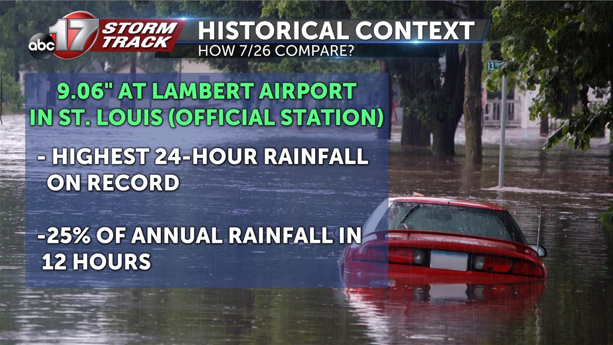
Less than 100 miles away, though, those living in St. Louis experienced a quarter of the annual average rainfall in just 12 hours at the end of July.
Lambert airport shattered a 24-hour rainfall record, with training storms putting down about 9 inches of rain. Just two days later, flash flooding again prompted several dozen water rescues in the STL metro.
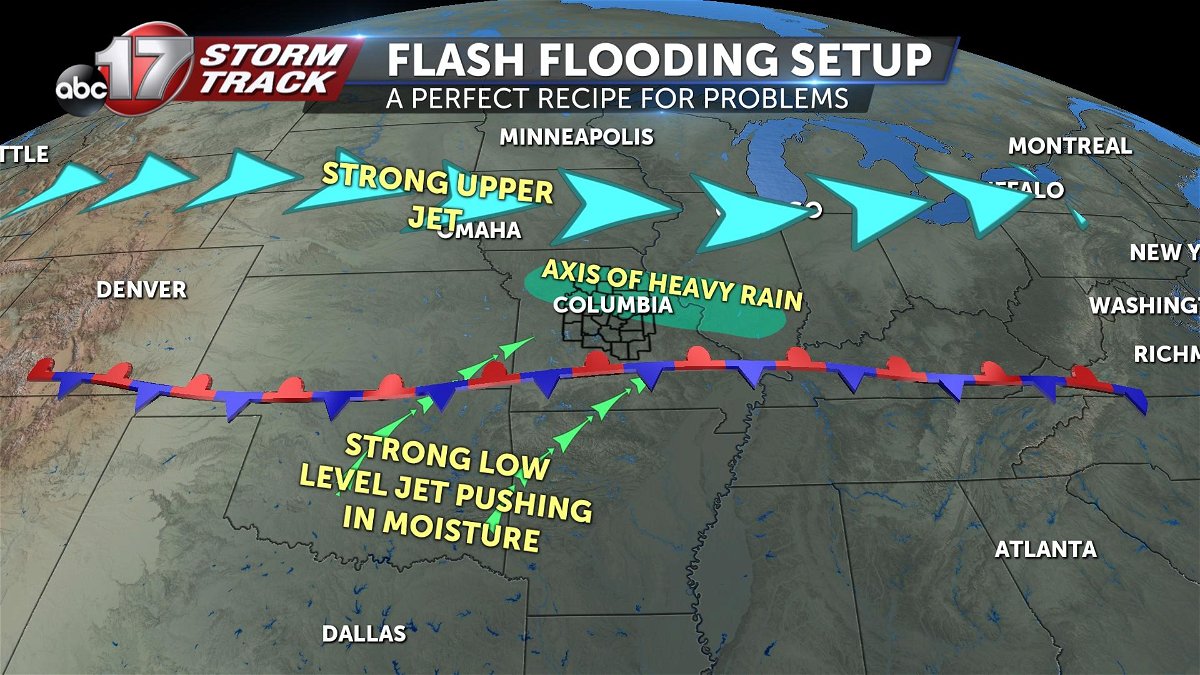
The weather setup was a perfect recipe for locally catastrophic rain. A stationary boundary was draped across southern Missouri, providing lift for storms to develop. Strong low-level winds brought in extreme amounts of moisture, interacting with the front and the upper-level jet stream to produce rounds of storms over the same area for several hours.
St. Louis wasn't the only waterlogged place in 2022. In fact, during that same week at the end of July, parts of Eastern Kentucky suffered deadly flash flooding. Thirty-nine people were killed and more than 600 helicopter rescues were made as 14 to 16 inches of rain fell at rates of 4 inches per hour at times. Extreme river and stream rises were responsible for much of the damage.
Both events ended up costing a total of $1.2 billion.
While these events are happening on a small scale, they could become more frequent as we experience a warming climate.
National Weather Service Hydrologist Mark Fuchs says he's noticed an increase in these local heavy rain events in the last 15 years.
"The frequency of more local flash flood events is more common across this part of the country than it used to be, but we're seeing a lot more of it with better observational equipment."
According to Climate Central, since 1988, increases in rainfall accounted for a third of flood damage in the U.S. For every 1 degree of warming, the air can hold an extra 4% of moisture. Since 1970, the country has warmed 2.6 degrees, meaning the atmosphere can hold 10% more moisture.
In the St. Louis area, hourly rainfall increased almost a tenth of an inch, indicating more than a 10% change since 1970.
In the period between 1958 and 2016, the heaviest 11% of rain events became 42% wetter in the Midwest. Climate experts warn that additional warming could increase the intensity of flash floods by 8% by 2100.
