Insider Blog: Freezing rain, drizzle could make some roads slick
UPDATE
As of Thursday morning, freezing rain and drizzle has left parts of mid-Missouri with potentially slick roadways, and more certainly, a glaze of ice on elevated surfaces like decks and vehicles. Rain and drizzle is expected to switch to snow by this afternoon.
BLOG
SETUP
A stalled warm front is draped just south of mid-Missouri. As this boundary comes to a halt just south of us, a low pressure system over New Mexico, Texas, and Colorado, will move along the boundary in our direction. Moving in overnight into tomorrow morning, this system will bring rain starting around midnight, which will mix with freezing rain and snow before exiting Thursday afternoon. Impacts will be limited across much of Mid-Missouri, but slick conditions are likely north of Highway 24 for much of Thursday morning into early afternoon.
TIMING:
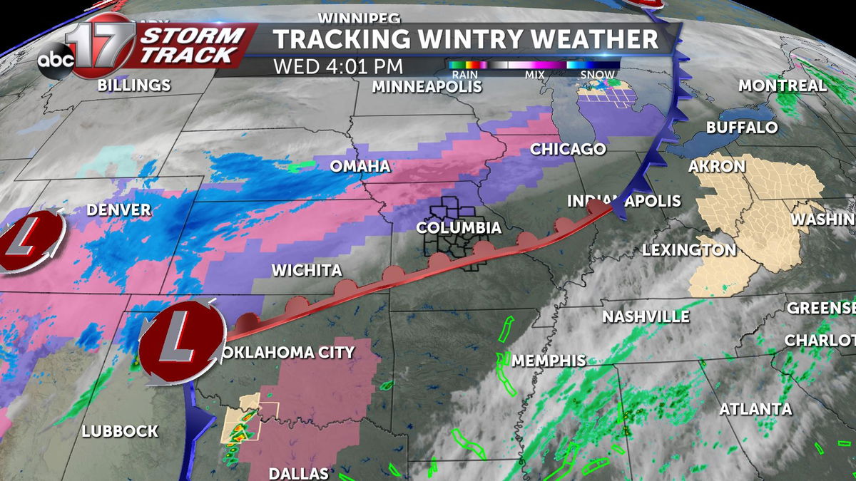
Rain arrives between 11 p.m. and 12 a.m. across western Missouri. As it moves into areas near Marshall, Boonville, Brunswick, Moberly, and Macon, it's likely that conditions will favor a wintry mix. It's possible that we see freezing rain and/or sleet at onset. It's in these areas where light icing will be possible. To the south and east, near Columbia, Montgomery City, Sedalia, California, and Kingdom City, we'll more likely see precipitation onset as rain before transitioning to a brief freezing rain/sleet mix. This window of time is shorter before snow mixes in areawide as temperatures fall early Thursday morning. Snow will mix in around 7-8 a.m. and linger with light and scattered snow showers lingering until early afternoon. Not all will see snow the entire time, as coverage may be spotty. Dry air kills off precipitation chances by about 3 p.m.
IMPACTS
Overall impacts will remain limited with precipitation remaining light, but accumulations and slick roads are likely.
The Winter Storm Severity Index suggests that all impacted areas in mid-Missouri will experience minor impacts with travel remain possible, but may be slowed a bit.
This lines up with the forecast, as a light glaze of ice will be possible by sunrise.
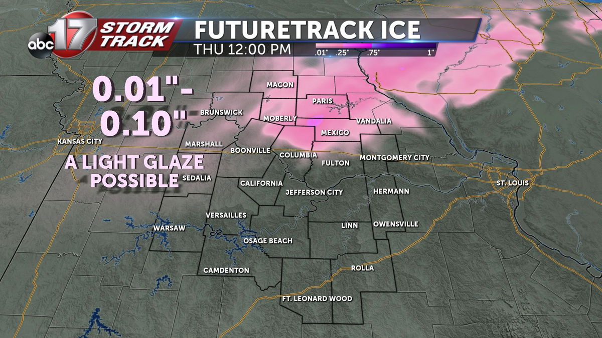
On top of that glaze of ice, we'll also likely pick up some minor accumulations, likely less than one inch, across northern mid-Missouri.
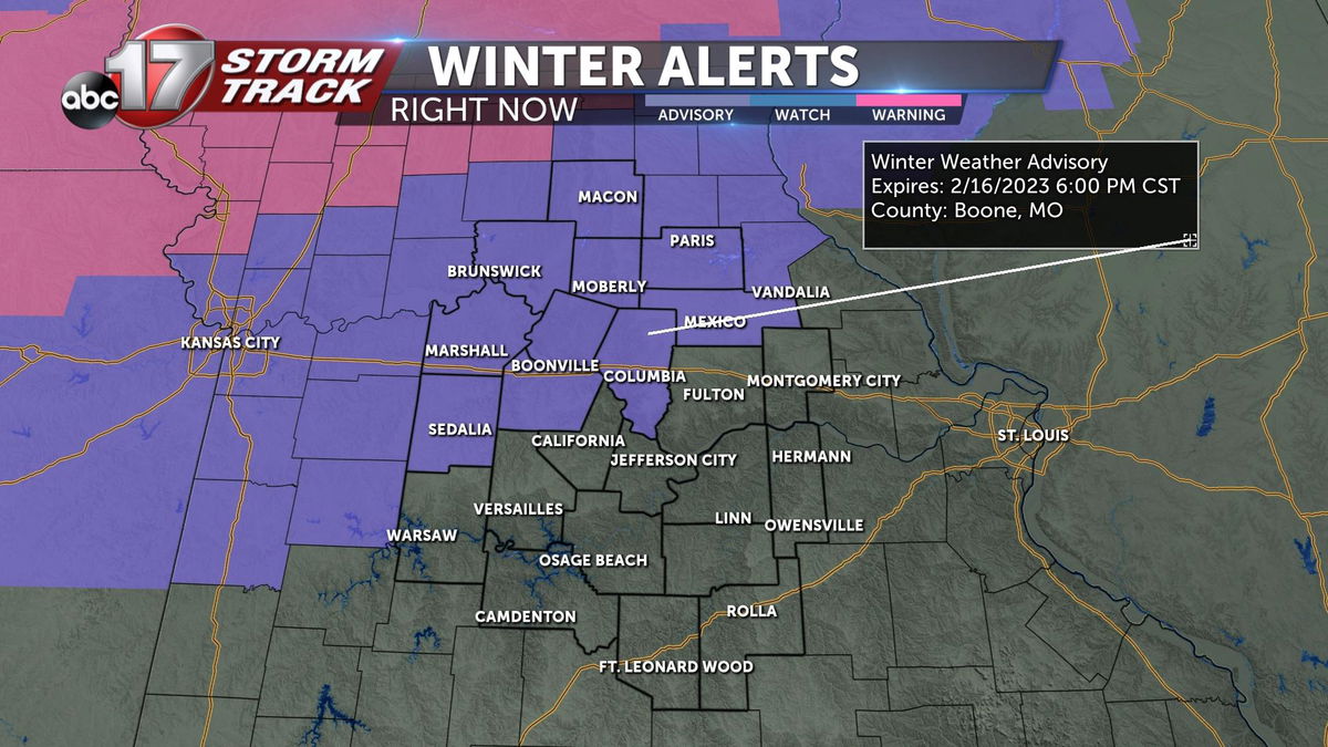
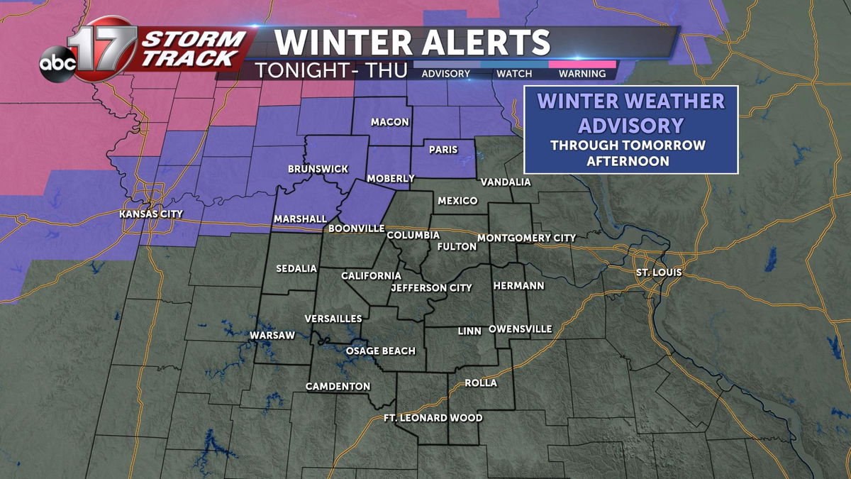
A Winter Weather Advisory has been issued for Chariton, Saline, Macon, Randolph, Howard, and Monroe counties, where impacts are greatest, and snow totals are more likely to reach one inch.
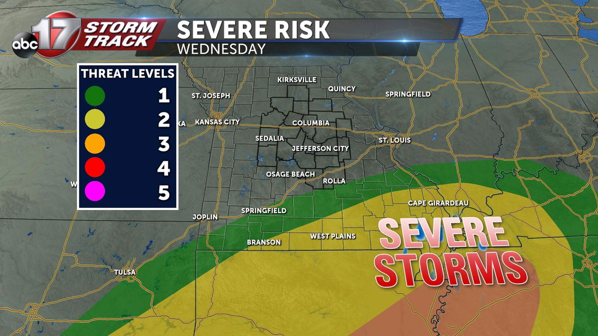
Severe weather will also be an element with this system, but it avoids mid-Missouri, as the bootheel becomes the target for strong thunderstorms.