Insider Blog: Rain and strong winds Tuesday, snow for parts of Mid-Missouri Thursday morning
The Stormtrack Weather Team is tracking an active weather pattern this week as two strong low pressure systems move through the region.
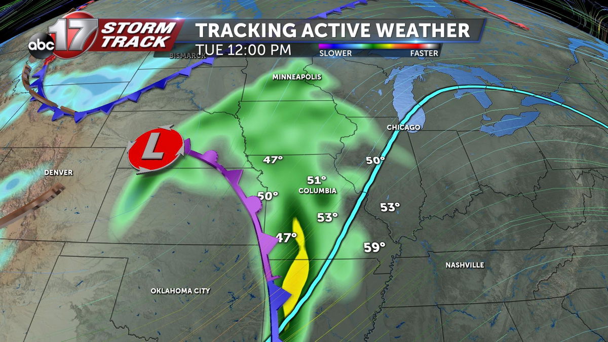
Low pressure will track to our northeast tonight into tomorrow, dragging a cold front through Mid-Missouri. Rain showers move in on early Tuesday and continue through early evening. A few rumbles of thunder are possible, but the risk for severe weather will be focused near the triple point, or where low pressure and the frontal boundaries meet in northwest Missouri.
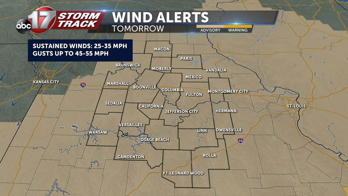
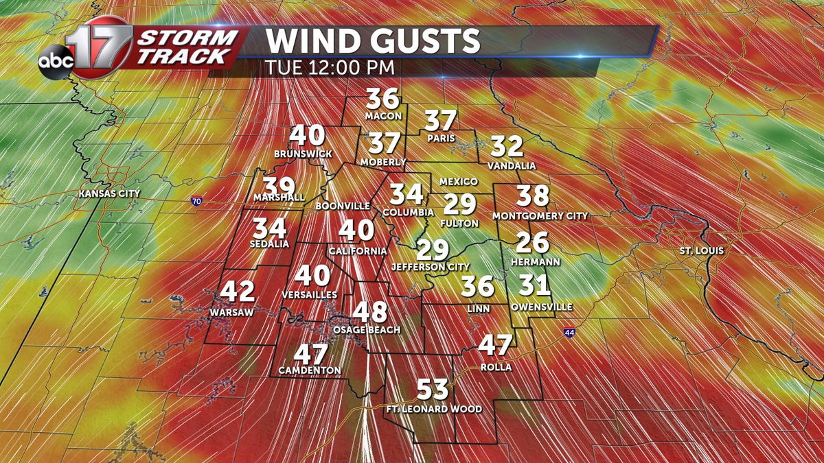
Along with rain, we'll see strong winds throughout much of the day, with south gusts between 45-55 mph. A Wind Advisory is in effect for all of Mid-Missouri between early Tuesday morning and before sunrise Wednesday.
Rain amounts on Tuesday will add up to between 0.25 and 0.4".
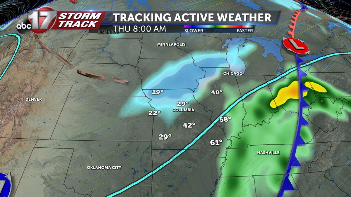
We'll get a bit of a break on Wednesday with breezy conditions continuing to keep temperatures mild early in the day as highs get to about 60 by early afternoon. Another strong low pressure system works through the region Wednesday night and Thursday. The forecast track of this low has shifted a bit further south, meaning there's a chance more of Mid-Missouri could see light accumulating snow early on Thursday.
Precipitation could start as early as around 10:00 p.m. on Wednesday as rain, changing to snow north of I-70 in to the morning. On the southern side of this system, rain showers and thunderstorms are more likely into Thursday afternoon.
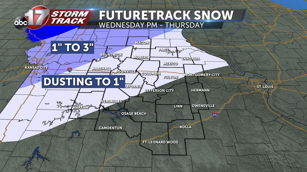
Snow amounts will be in the dusting to 1" range along and north of I-70, and with lower snow to liquid ratios, we are expecting a wet snow that likely stays on grass or makes roads temporarily slushy. Road impacts will be limited to minor slick spots, but could become more dangerous the farther north and west you travel Wednesday night into Thursday.
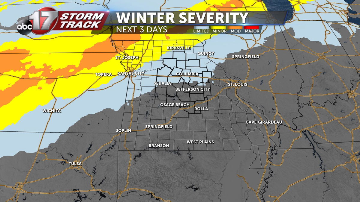
Temperatures drop dramatically behind the cold front that accompanies this system, with highs only making the upper 30s on Thursday and Friday before warming up over the weekend.
