Tracking near average snowfall, temperatures for the upcoming winter
No two winters are the same in Mid-Missouri. After all, we recorded the first measurable snowfall before the calendar flipped to December.
We're coming up on a year since a deadly tornado outbreak rocked much of the Mississippi and Ohio Valleys on Dec. 10, 2021. An EF-0 tornado did damage near Wellsville in Montgomery County, and a few stronger tornadoes hit the St. Louis area. One of those killed six workers at an Amazon facility in Edwardsville, Illinois. The outbreak went on to produce more devastating tornadoes in Arkansas, Kentucky, and Tennessee.
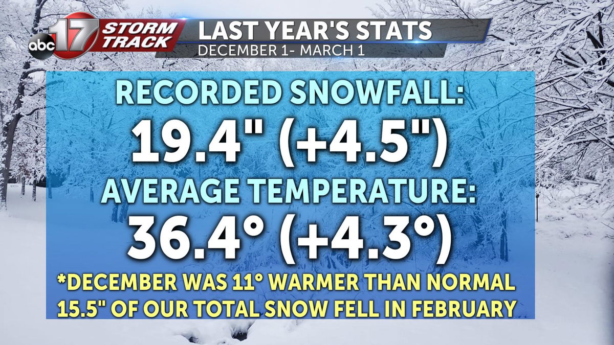
December ended up 11 degrees warmer than normal, but we made up for it later in the season with almost weekly snowfalls in February. We ended up with almost 5 inches above our normal seasonal snowfall, with most of it falling in February.
A moderate to strong La Nina was in place, and this winter, the global pattern looks to hold on in a moderate state for the third season in a row. This is a rare phenomenon climate experts call a "triple dip." There have only been two other times since 1950 that La Nina has occurred three seasons in a row; the winters of 1974-76 and 1999-2001.
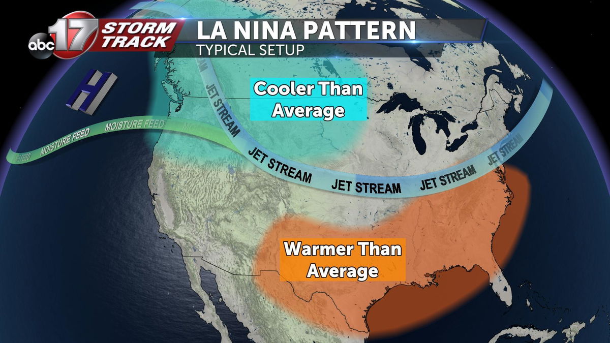
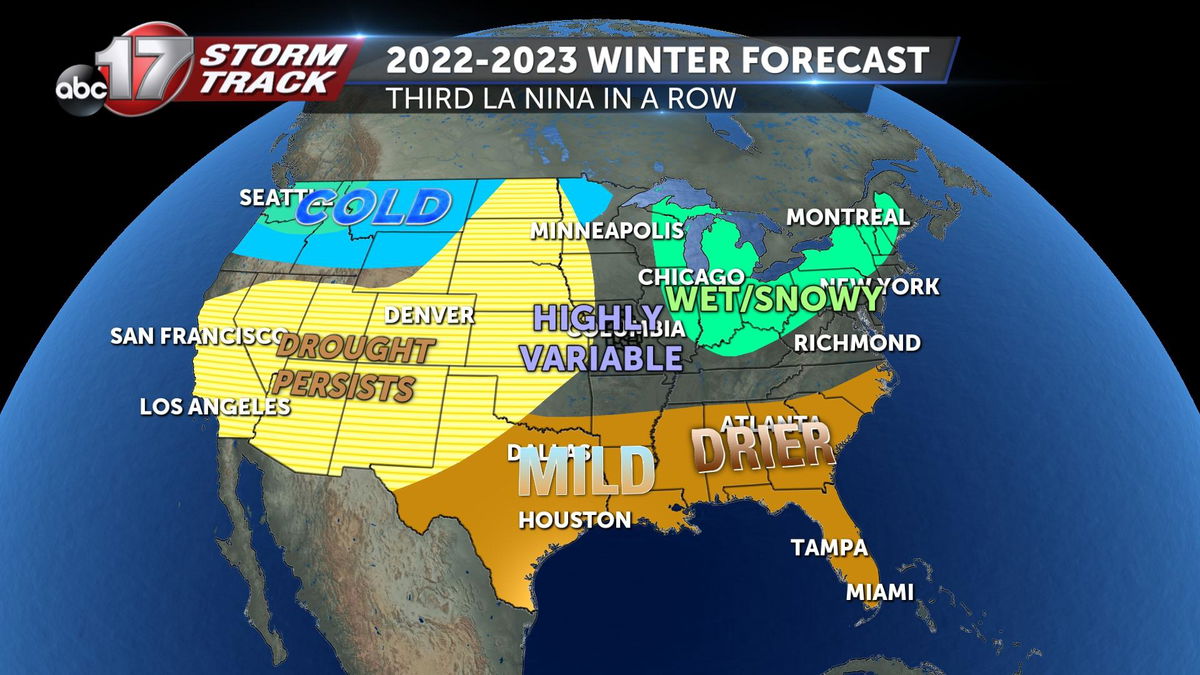
When a La Nina pattern is present, the polar jet stream lines up with the Pacific Jet, bringing more moisture and forcing more active weather from the Pacific Northwest and the Midwest to the Ohio Valley. Temperatures could go either way in our area versus warmer and drier in the southern states.
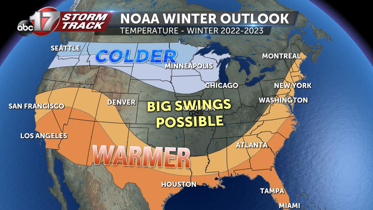
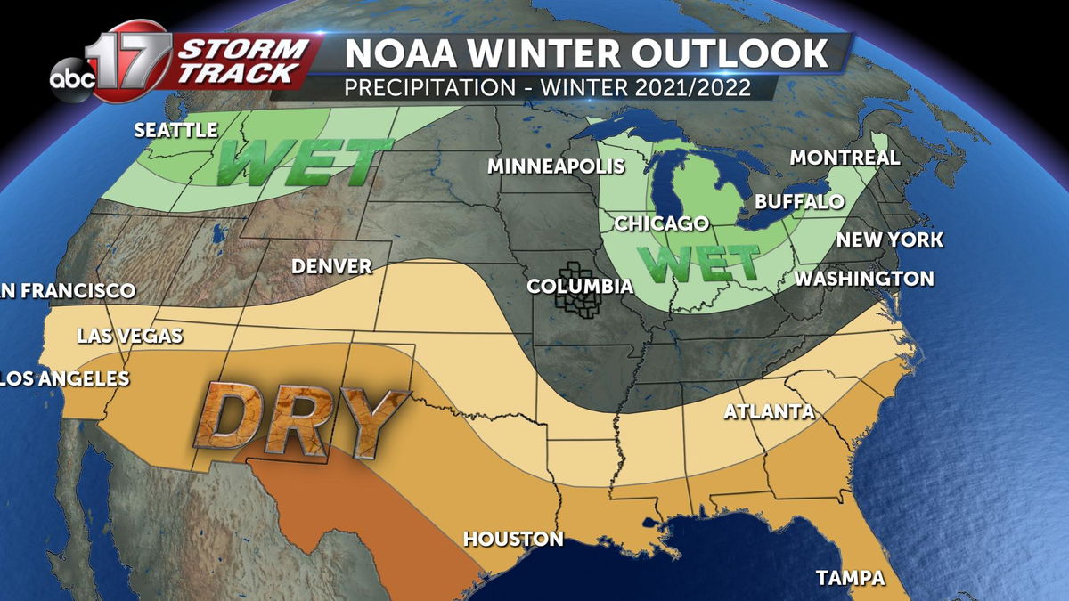
NOAA is predicting equal chances of higher or lower-than-average temperatures for Mid-Missouri, and the same probability of above or below-average precipitation this winter. This is a little different from last year when the forecast had us warmer and wetter than normal. This can be attributed to a slightly weaker La Nina.
How does that translate to what our winter will be like?
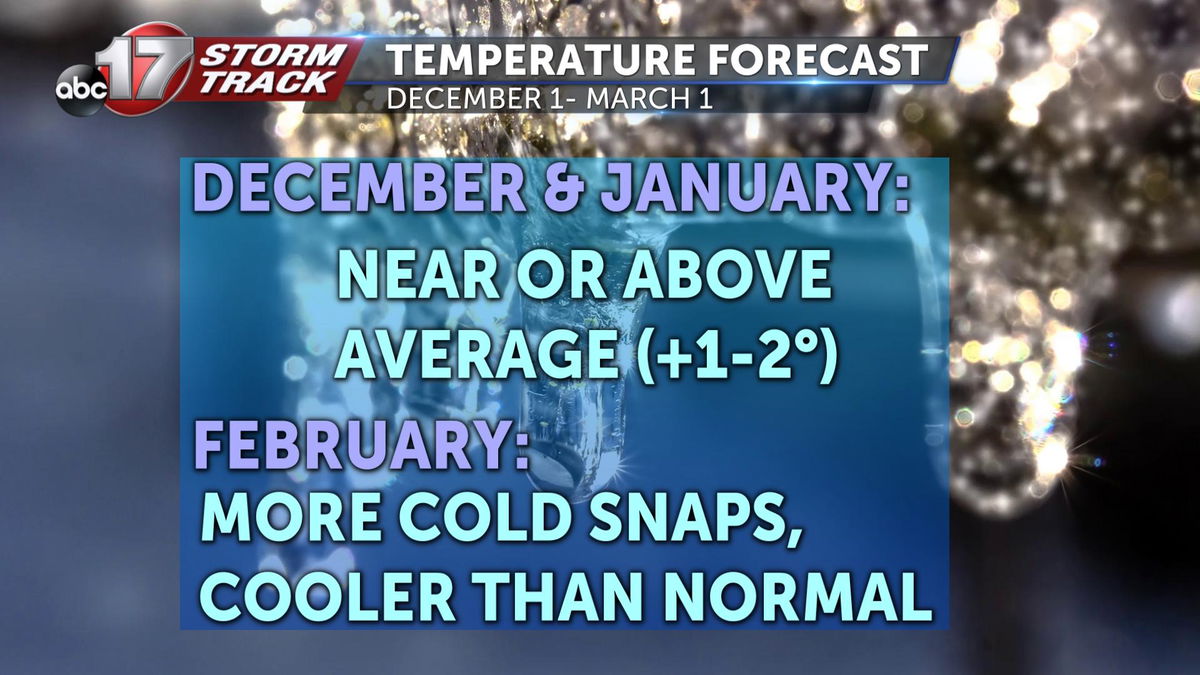
I'm expecting near or above-average temperatures in December and January, on the order of 1-2 degrees. February still looks like it will be cooler, with more stretches of frigid air.
I'm tracking near or slightly-above-average precipitation with more of our snowfall coming in February again, but there will likely be several storm systems that will bring alternate precipitation types like ice, sleet or rain.
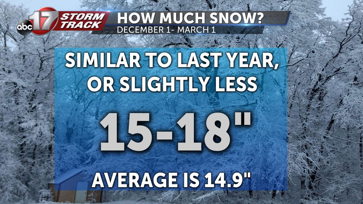
Snowfall amounts will come in at the 15-18-inch range, a little higher than normal.
The Ohio Valley will likely have more snow and ice than normal, while much of the Plains and Southwest will experience continued drought conditions. The coldest air spreads a bit farther east this year, impacting the Pacific Northwest, all the way to Minnesota.
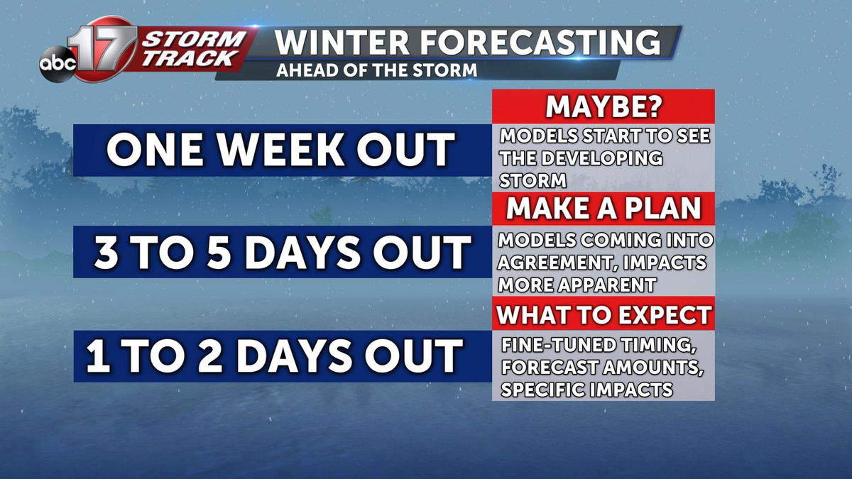
To stay prepared ahead of winter weather this season, make sure you know when a Weather Alert Day is in effect. The Stormtrack Weather team starts analyzing a storm on forecast models a week out. From there, we start to see trends on amounts and impacts about three to five days out. You can expect fine-tuned forecasts with specific amounts and hazards about 24 to 48 hours ahead of the storm.
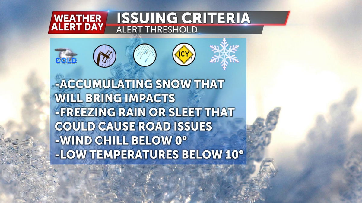
We issue Weather Alert Days for accumulating snow that will bring road impacts, freezing rain or sleet that could cause road problems and power outages, and dangerous wind chills below zero along with low temperatures below 10 degrees.
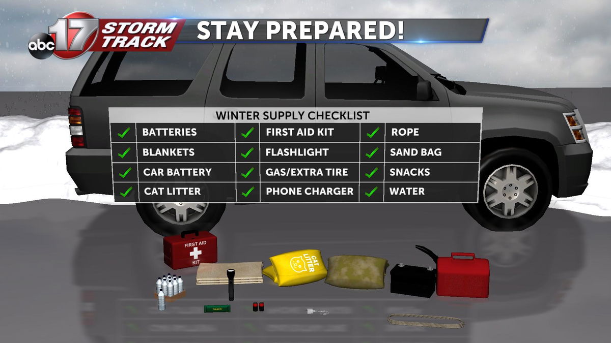
Make sure to have an emergency kit in your car packed with batteries, blankets, a first aid kit, water, a flashlight, non-perishable snacks and a cellphone charger if you must travel on bad weather days. Download the ABC 17 Stormtrack Weather App to get immediate updates on changing weather conditions, closings, and delays.
