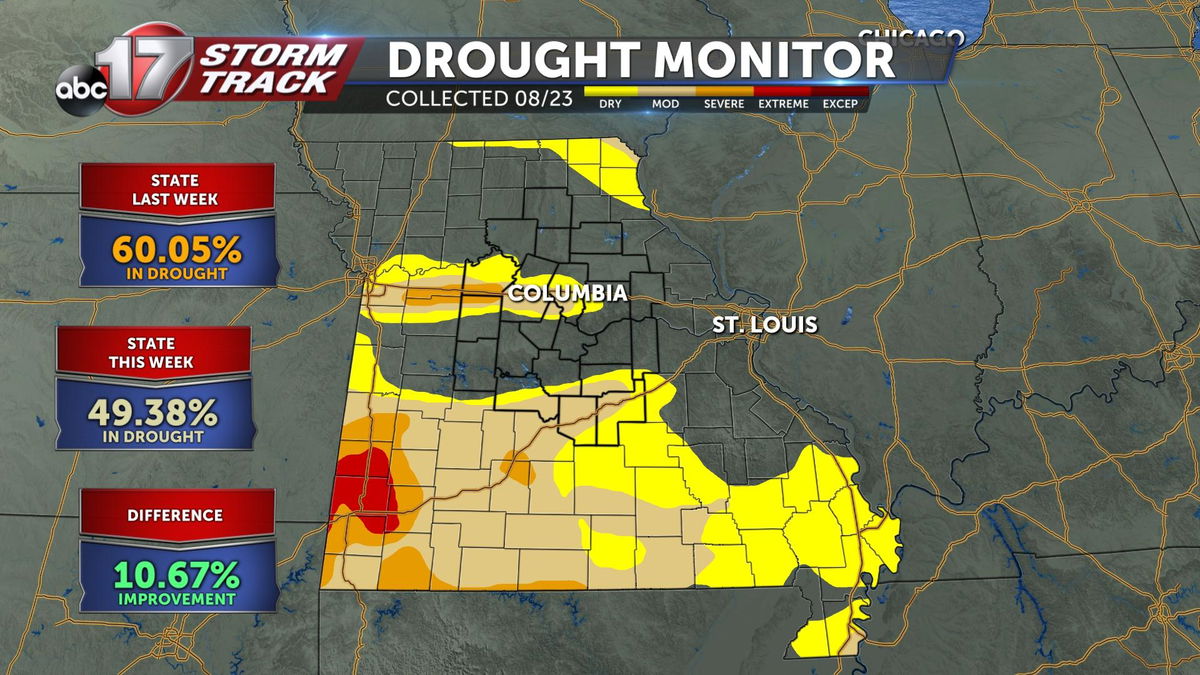
Statewide drought recedes for second week in a row
DROUGHT MONITOR:
The drought monitor is a product collaboratively produced by various government agencies and other organizations, to keep tabs on how dry (or not) communities are around the country. The product is updated every Thursday morning based on data collected through Tuesday morning of the same week. This means the drought monitor is updated once a week, and doesn't always include the latest rainfall recorded.
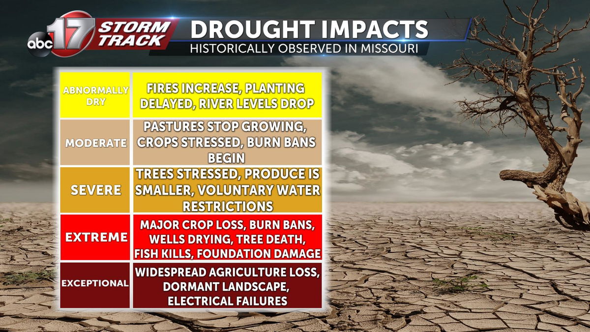
Drought conditions are broken down into 5 main categories; Abnormally Dry, Moderate, Severe, Extreme, and Exceptional.
WHAT IT MEANS FOR US:
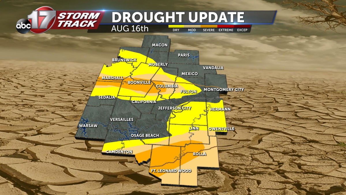
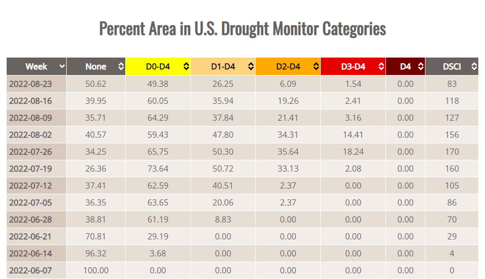
The latest released drought monitor shows some improvement across mid-Missouri. Here's the map collected on August 16th, and released on the 18th.
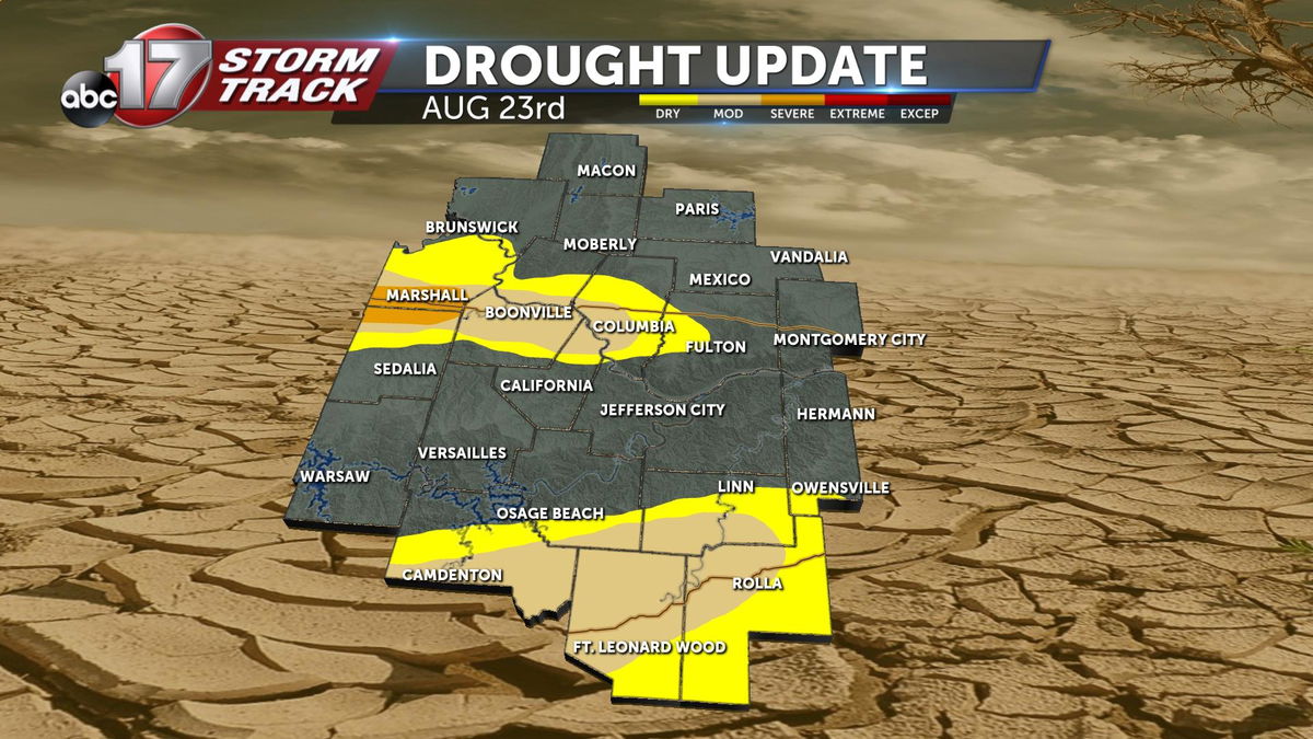
Compare that to the latest update released on the 23rd, and you'll notice continued improvement.
This impact is felt statewide. The state of Missouri saw more than a 10 percent reduction in drought in whole.
Much of the improvement that is reflected in this map, comes from the soaking rain recorded on Tuesday, August 16th. Columbia Regional Airport recorded 1.62 inches of rain that day, but some recorded much more. Much of this event just missed the cutoff from last week's map, which occurred that morning.
Drought conditions have ballooned since they took hold in late spring. Today's map release marks the second week in a row of steady improvement across all categories.
For more details about the drought, or the U.S. Drought monitor, click here.
