Insider Blog: Drought Monitor shows relief for some, worsening conditions for others
DROUGHT MONITOR:
The drought monitor is a product collaboratively produced by various government agencies and other organizations, to keep tabs on how dry (or not) communities are around the country. The product is updated every Thursday morning based on data collected through Tuesday morning of the same week. This means the drought monitor is updated once a week, and doesn't always include the latest rainfall recorded.
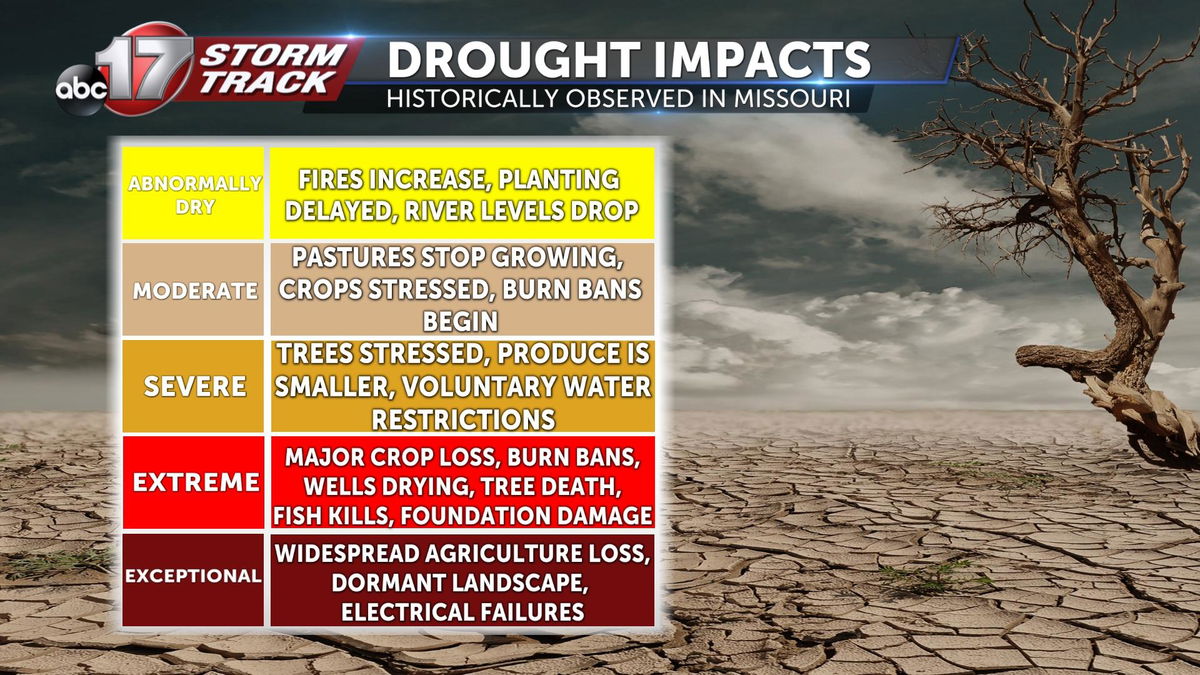
Drought conditions are broken down into 5 main categories; Abnormally Dry, Moderate, Severe, Extreme, and Exceptional.

WHAT IT MEANS FOR US:
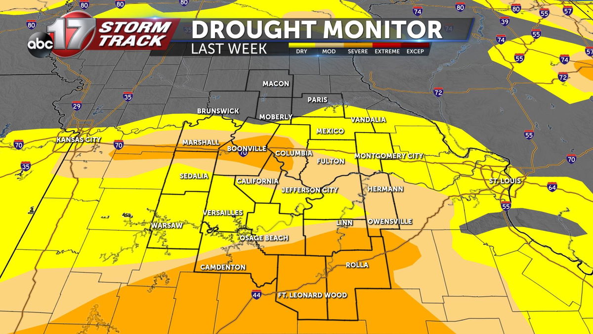
Last week, the drought monitor showed everything from abnormally dry (yellow) to extreme drought conditions (red) across Missouri, with mid-Missouri missing out on the extreme drought. Severe drought conditions spanning at least some portion of 11 counties represented the driest conditions locally.

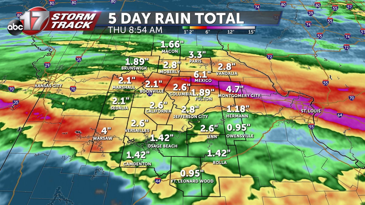
Today, the latest drought monitor was released, after a week of rain that brought at least several inches of rain area wide.

Because not all of this rain fell before Tuesday at 7 am, only some of the rainfall is accounted for.

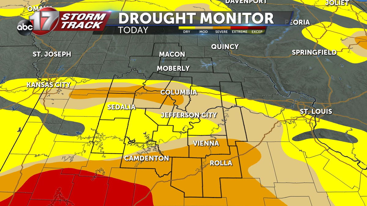
The latest report shows narrowed drought conditions for some, especially where the axis of heavy rain fell early Tuesday morning in Montgomery and Audrain counties, but drought conditions south of I-70 are largely unchanged, with extreme drought coming closer to mid-Missouri.
This means for a better understanding of what this week's rain means for the ongoing drought in our state, we'll have to wait until next Thursday. Stay tuned on air, web and social media for next week's update. For more detailed information on the Drought Monitor, click here.
