Weather Alert Day: Snow exits this evening, dangerous cold sets in
Watch an afternoon update on road conditions and snow totals in the player above.
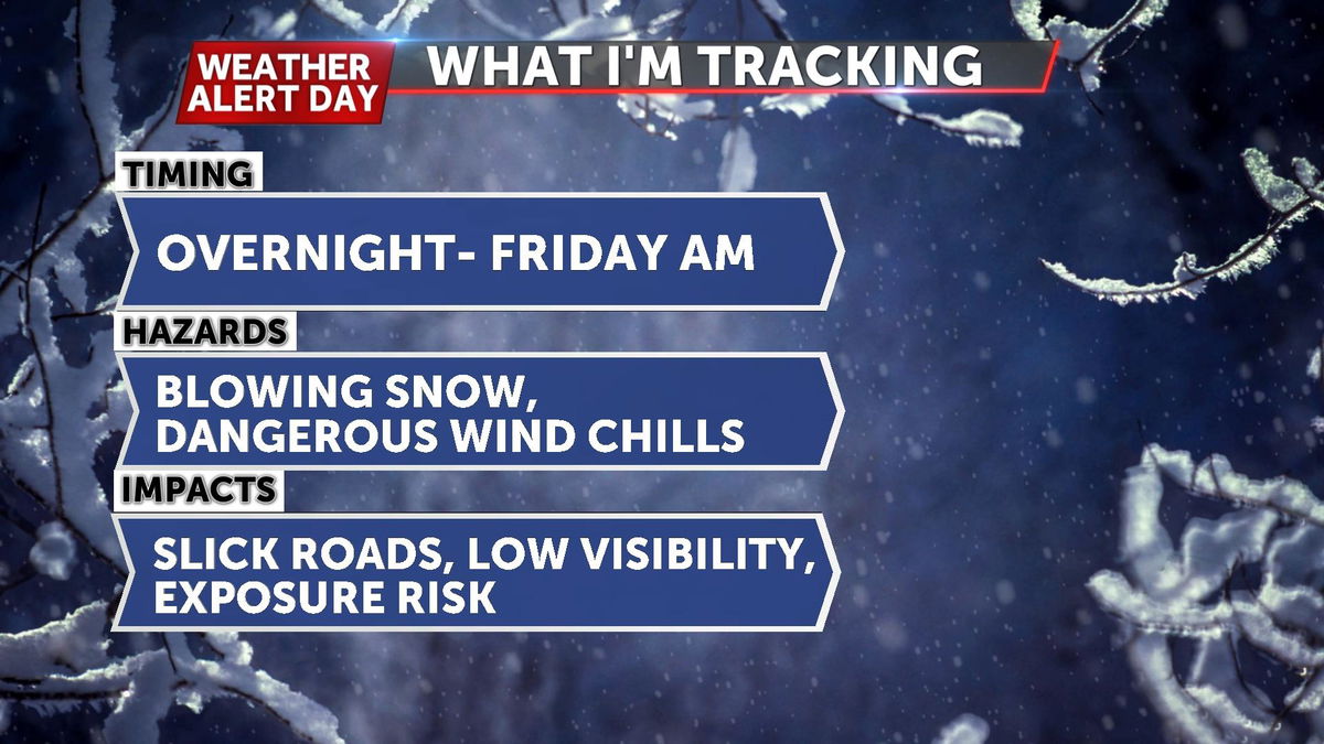
An ABC 17 Stormtrack Weather Alert Day is in effect through Friday morning as snow continues to work across Mid-Missouri and exit after sunset tonight.
THURSDAY AFTERNOON UPDATE:
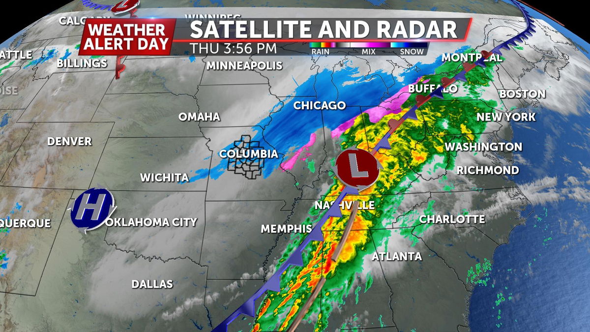
The last bands of snow are working across Mid-Missouri late this afternoon, adding another 1-3" on top of sleet and snow we saw earlier today. As snow works east, we'll be left with gusty winds and frigid temperatures as lows drop into the single digits.
SETUP:
Strong low pressure continues to work across much of the country today, bringing wintry weather to Missouri and the upper Midwest, with heavy rain and severe weather to our south. Bitterly cold air is expected to stick around overnight as strong northwest winds continue to usher in frigid temperatures.
Timeline:
Snow showers will exit to the east between 5:00 and 7:00 p.m., but road temperatures remain below freezing until Friday afternoon as sunshine returns along with temperatures in the mid-30s. This will help out with snow packed and icy roads, but still expect slick spots in untreated areas into Saturday morning as we get below freezing once again Friday night.
IMPACTS:
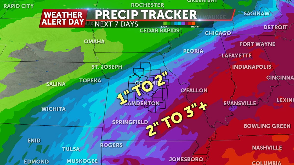
Rain amounts will range between 1-3" over the entire event, but some of this will likely fall as sleet and snow. There is a Flood Watch in place until Thursday night for areas along and south of Highway 50 where 2-3" of rain could fall between Wednesday night and Thursday morning. Low water crossings, streams, and creeks will all be affected.
Given the temperatures, the snow ratio will end up somewhere between 8:1 and 10:1, meaning it will be somewhat of a wet snowfall.
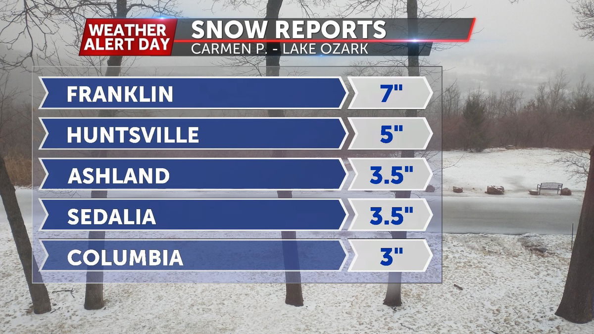
Combined sleet and snow amounts will end up between 3-7", with isolated higher amounts north of I-70. Roads will be slick with a coating of ice lurking beneath the snow and sleet.
Gusty winds will also make it difficult to see as snow comes down, with wind gusts between 25-35 mph Thursday. Blowing snow will be an issue along with frigid wind chills dropping below zero by Thursday night.
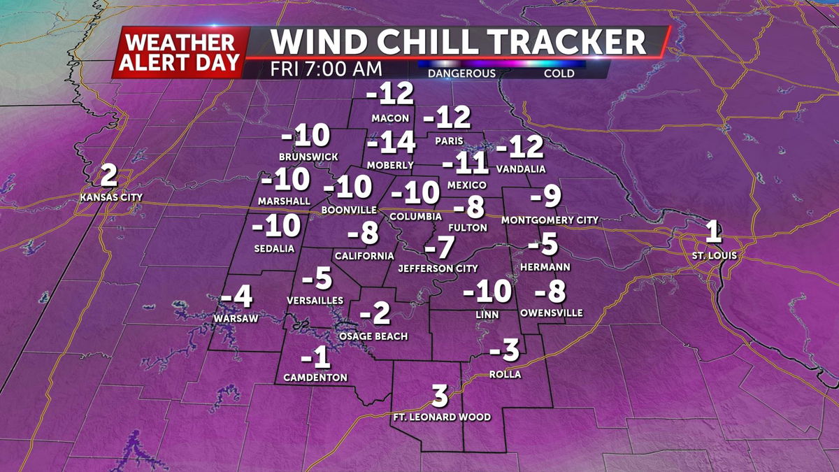
Temperatures drop into the single digits by Friday morning, so there could still be some complications to travel into early Friday before temperatures rise above freezing.
PREPARE:
Try to stay off the roads before sunrise on Thursday through at least the afternoon while precipitation is still falling. Get the hour-by-hour forecast and a live look at radar by downloading the ABC 17 Stormtrack Weather App. You can get that here.
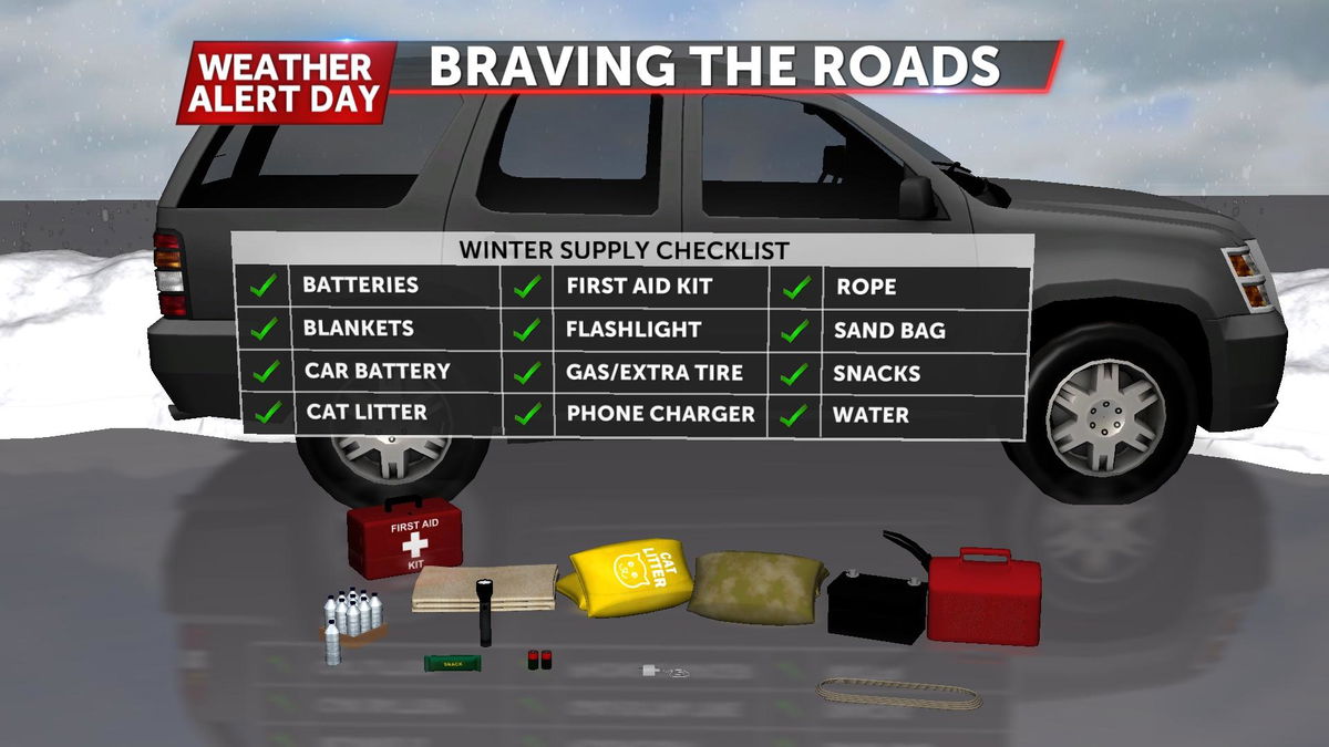
If you do have to venture out into these elements, be sure to pack all the necessary supplies, should you get stuck: