Insider Blog: Why wind is a concern on Wednesday
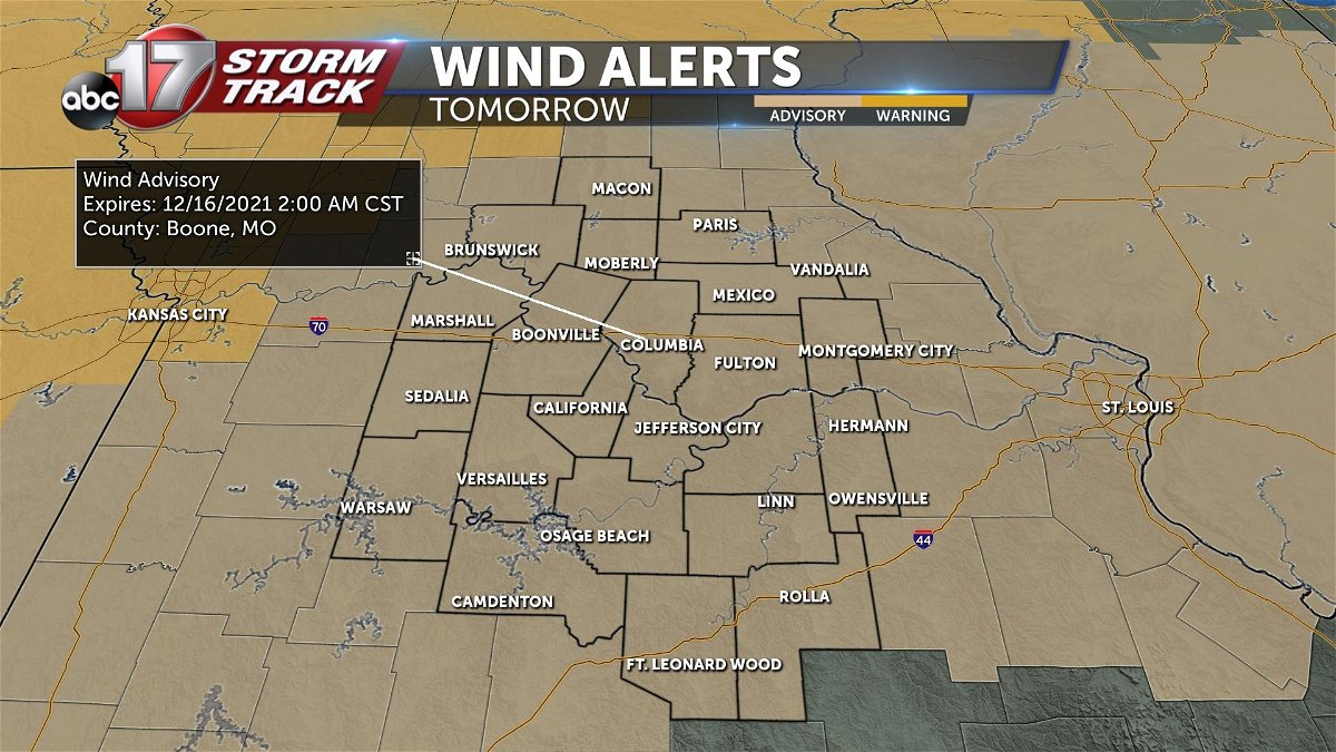
A Wind Advisory is in place for the entire viewing area for tomorrow, as our next system approaches from the west.
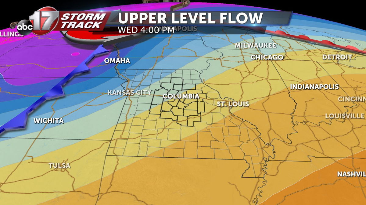
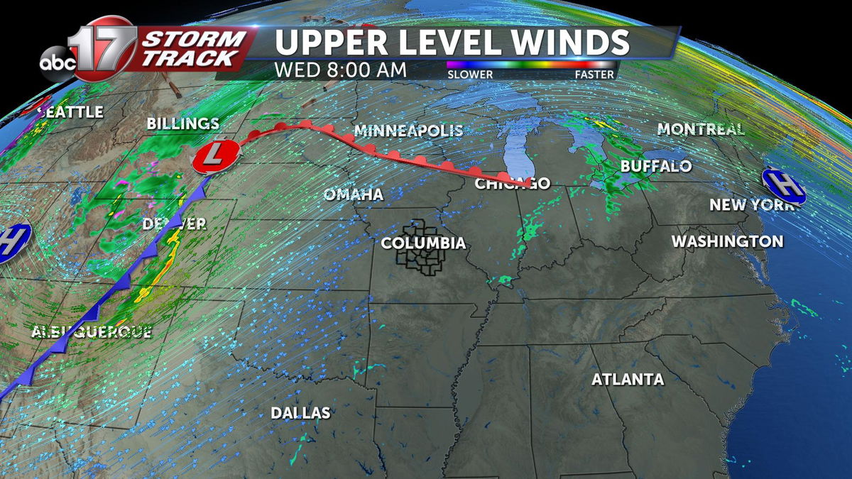
Really, this is all thanks to the upper level pattern across the central U.S. Low pressure in the west will move towards us, while high pressure to our south will barely budge.
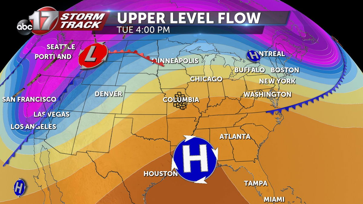
We get sandwiched in-between the two, meaning so do our pressure gradients aloft. A tightening pressure gradient both aloft and at the surface will result in both strong winds aloft and strong non-thunderstorm winds at the surface.
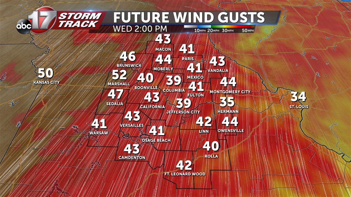
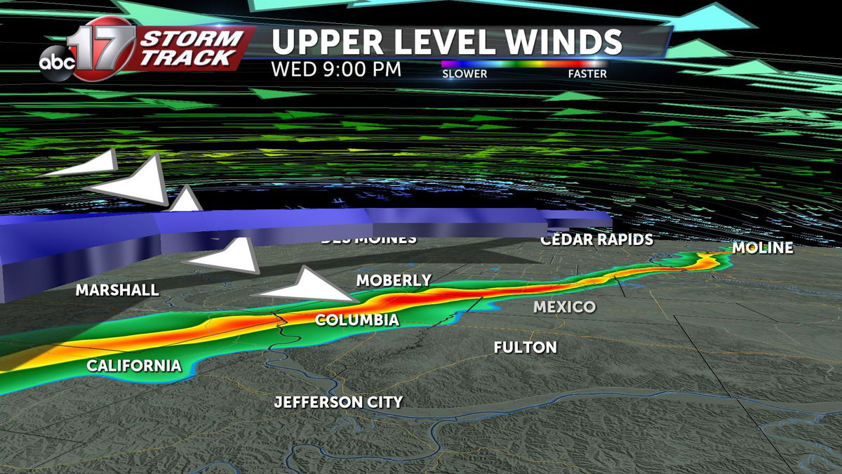
Wind gusts Wednesday afternoon will range anywhere between 35 and 50 mph, with strongest gusts coming in the west. Overnight into Thursday, a wind shift brings a brief break from the wind, but ultimately more gusty conditions out of the north. This is the suface cold front passing through.
The front we're tracking will also bring us a chance for showers and storms Wednesday night.
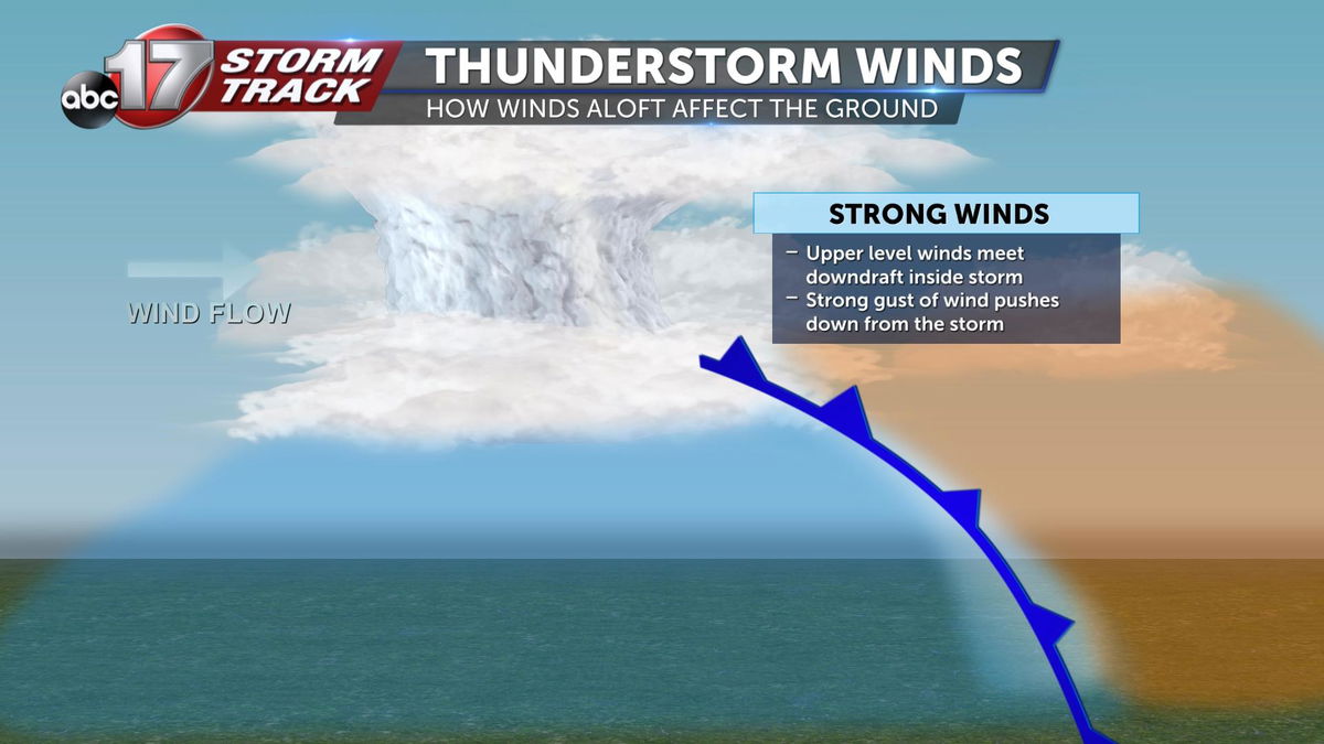
As thunderstorms form along the cold front, strong winds aloft will be rushing overhead. This is when storms may be able to transfer that wind's momentum down to the surface via downdrafts inside the storm.
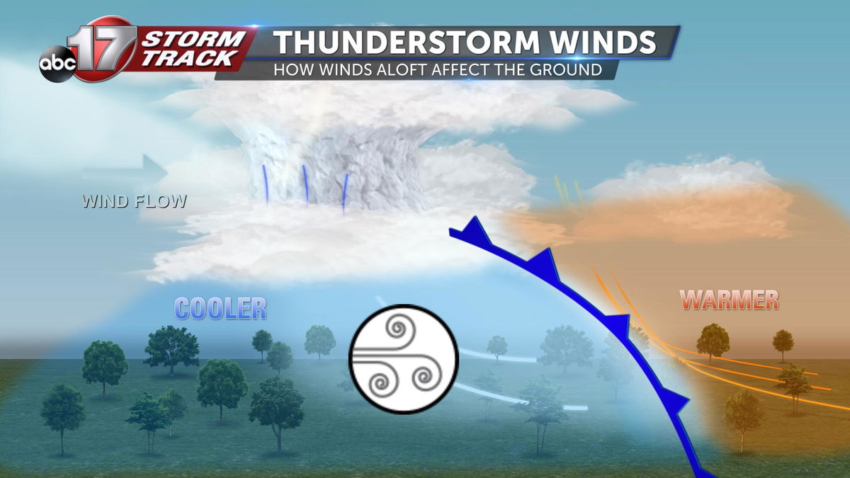
This can result in damaging thunderstorm winds at the surface, and is why wind is our primary concern with any storms that develop Wednesday evening.
