Insider Blog: Why we saw snow on Radar, but not out our window
The snow that was in the forecast today did show up, but it had a hard time making it all the way to the ground.
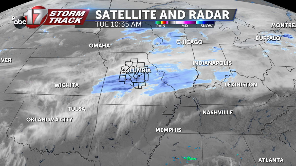
Satellite and Radar from Tuesday show plenty of moisture aloft in the form of clouds and snow.
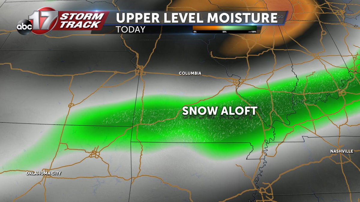
A quick analysis of upper level moisture will back that up. Plenty of moisture can be found about 15 thousand feet up in the atmosphere. It's what is below, that likely dissapointed snow lovers Tuesday.
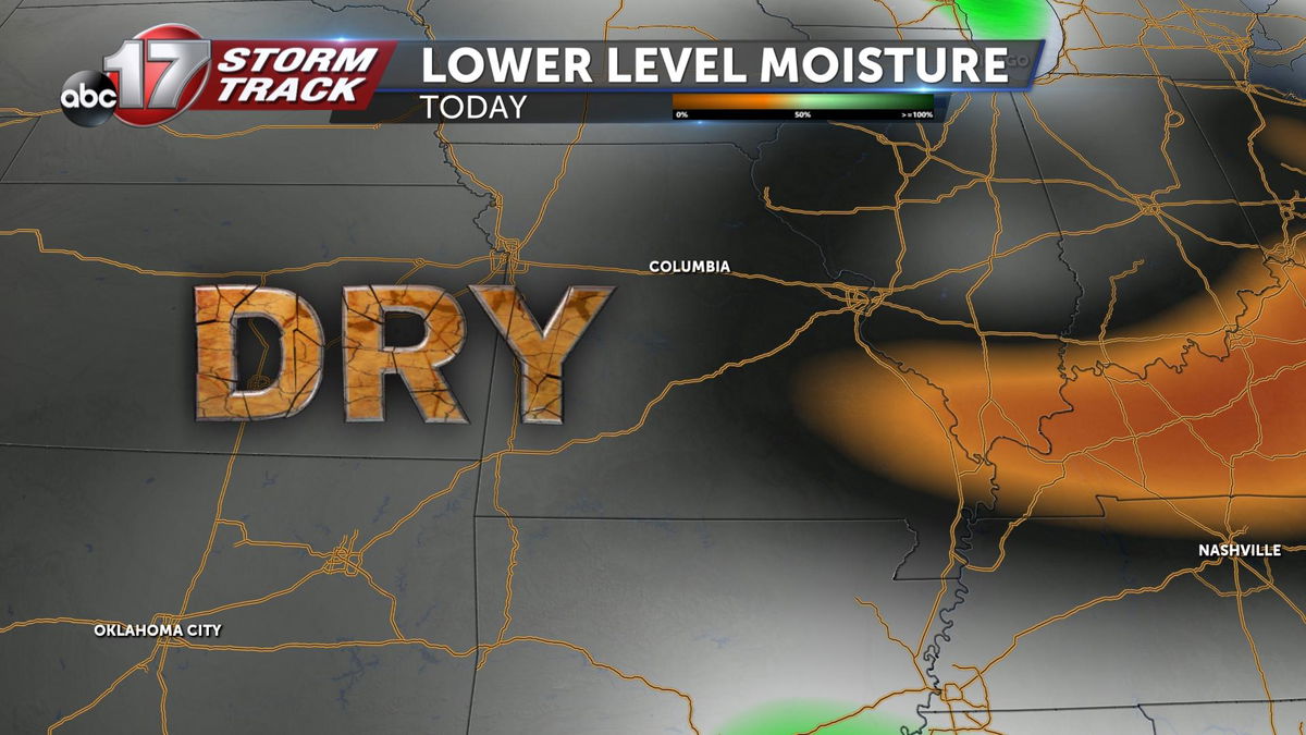
Step down to about 6 thousand feet in the atmosphere, and things look much different. Dry air prevailed through the lowest levels of the atmosphere for most of the day.
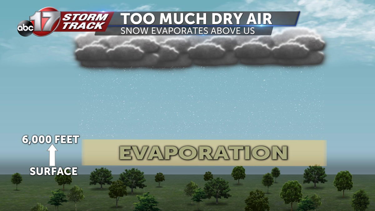
The picture as a whole shows snow falling in the upper levels of the atmosphere, and evaporating before it hits the ground. The layer of dry air prevents the snowflakes from getting close enough for us to see them. Mean while they are still falling way above our heads. Contributing to the wintry and dreary look to Tuesday's sky.
