Insider Blog: Wintry precipitation falls Thursday despite mild temperatures
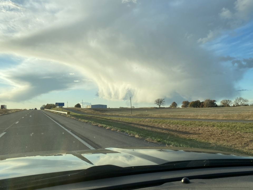
A cold front worked through Mid-Missouri last night, bringing gusty winds and temperatures back into the low 50s this afternoon. We were expecting a cool down, but how did some areas end up with what looked like snow showers when we were above freezing?
It's an interesting phenomenon that can happen when there are varying levels of temperature throughout the atmosphere, and a strong enough updraft to send water droplets to the part of the atmosphere where it's below 32 degrees.
On Thursday, there was enough lift rounding the base of the upper level low that brought us rain on Wednesday night to force up a few more showers by late afternoon.
On radar, these looked like harmless spot showers, but the photos and reports came flooding in as our viewers noticed what looked like large clumps of snow falling in sheets while it was sunny elsewhere.
Temperatures around the area at 4:00 p.m. were in the mid-50s. Taking a look at the strength of these cells and the marginal but ample amount of instability in place, the setup was favorable to see some pockets of what is called graupel.
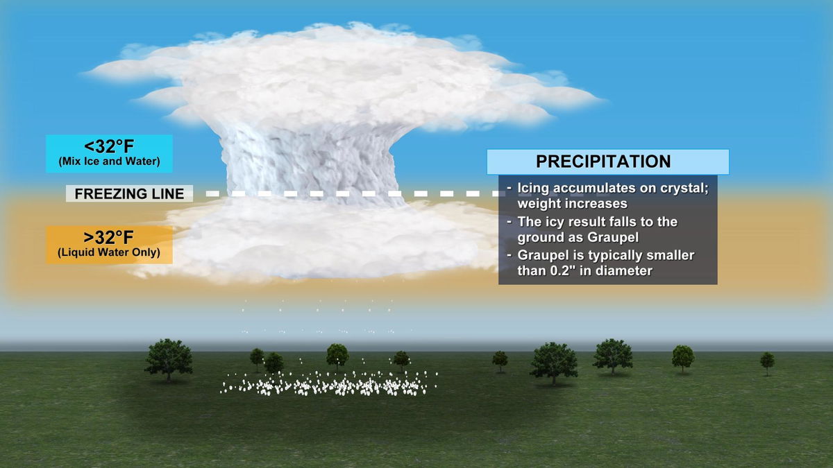
Graupel can be best described as frozen pellets that often look like the dessert Dippin' Dots. As the precipitation falls, it can meld together and create what looks like small ice balls or snow balls similar to what was reported today.
To get technical, there are a few different processes involved when it comes to precipitation. Rain, snow, freezing rain, sleet, and hail all form under different conditions.
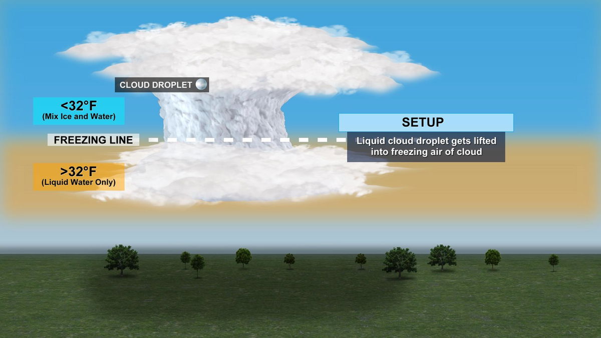
In the case of graupel, we have temperatures well above freezing at the surface. Check.
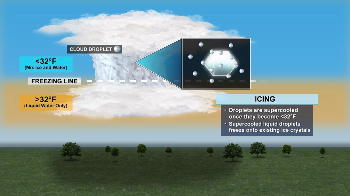
Next, liquid cloud droplets get sent up in an updraft where temperatures are below freezing at the top. Since we had stronger forcing today and modest updrafts, these supercooled droplets were sent far enough up into the updraft to where they collided and froze onto existing ice crystals at the top of the cloud. As this icing occurs on the crystals, the precipitation gets too heavy for the cloud to hold against gravity, and falls to the ground as graupel.
Other forms of wintry precipitation are a little easier to forecast when we can take a look at the layers of temperature differences through the low and mid-levels of the atmosphere, if there are any. If not and the whole layer is under 32 degrees, that's when we have all snow as a precipitation type.
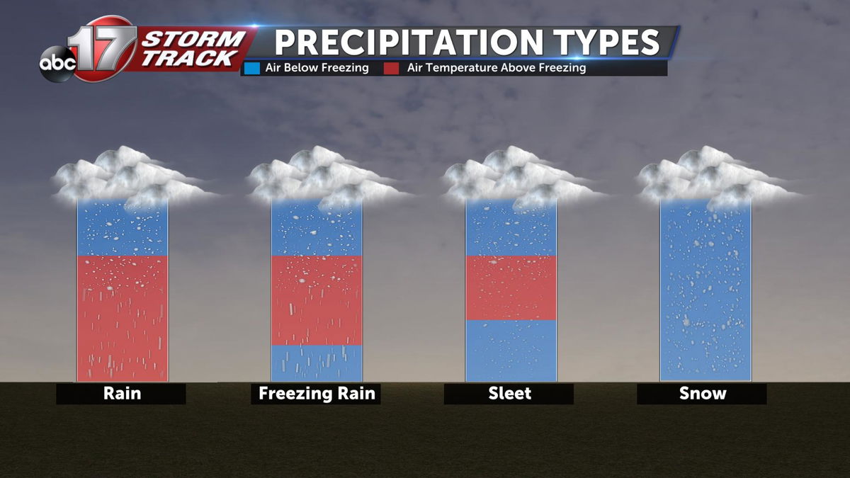
This chart above sums up each type fairly well, something we'll be watching for more often as we progress into winter.
