Insider Blog: Kansas City gets their first snow of the season, Columbia misses out
Those who don't enjoy winter should've enjoyed Monday's cold and rainy weather. After all, at least it's not snow, right?
The same can't be said for those just down the road in Kansas City. Flakes could be seen falling across the city, including on our camera at Legends Field.
The temperature reading around this time was still in the 40's. It's possible that this reading was a little off, but temperatures were still well above freezing when the snow fell to the ground around 11 am.
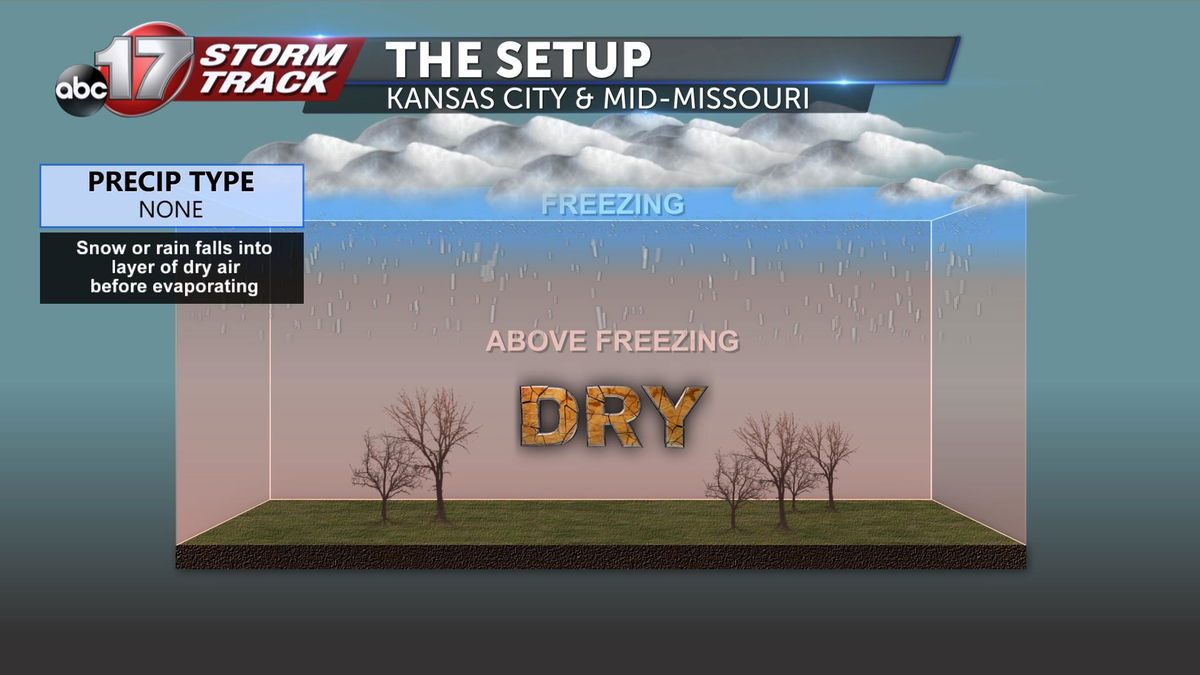
So how did we see flakes make it all the way to the surface, with the temperatures so warm? Simply put, the snow didn't have time to completely melt before it fell to the ground. The showers forecast for Monday morning initially started off as snow aloft. The precipitation then fell through a relatively warm and dry layer, evaporating before it hit the ground.

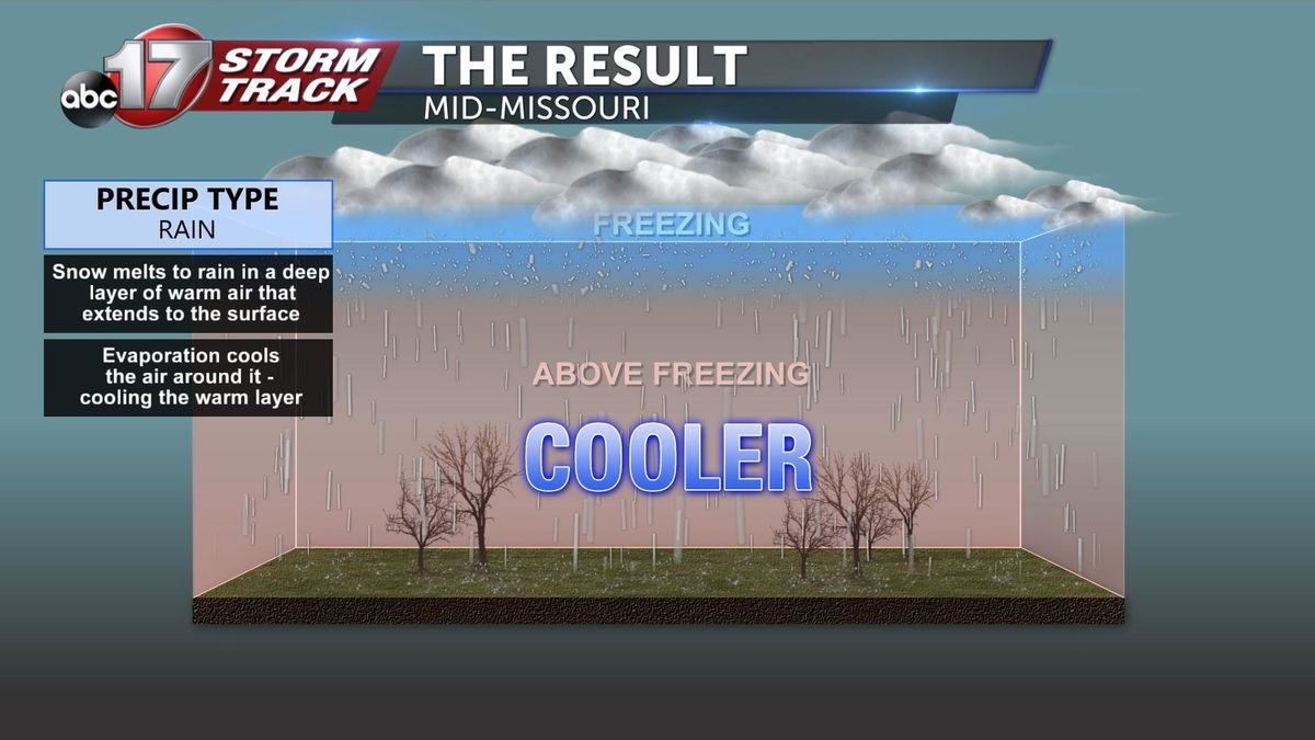
We expected the snow flakes aloft to melt, allowing rain to eventually erode away the dry layer, allowing for the precipitation to completely melt and make it all the way to the ground. That is largely what happened in Columbia.

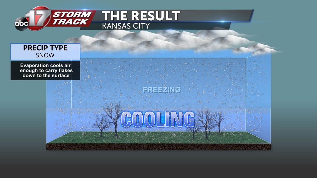
Closer to Kansas City, things played out differently. When the melting snow flakes evaporate, the air around them cools. The layer of dry air above Kansas City wasn't quite as warm to begin with. This means that their atmosphere needed less additional cooling from evaporation to create air cold enough to get the snow flakes to the ground. With this said, temperatures at the surface were still in the upper 30's and lower 40's which is just cold enough to get them to the ground without them fully melting.


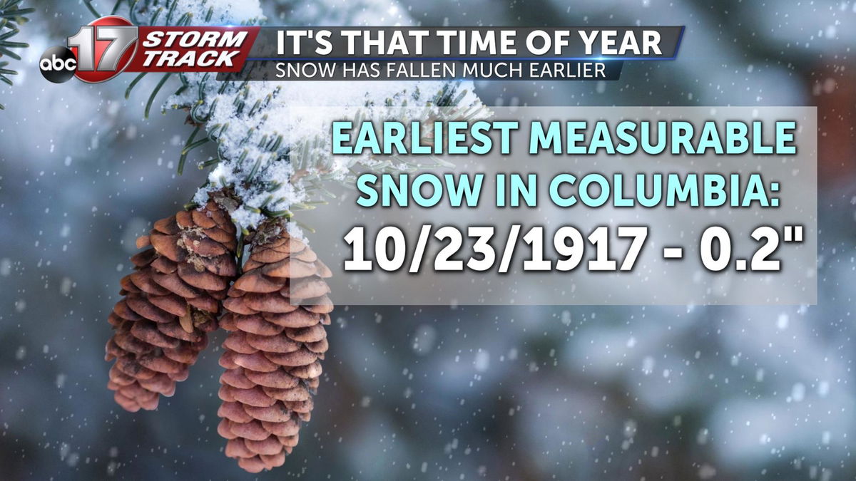
Now snow officially fell in Columbia on Monday but some did report graupel. Either would have certainly been possible, as this time last year we had already seen our first snow and the record for the earliest measurable snow in Columbia is October 23rd.
