Weather Alert Day: Dangerous heat returning today
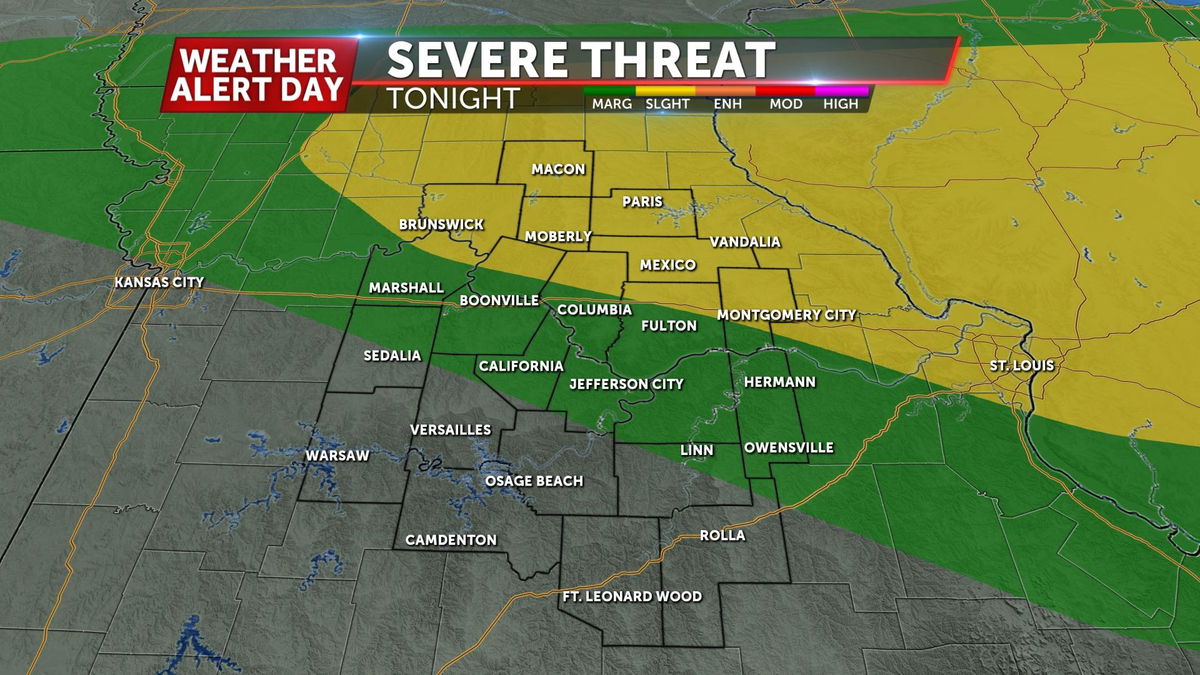
MORNING UPDATE: Some clouds from a complex of storms in Illinois are casting a shadow of doubt on us getting to 100°. Still going to get extremely hot, but maybe not much worse than yesterday, like we thought. That front firing storms in Iowa will eventually make it here late tonight.
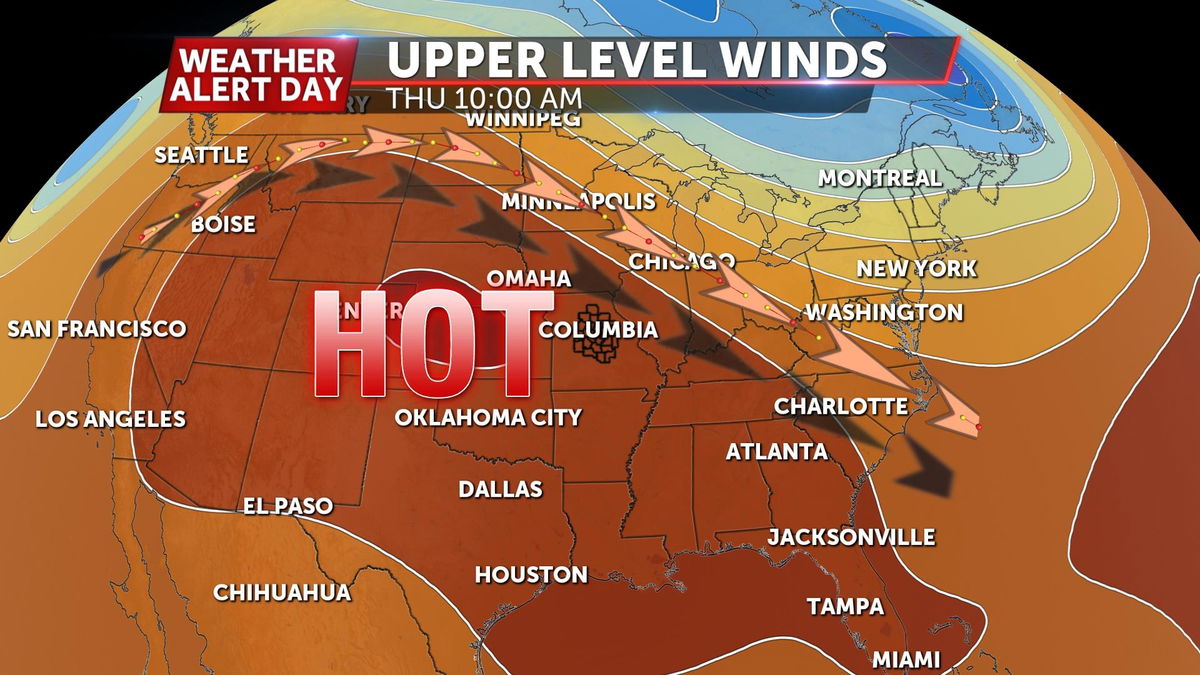
Another hot week has taken shape across Mid-Missouri as the upper-level pattern begins to shift once again thanks to high pressure forcing the jet stream to our north. A strong area of high pressure has moved overhead, blocking us in for an uncomfortable Thursday.
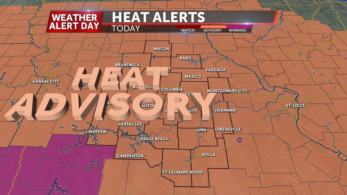
High temperatures are expected to climb into the upper 90s with dew points back into the low 70s. The higher both numbers are, the higher the heat index will be. A Heat Advisory is in place for the entire viewing area until Thursday at 9 PM.
IMPACTS
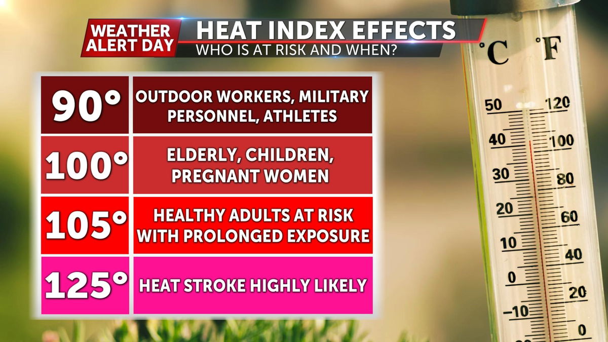
Heat indices are expected to reach the 105-110 degree range Thursday. Limit your time outdoors as much as you can, and make sure to stay more hydrated than you normally would. A good guideline is to drink 0.5 to 1 ounce of water for each pound you weigh, per day.
HOW TO PREPARE
Know the signs of heat exhaustion and heatstroke. A person experiencing heat exhaustion may have cool, clammy skin, heavy sweating, become faint, dizzy, tired, and a weak rapid pulse. Heatstroke can quickly become serious and life-threatening. The signs to look out for are a throbbing headache, no sweating, red, hot, and dry skin, a fever above 102-103, nausea and/or vomiting, and a rapid strong pulse.
Make sure pets have a cool shelter, preferably indoors, and limit their exercise to early morning or around sunset when the outside temperature and pavement cool off. Pets can't cool themselves through sweating like humans but can get just as stressed by hot temperatures.
RELIEF IS ON THE WAY
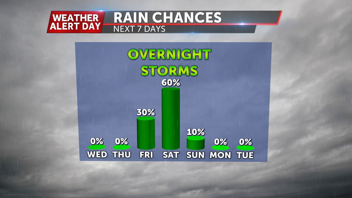
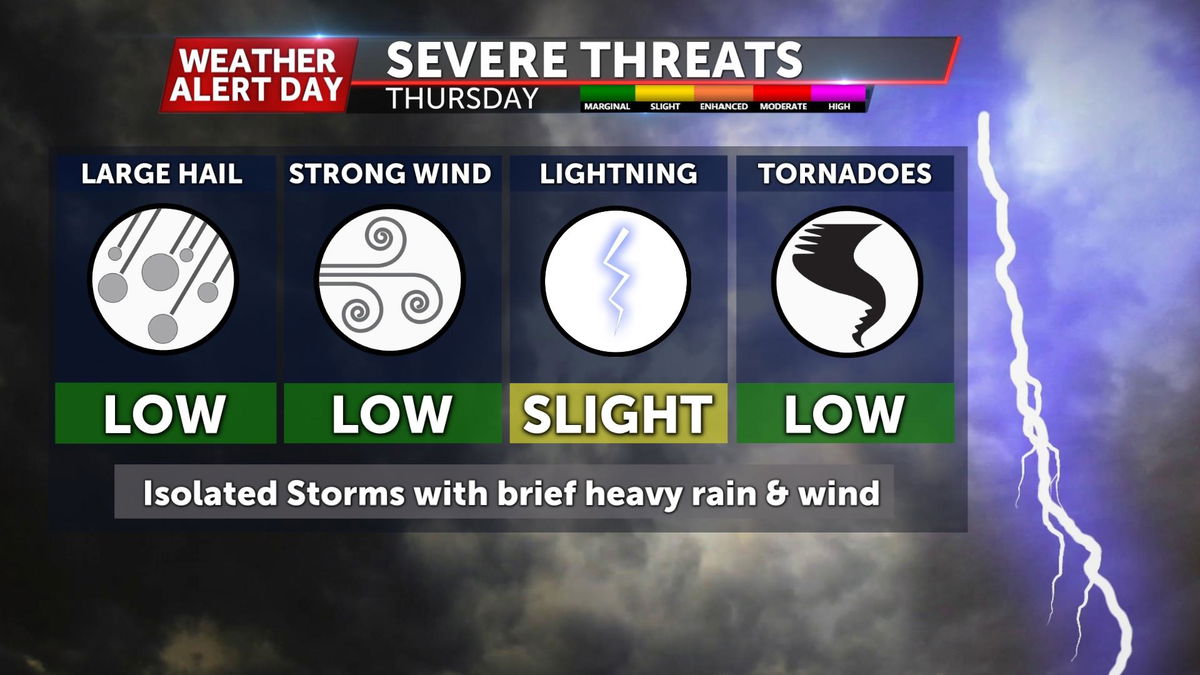
We'll get some welcome relief from the heat by Thursday night into Friday as a cold front works through the region, bringing a chance for storms and cooler air as temperatures drop 10 degrees back into the upper 80s Friday. Rounds of showers and storms will keep temperatures in the mid-upper 80s over the weekend.
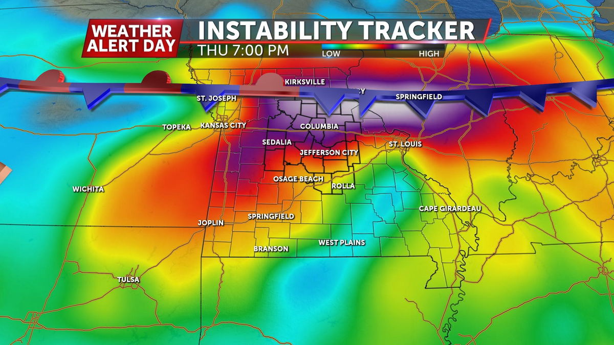
With all of the heat and humidity present, storms could pack a punch. With the front taking its time, storms will not arrive until after sunset tonight.