March Weather Recap: Will April bring more severe weather?
March: Both sunny & stormy?
March 2020 was a completely different month from its annual counterpart in 2019. For those who have an acute memory for weather, you'll remember how bitterly cold last March started out, several nights saw temperatures near and below zero.
This year, we only managed to drop into the 20s once, which occurred on the 21st.
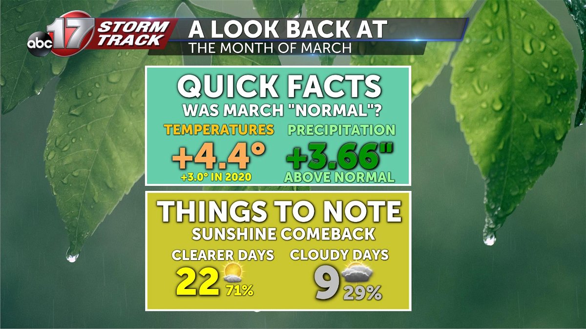
Temperatures ended up 4.4º above normal (putting us a 3.0º normal so far this year) with precipitation coming in at a stout 3.66" above average. Despite a very wet March, sunshine dominate a majority of the month too.
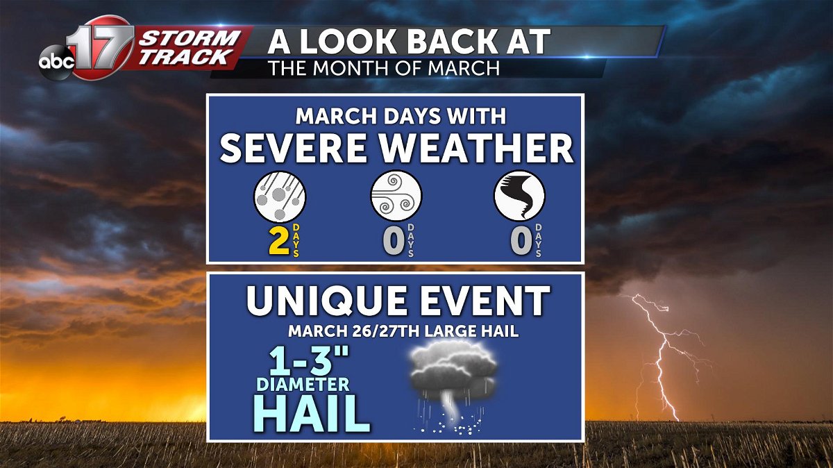
Even with all the rain, severe weather was limited... but when it came, it hit hard. The final week of March brought a series of crushing hail storms to Jefferson City and surrounding communities, less than a year following the EF-3 tornado in May of last year.
Sunny & Stormy: How was that possible?
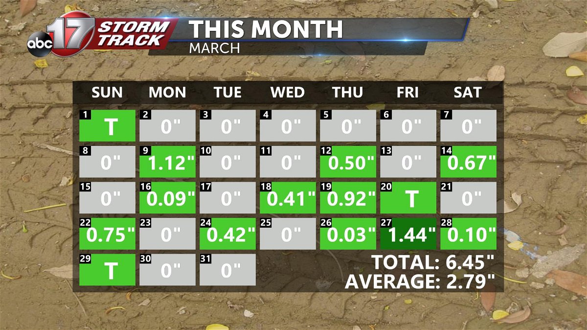
This was actually our 6th wettest March ever recorded at Columbia Regional Airport. At the same time, over 70 percent of our days featured partly cloudy to mostly sunny skies!
What was the reason for this?
There were actually a couple. For one, most of our rainfall this month fell at night, clearing out in time for the sun to come back out. Second, speed of these storms. Most of what we saw were quick-hitting systems that brought moderate, to even heavy amounts of rainfall. The pattern was persistent enough to allow precip totals to pile up.
The pattern behind the storms
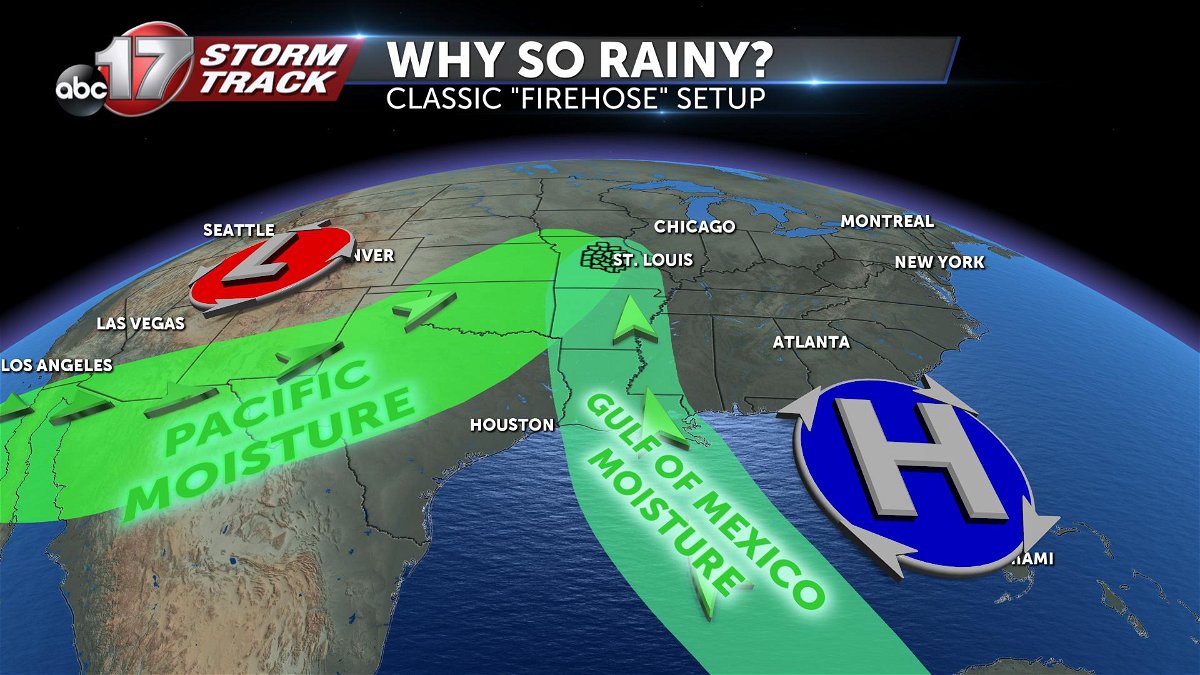
A persistent area of low pressure across the western United States, with a tag-teaming high pressure over the southeast brought a double barrel source of moisture to mid-Missouri.
These moisture streams clashed together to create the perfect recipe for thunderstorm development over mid-Missouri.
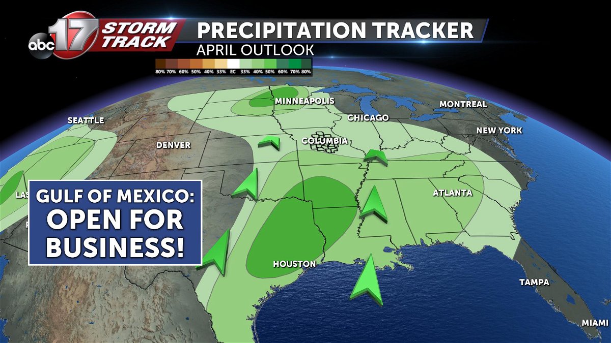
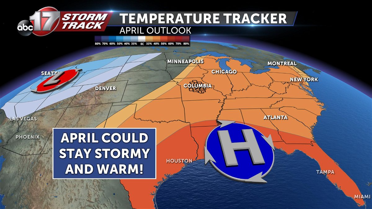
Will April bring more severe weather?
The latest from the Climate Prediction Center forecasts that to be a real possibility. Based on their precipitation trends, they seem to be favoring a continued stream of moisture pushing into mid-Missouri this month.
To further this idea, their forecast for temperatures looks eerily similar to the pattern that brought severe storms to mid-Missouri this March. Warm high pressure over the southeast, and colder low pressure stuck across the rockies. The battle of these two systems puts mid-MO in the middle, which tends to be where the track for storms mains predominant.
As always with any severe weather threat, we're looking ahead to make sure we give you the most heads up possible. You can download the ABC 17 Stormtrack Weather App to keep yourself ahead of any potential severe storm threat.
-Luke
