After Christmas brought us warmth and sunshine, January kept us soggy and cloudy
We were off to such a good start...
The end of 2019 and start of 2020 was one of the warmest stretches of weather to start the winter season ever in Mid-Missouri. This was coupled with plenty of sunshine, with many of us asking if winter was going to make a return after its quick start in November and December.
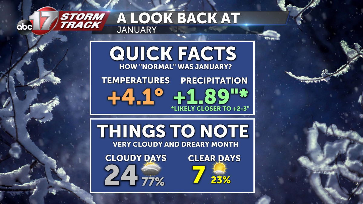
January definitely managed to get rid of sunshine, with eight of the last nine days of the month featuring completely overcast skies. Yeah, it's been VERY dreary, you're not imagining it.
Then came the rains...
(and snow and ice!)
One of the possible causes for this cloud cover could be the abundance of precipitation that we've seen so far this month.
"Officially" at Columbia Regional Airport, we recorded 3.74 inches of precipitation (if we melt down all the snow and combine it with the rainfall/ice). That's 1.89 inches above normal. The reason I put quotes in the word "officially" is because of the icing event from Jan. 17. The databook for the airport has a missing value for that date this month.
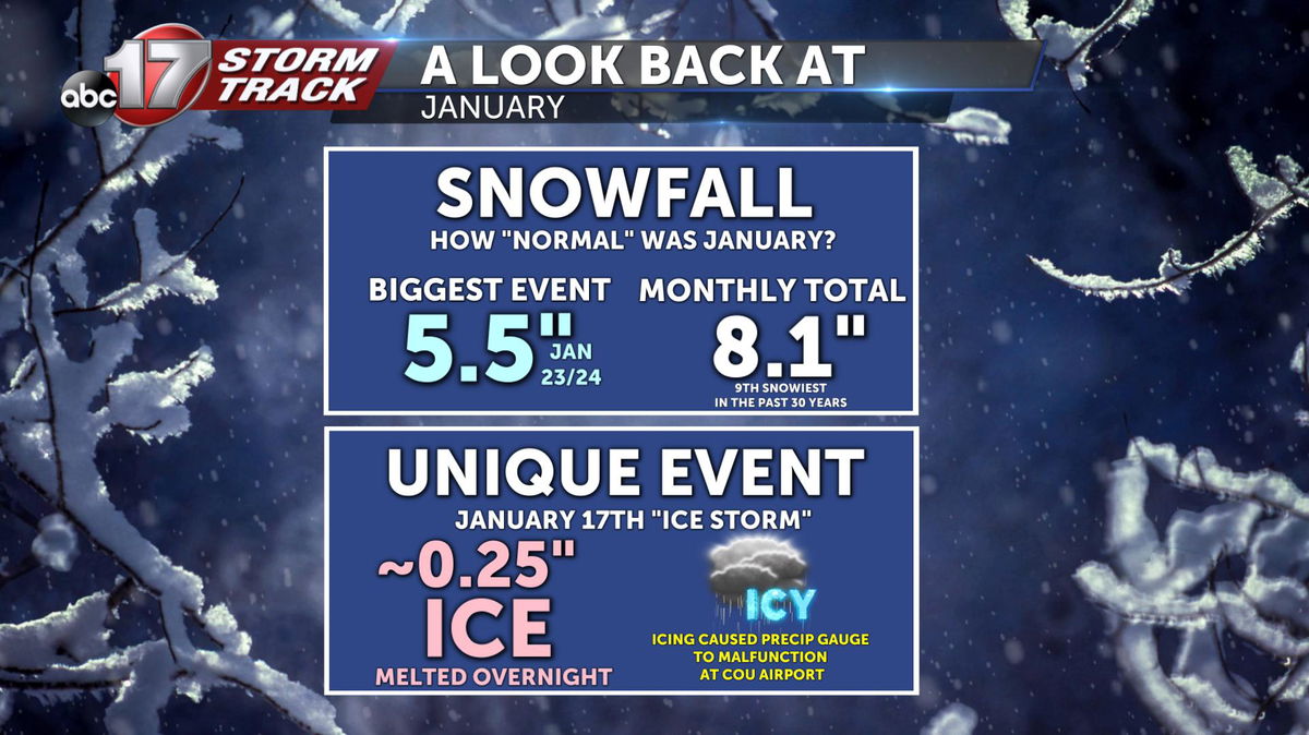
That's because the rain gauge had originally reported over 4.25 inches of rain on the 17th alone. This was an incorrect value and was a product of a malfunction due to the ice that had accumulated on the sensor.
After speaking with the National Weather Service, we agreed that 1.30 inches was a good estimate of rainfall for that day because of other surrounding reports that were verified. This would put our monthly value at 5.04 inches, 3.19 inches above normal, and the fifth wettest January ever recorded at the airport. For now, we're sitting pretty at No. 10.
Better weather ahead?
As far as the first few days of February, we're expecting pretty pleasant weather. Near-record highs are possible on Sunday as the sun is expected to finally break out again on Saturday afternoon.
Unfortunately, the brief warm-up is expected to be quickly replaced by colder weather in the middle of next week. Much colder air is expected to filter out of Canada and push southward because of strong northwest flow.
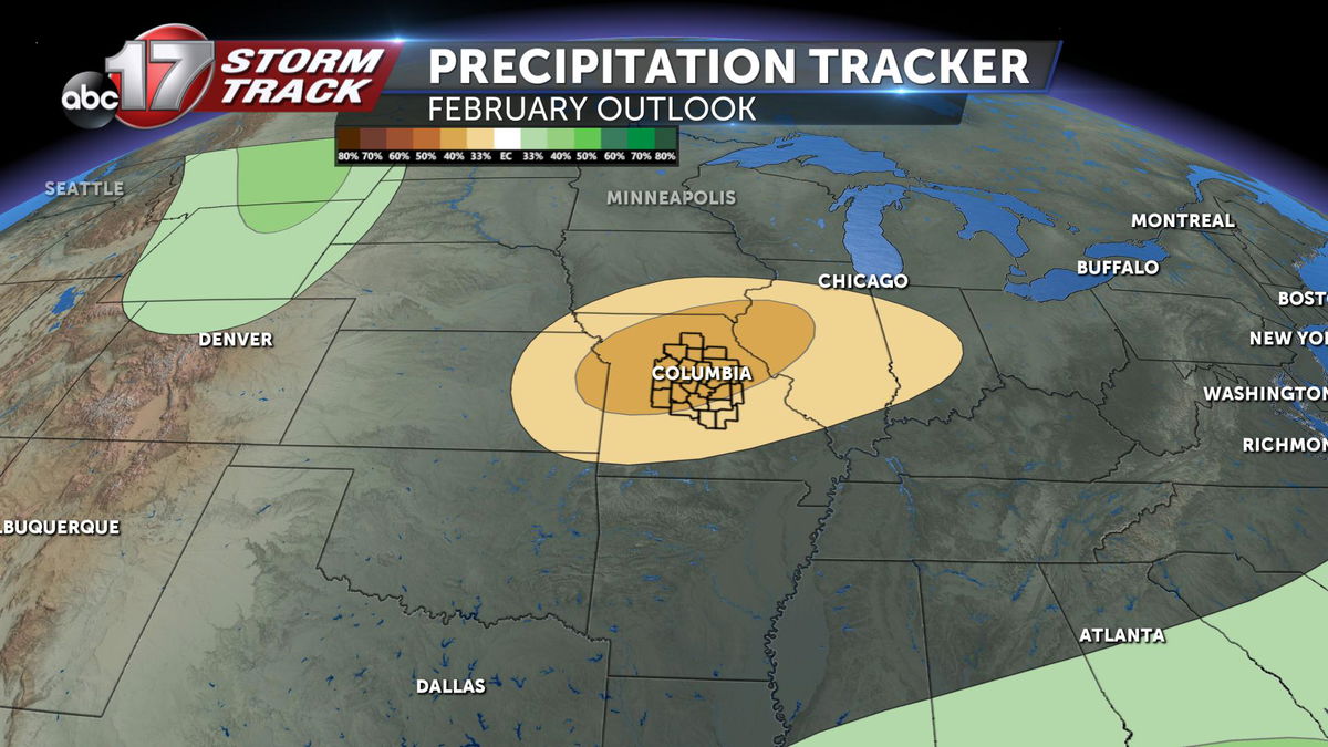
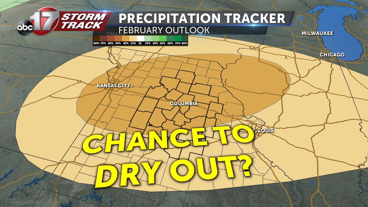
The Climate Prediction Center's latest outlook seems to favor this pattern continuing for most of the month.
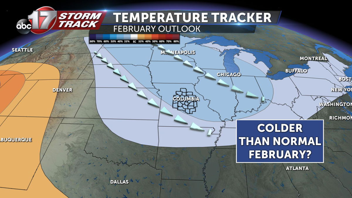
There's at least some glimmer of hope. There's a bullseye of drier-than-normal conditions expected for most of the state of Missouri, focused primarily on our viewing area.
This trend could be very important, after an extremely wet January (normally our driest month of the year). If we were to continue to stay wet/saturated, the already expected flooding potential would be even worse come springtime.
For now, let's enjoy what we have this weekend ... hopefully we can cap it off with a Chiefs win!
-Luke
