The Science Behind: The spring-like Sunday ahead

Getting our head out of the clouds
It's been a pretty crummy week weather-wise.
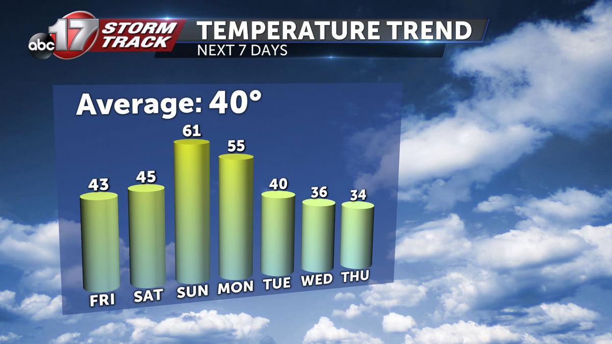
Temperatures have been below average and the only substantial day of sunshine was this past Sunday. This stretch of cool, cloudy weather stretches all the way back to last week's snowstorm.
Low-level moisture from melting snow and the lack of any push from the jet-stream has kept things dreary, for the most part.
But big changes are on the way.
Sunshine is expected to start breaking out Friday afternoon which will kick off the warming trend into the weekend.
... and it's not just Mid-Missouri
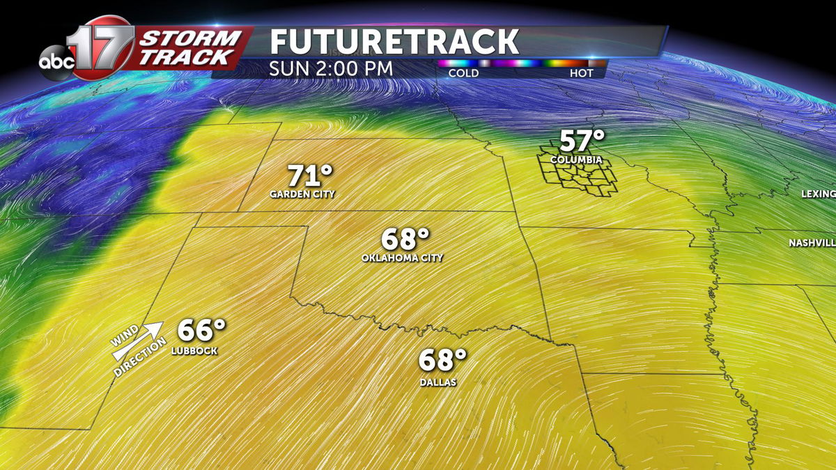
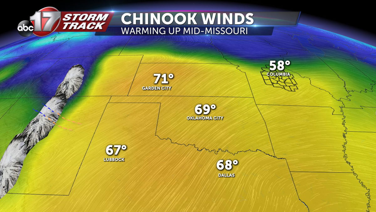
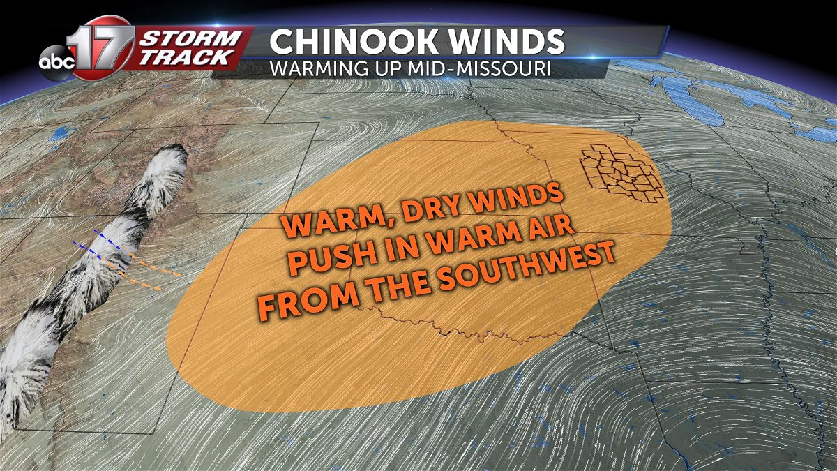
Strong southwesterly flow is expected to develop across the central and southern plains leading to temperatures which will be 20-30 degrees above average by Sunday afternoon, with plenty of sunshine.
Unfortunately, this also comes with a risk for wildfires. In this type of setup, the air tends to become very dry, which allows strong wind gusts to develop. Those are two key features in forecasting fire weather. This threat is focused mainly over central Oklahoma.
Rocky mountain high...
A big component in this type of widespread warm-up is a phenomenon known as the Chinook wind. It occurs when cool moist air flows from the Pacific Ocean and slams into the windward side of the Rockies.
As the air pushes over-top the peaks of the mountain range, the air will descend across the lee-side of the Rockies. As the air loses altitude, its atmospheric pressure increases. From the ideal gas law, air that increases in pressure must increase in temperature as well.
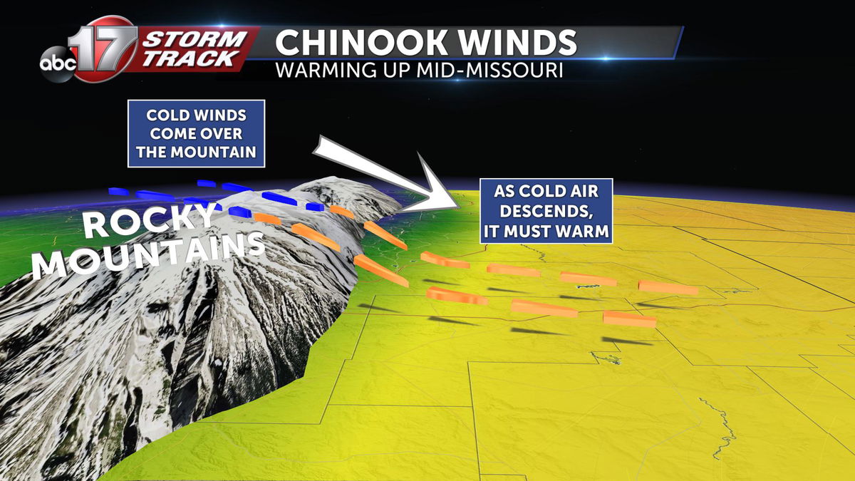
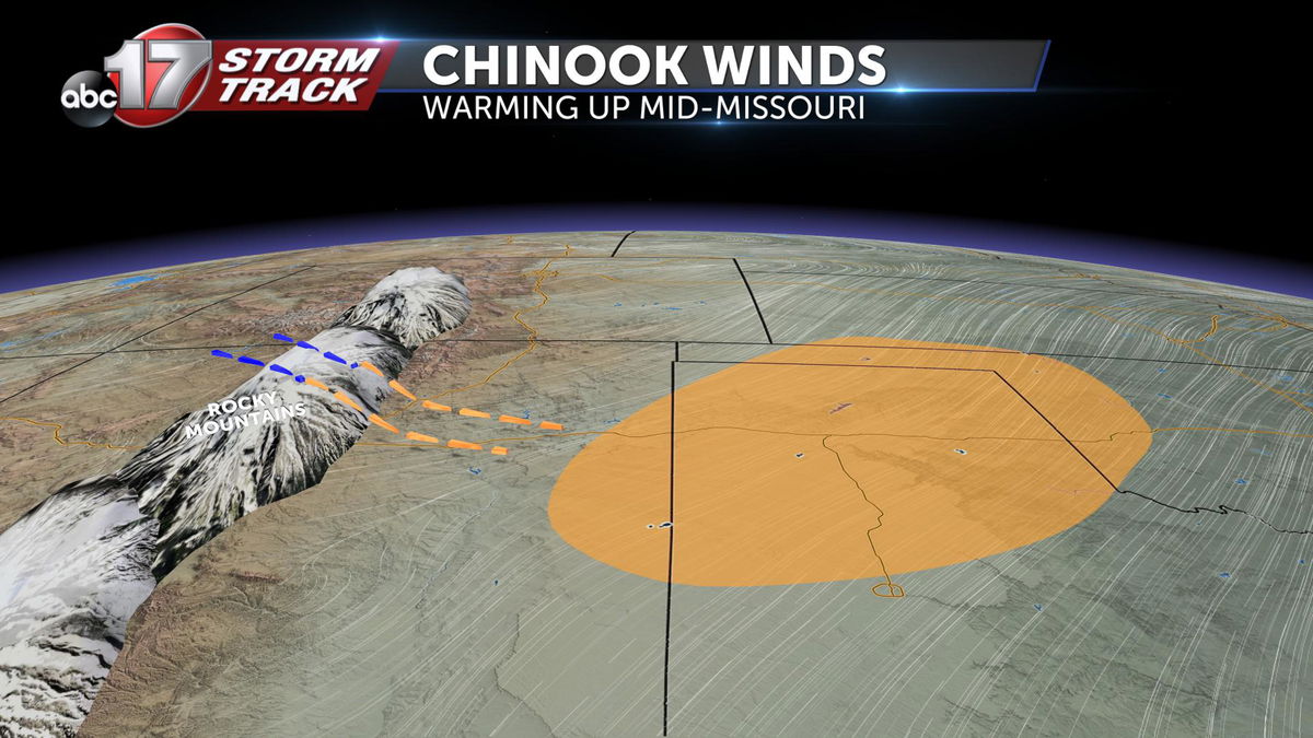
This blob of warm air will continue to grow and feed off of these Chinook winds and expand in the direction of the general flow of wind. In our case, strong southwesterly winds through the lower third of the atmosphere will push this warm, dry air our way -- kicking out the clouds and giving us a taste of spring by Sunday afternoon.
All good things come to an end...
Let's remember that it's still winter. We'll get a good day or two of nice temperatures before, in typical Missouri fashion, we snap back to winter by midweek. We may even be "lucky" enough to see more rain and snow out of the deal.

Garden City, Kansas, will see the brunt of it. Temperatures are expected to drop from 71 degrees Sunday afternoon, all the way to 18 degrees by Tuesday evening.
-Luke
