Insider Blog: Heavy rain expected overnight, another round by mid-week
After an extremely warm week across Mid-Missouri and much of the country, we're finally seeing a big pattern change this week with cooler temperatures and daily chances of much needed rain.
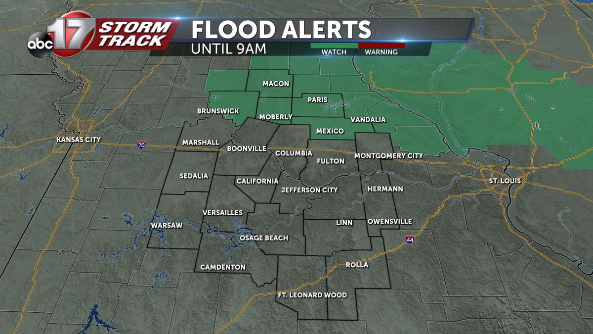
Rain could be heavy at times tonight into Tuesday, and a Flood Watch is in effect until Tuesday morning at 9:00 for areas along and north of Highway 24.
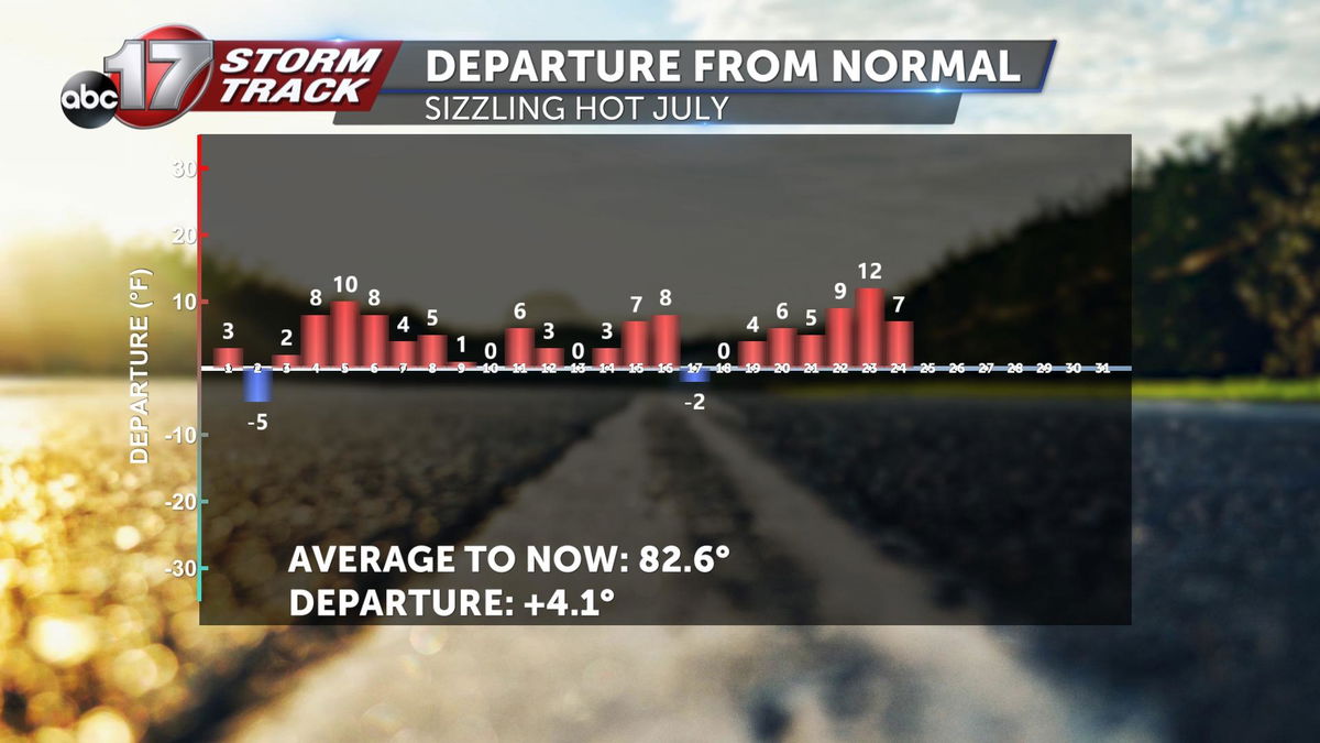
High temperatures topped out in the triple digits Thursday through Sunday, with many areas still reaching the upper 90s on Sunday, more than ten degrees warmer than average. So far for the month of July, it's been more than four degrees above average with only two days below normal.
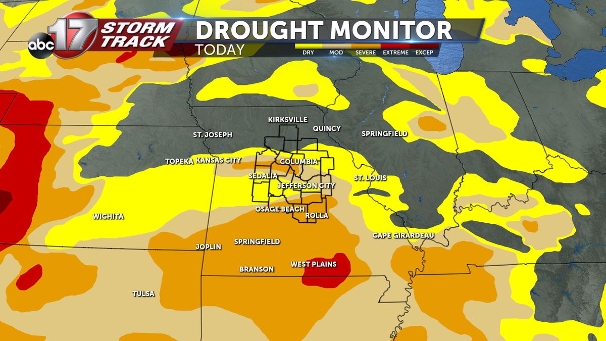
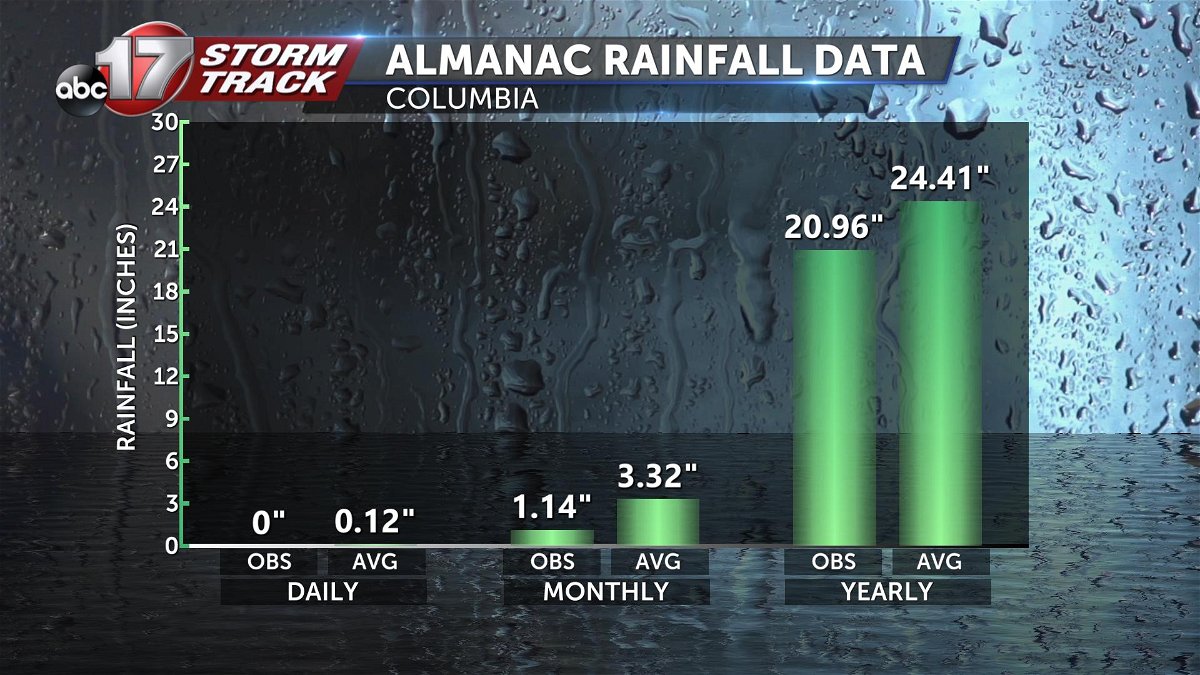
Much of the state is experiencing drought, with 33% of Missouri in severe drought as of July 19. So far this month, we have only received 1.14" of rain in Columbia, which puts us at more than 2" below average on rainfall since the start of July. For the summer, we're 3.68" below average on precipitation.
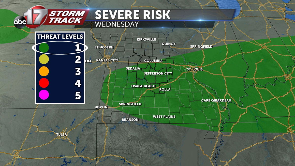
The upper level pattern has started to shift, with upper high pressure finally leveling out. More zonal or west to east wind flow through the jet stream is expected next week. This, along with a stalled front will allow rounds of showers and storms to move through the area over the next several days. Low level winds will enhance the amount of moisture in the vicinity each night, potentially bringing rounds of heavy rain. While there will be chances for scattered showers and storms each day, the best opportunities to see widespread rain will be overnight into Tuesday morning, and again Wednesday night into Thursday.
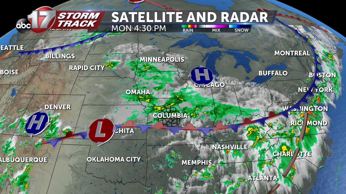
We've had scattered showers since this morning, but heavier rainfall is expected overnight into Tuesday morning along and north of I-70 where the low level jet stream will be maximized overnight.
The front lifts back north mid-week, bringing in slightly warmer air Tuesday into Wednesday. A few storms may be strong Tuesday into Wednesday, and again Wednesday night into Thursday morning with gusty winds and heavy rain.
The front finally pushes back south of us between Wednesday and Thursday, bringing the potential for more storms and cooler air to end the week. We'll drop below average with highs in the mid-80s starting Thursday on into the weekend, bringing much needed relief from the extreme heat.
Rain amounts through the end of the week will range between 1-3" with locally higher amounts. Most of the rain will fall between tonight and Tuesday morning, and Wednesday night through Thursday morning. Flooded roads are a concern Monday night into Tuesday morning, especially along and north of I-70 where rainfall rates could be high.
