WEATHER ALERT DAY: Strong winds remain overnight, rain and snow moving in
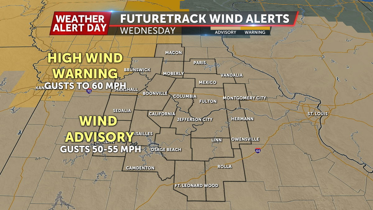
The ABC17 Stormtrack Weather Team has issued an ABC17 Stormtrack Weather Alert Day on Wednesday for wind gusts upwards of 50-55 mph at times through early Thursday morning.
A Wind Advisory is in effect area-wide, with a High Wind Warning to our northwest.
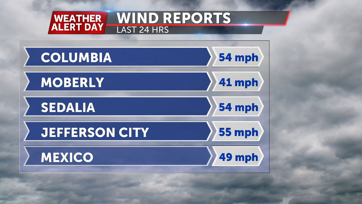
Winds have gusted to 50-55 mph area wide, with the strongest reported gust in Morgan County up to 58 mph.
SETUP:
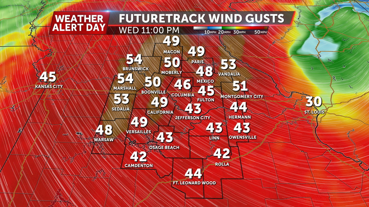
A strong area of low pressure will roll through the region tonight into Thursday, making for some wild temperature extremes. This will be thanks to the strong pressure gradient, and the gust winds that it inspires. Winds will be sustained around 20-30 mph from Wednesday morning through the evening. Gusts may reach as high as 55 mph in the most extreme cases.
TIMING:
This ABC17 Stormtrack Weather Alert Day lasts through midnight Wednesday.
These will be non-thunderstorm winds, primarily driven by the pressure gradient of this low pressure system. Winds will be gusty all day, but will gradually weaken through late Wednesday night, as the low moves away.
HAZARDS & IMPACTS:
These non-thunderstorm winds may reach Severe Thunderstorm Warning criteria (58 mph) in short bursts, but on a very isolated basis. We are issuing an ABC17 Stormtrack Weather Alert Day, as this may create isolated damage to trees, power lines, and other structures. Even lesser winds can have structural impacts.
A secondary impact will be a dramatic cool down tonight. Temperatures will fall into the low 30s by Thursday morning.
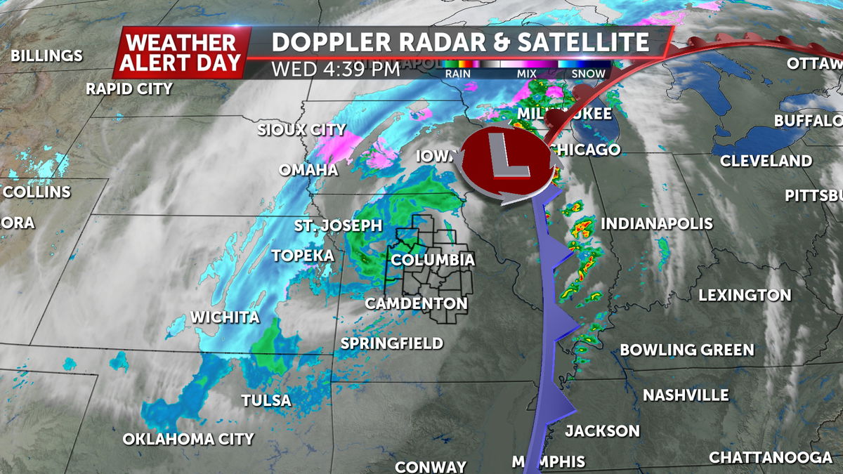
The wrap-around precipitation on the back side of the low will come in as a cold rain Wednesday evening, and then transition to snow around sunset.
This will be short lived, and given an even shorter window of temperatures near freezing; a dusting to half an inch is possible on elevated and grassy surfaces.
