Weather Alert Day: Severe storms possible this evening
UPDATE: 4PM FRIDAY
Storms are expected to fire up along and east of Highway 63 after 6:00 p.m., and will maintain intensity through about 10:00 or 11:00 p.m. Storms will have the capability of producing large hail and damaging winds, along with heavy rain. Updated below are the severe risk map and latest Futuretrack with the timing of tonight's storms.
SETUP
The large upper level high that has sat over us for most of this week has allowed heat to build at the surface. This warmth at the lower levels of the atmosphere has contributed to abundant convective potential energy which has been available in the atmosphere just about every day. Despite this, the very same pattern has been blocking any mechanism in the atmosphere that might be able to trigger storms that could utilize it.
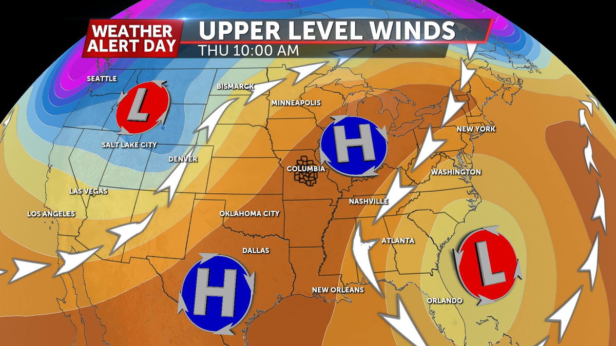
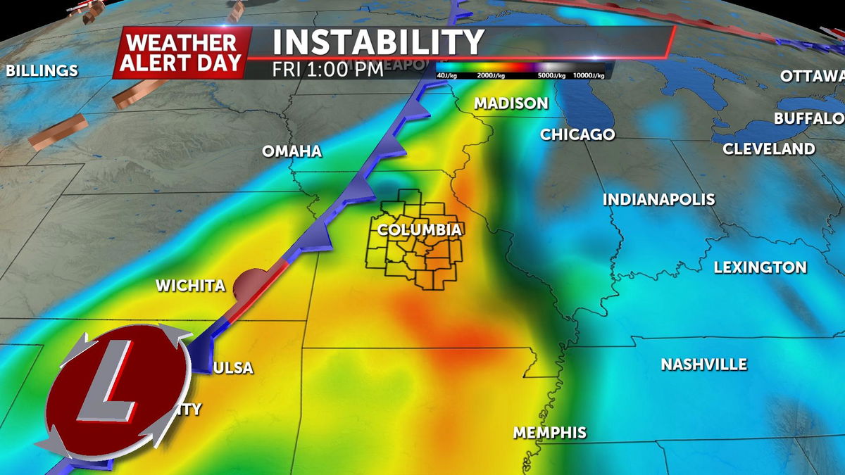
This will all change Friday, when a modest cold front will provide the trigger needed to utilize the copious amounts of energy sitting above our heads. The cold front is labeled modest here because it doesn't have relatively high levels of wind shear. Shear is something that helps sustain thunderstorms and can sometimes help psawn tornadoes. Still, the combination of the two will be enough for us to issue a Weather Alert Day for the potential for severe storms.
IMPACTS
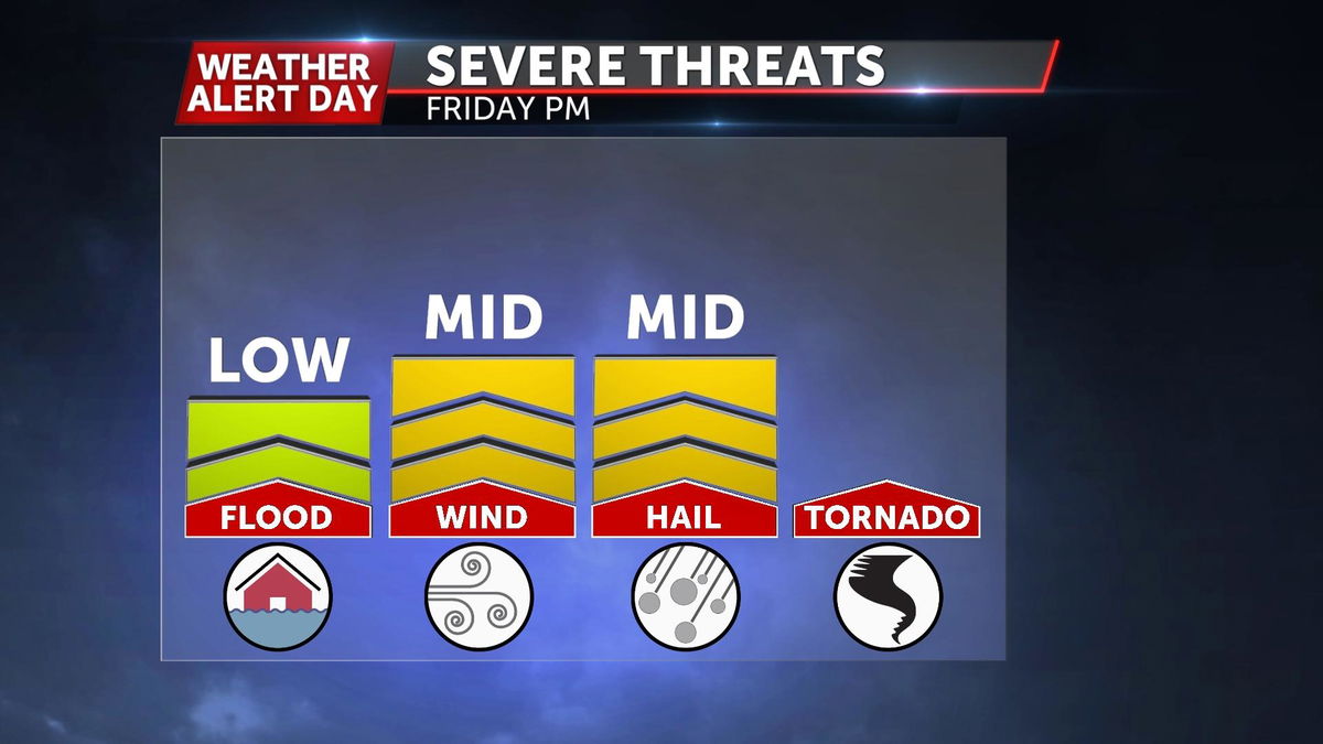
This type of setup means our biggest risks are hail and damaging winds. The high amounts of energy in the atmosphere, means we may see large updrafts in these storms. This means we're fairly confident that thunderstorms that do develop will have the potential to get rain drops high enough in the atmosphere, and keep them there long enough to create large hail. What goes up, must come down, which effectively means we'll have the possibility of seeing all of that come crashing down in the form of damaging winds as well.
Impacts will be pretty evenly widespread where we see storms develop which has more to do with tomorrow's timing.
TIMING
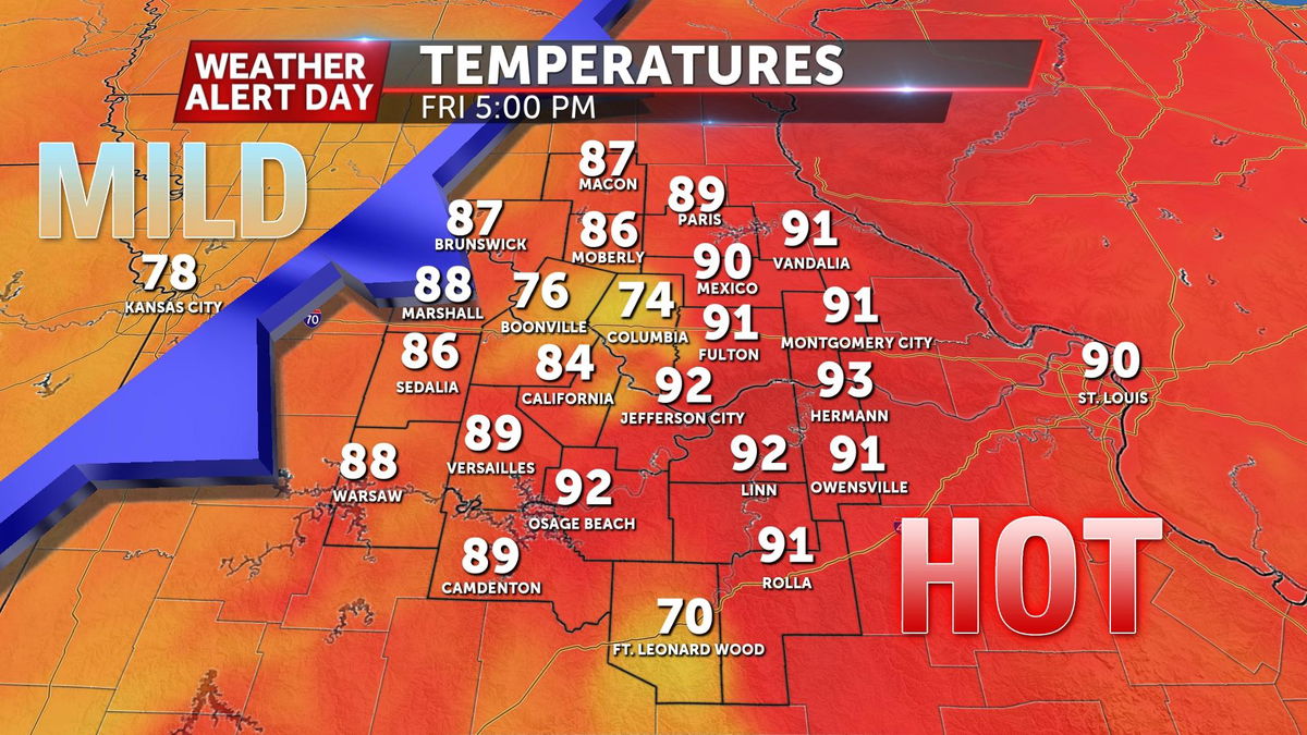
Timing of Friday's storms will greatly impact the forecast. The front itself may delay until the late evening hours, but storms will likely fire up ahead of it. These storms ahead of the front will have a big impact on afternoon temperatures where they develop.
Thanks to a later evening timeline, some in the east may see another record breaking day temperature-wise, and consequently a better window for severe storms.
WHAT COULD CHANGE
Timing is currently the biggest variable, and as mentioned above, it could impact our severe impact as well as our high temperatures. It could also impact the area of greatest risk.
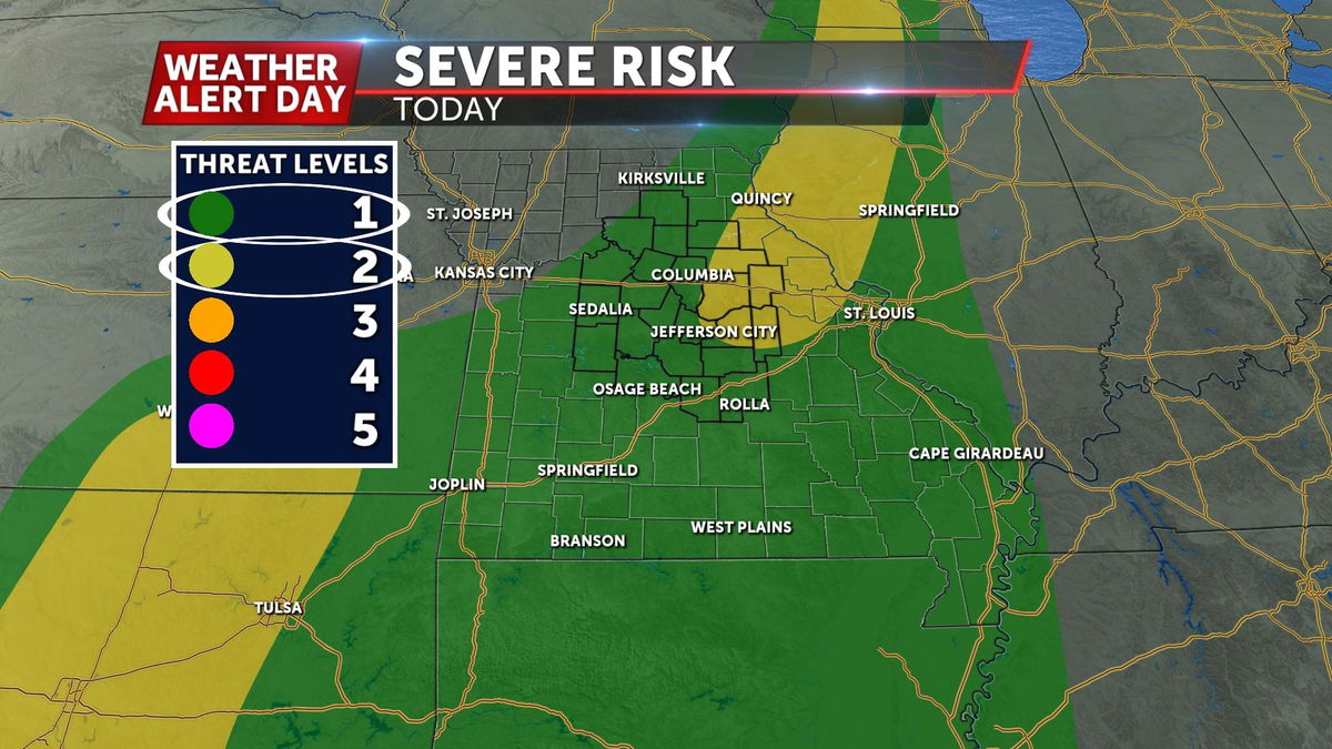
Right now, the Storm Prediction Center has most of the region highlighted in a level 2 of 5 risk, it currently looks like the greatest threat for severe will fall east of Highway 63.
Stay tuned and we will keep you updated on air, web, social, and on the ABC17 StormTrack Weather App.
