Weather Alert Day: Severe storms with wind, hail, and tornadoes possible early Wednesday
Tuesday Evening Update:
A warm front has lifted north of Mid-Missouri bringing clouds more humid air to the region. As the front pushes farther north, temperatures will warm, and skies will start to clear which will boost temperatures even further. Despite temperatures pushing into upper 70s to low 80s and dewpoints in the mid-60's, a strong capping inversion aloft will likely prevent storms from firing up.
This capping inversion in this case is a layer of warm air about 5,000 to 10,000 feet up that will block rising air from continuing to rise. Warm air at the surface rises because it's warmer than the cool air above it; that is until you get to the cap. This cap looks like it will keep storms from developing in an otherwise favorable environment for severe weather, Tuesday afternoon.
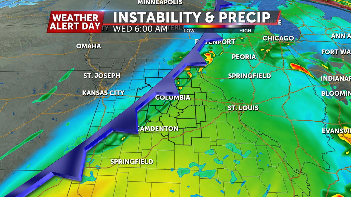
We'll likely have to wait for Tuesday night's/Wednesday morning's cold front to push into the area to initiate storms.
This will likely be during a time of relatively low instability, resulting in a smaller risk for severe storms over mid-Missouri early on Wednesday.
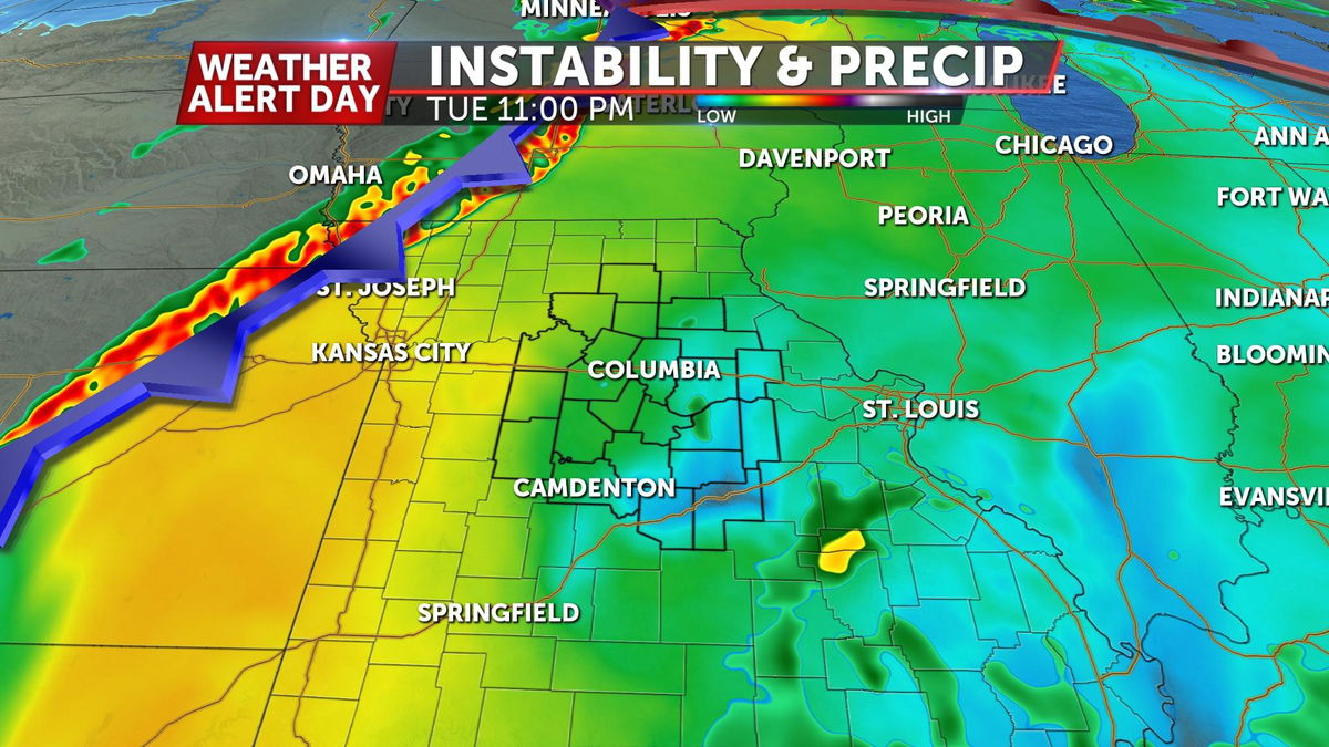
However, the front will still likely be draped across the region as the sun comes back out during the late morning and early afternoon. This will set up those to the east of the cold front to see severe storms develop along the front.
IMPACTS
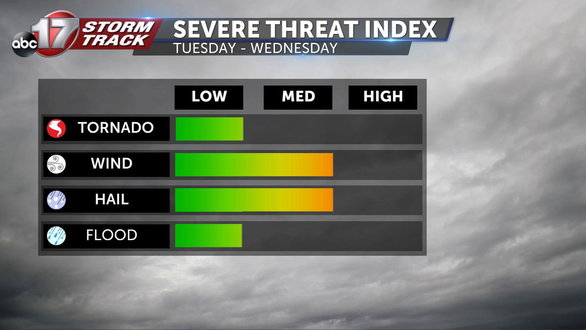
All types of severe weather will be on the table for this event. Whether it be Tuesday ahead of the front, or along the front Wednesday, storms will have potential for one inch or larger hail, damaging winds, and even tornadoes.
As of right now, if the cap holds on Tuesday, it stands to reason that Wednesday will bring the greatest impact.
TIMING
Timing and placement again breaks down to two things; CAP and Front.
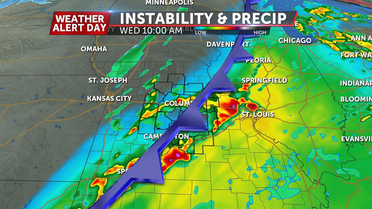
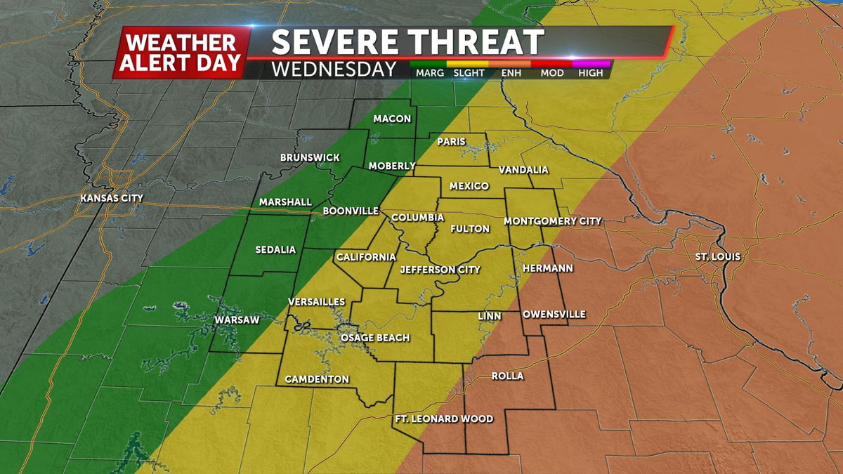
If the cap holds, we expect a later storm risk that may bypass Tuesday all together, and become a Wednesday morning problem. This is becoming the dominant solution. Overall, the threat across Mid-Missouri looks highest between mid-morning and late afternoon Wednesday, with a time frame of about 9:00 a.m. to 3:00 p.m.
In this case, activity west of highway 63 would likely happen during overnight/early morning and bear less impact. Areas east of Highway 63, especially toward the St. Louis area into Illinois will have the greatest threat by Wednesday afternoon.
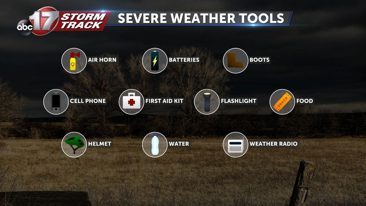
STAY PREPARED:
Make sure to download the ABC 17 Stormtrack Weather app and set it to your location to receive alerts. A NOAA weather radio is also a great option to wake you up if overnight warnings are issued. Have a plan for where you're going to take shelter if a warning is issued, and have a basic emergency kit ready to go in that location. That can include a flashlight with fresh batteries, first aid kit, water, cordless phone charger, a helmet, and sturdy shoes like tennis shoes or boots.