Weather Alert Day: Ice creates dangerous conditions into Friday
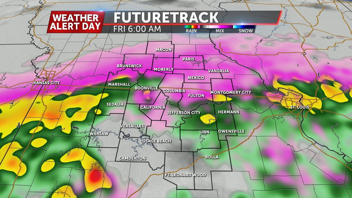
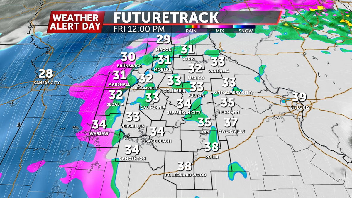
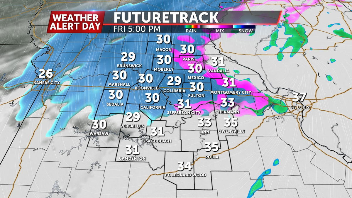
FRIDAY LATE MORNING UPDATE: The worst of the conditions will be in our western counties. That's in the process of changing over to snow if it hasn't already and will start to pull east. Most locations east of HWY 65 have replaced freezing rain with near freezing drizzle. Temperatures will play an important role-if we can hang at or above freezing, the problems will be limited. Areas that drop below freezing will see roadway issues continue.
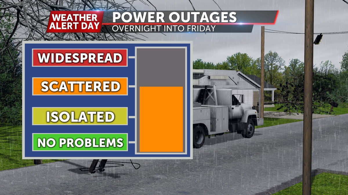
Power outages will still be possible, but not quite as likely with winds backing off from where they got this morning.
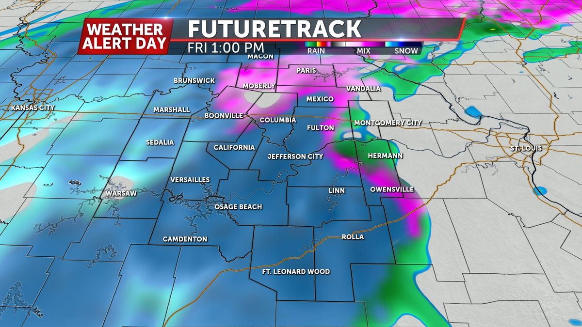
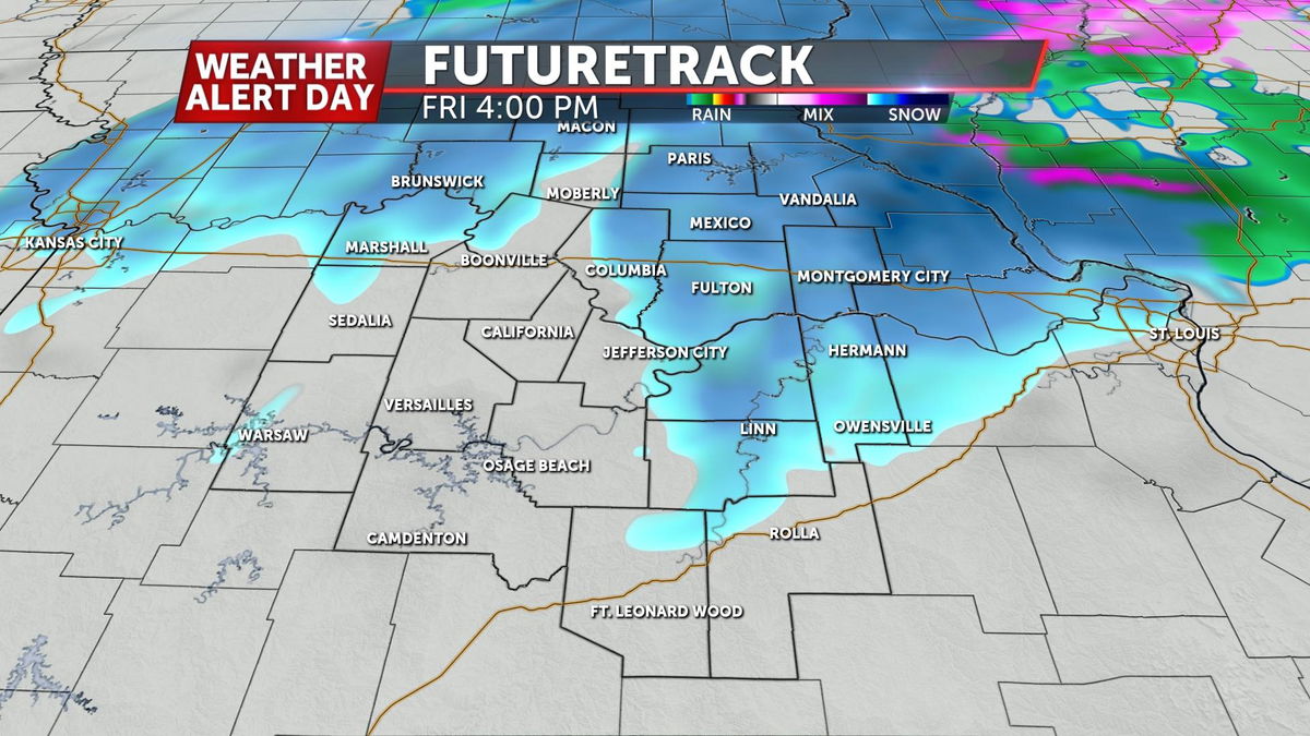
Attention will turn to the last significant wave of this storm in the form of moderate to heavy burst of snow moving through this afternoon. The southern half will likely see a good shot of snow early this afternoon. The window to pick up meaningful accumulations looks small, but could find a few areas with a half-inch to an inch.
The ABC 17 Stormtrack Weather Team has issued a Weather Alert Day for today, January 1st. Freezing rain from early this morning will lead to treacherous roads lasting into the day today.
SETUP
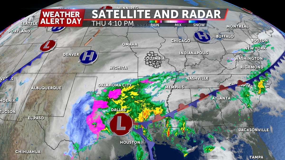
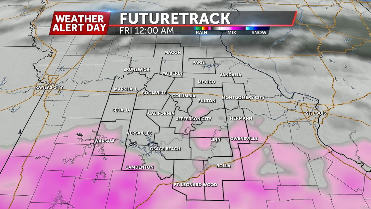
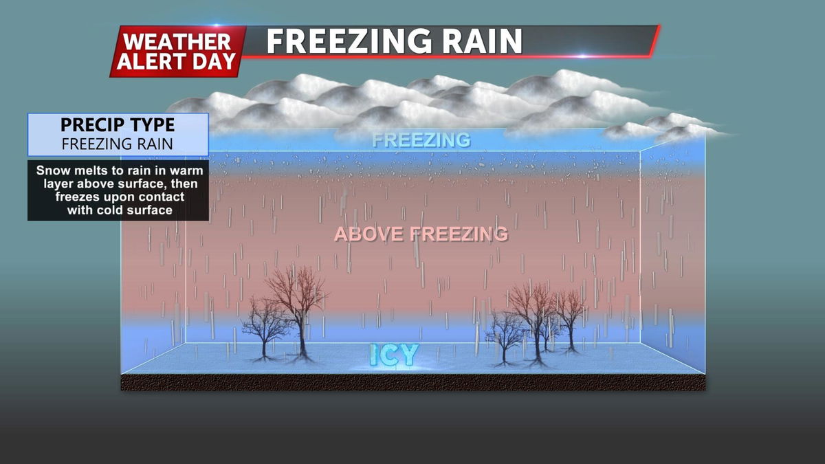
Another strong area of low pressure is lifting out of Mexico and Texas this morning. That is slated to move just to our south along a stationary boundary already in place. This boundary will keep temperatures close to freezing during the day on Thursday, but we'll be dry. As lift enters the area, precipitation will overrun this boundary and drop rain into near to slightly below freezing temperatures.
TIMING
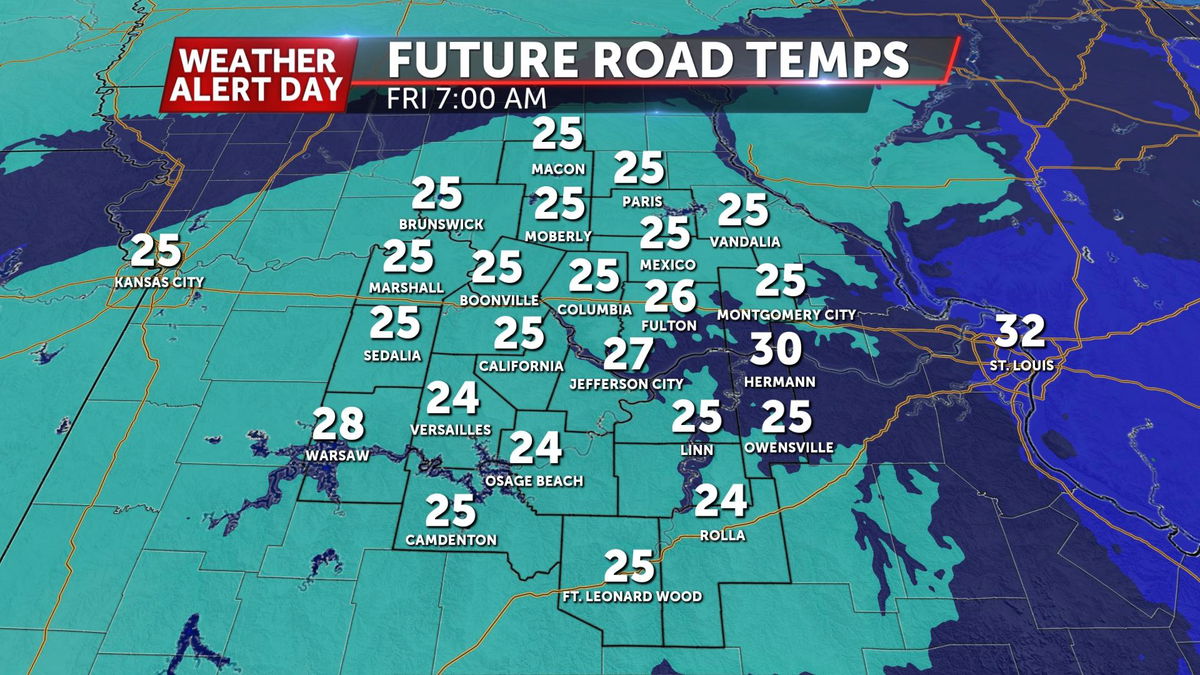
Timing has been relatively consistent. Moisture moved in from the south around 9p-midnight Thursday. From then to about noon on Friday, the concern will be there for that precipitation to freeze. Temperatures are expected to warm up enough to hold back issues from getting worse this afternoon. Precipitation will continue until tonight before lifting off to the north.
IMPACTS
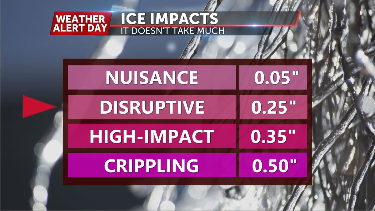
As with any freezing rain event, the big concerns fall into two areas: roads and power outages. Right now, we're expecting in the neighborhood of 0.3-0.4 of an inch to some higher amounts west of Highway 63. That is more than enough to create slippery roadways tonight but especially by this morning. As for power outages, they'll be possible with that much ice alone but winds are expected to gust around 25-30 mph, adding to the possibility.
WHAT COULD HELP OUT
Any freezing rain forecast comes down to a degree or two. This one appears to be no different. There are a few things that could limit our ice potential tonight into Friday:
- Heavy precipitation rates
The harder that it rains tonight, the less efficient it will freeze on contact - Marginal temperatures
Surface temperatures will be hovering right at that freezing mark. A degree or two, either way, will make a huge difference. - A warm "warm nose"
A warm nose is needed to create freezing rain. It melts the snowflake as it falls, but if it's a few degrees warmer than "normal" it would make it a bit tougher to freeze
HOW TO PREPARE
The easiest way to avoid problems is by staying off the roads. But having a plan in place in case power goes out is never a bad idea. Have ways to charge phones or any other essential electronics. Stay up with this tricky forecast by grabbing the ABC 17 Stormtrack Weather App.