Weather Alert Day: Winter storms brings snow and ice, road impacts through Monday morning
SUNDAY EVENING UPDATE:
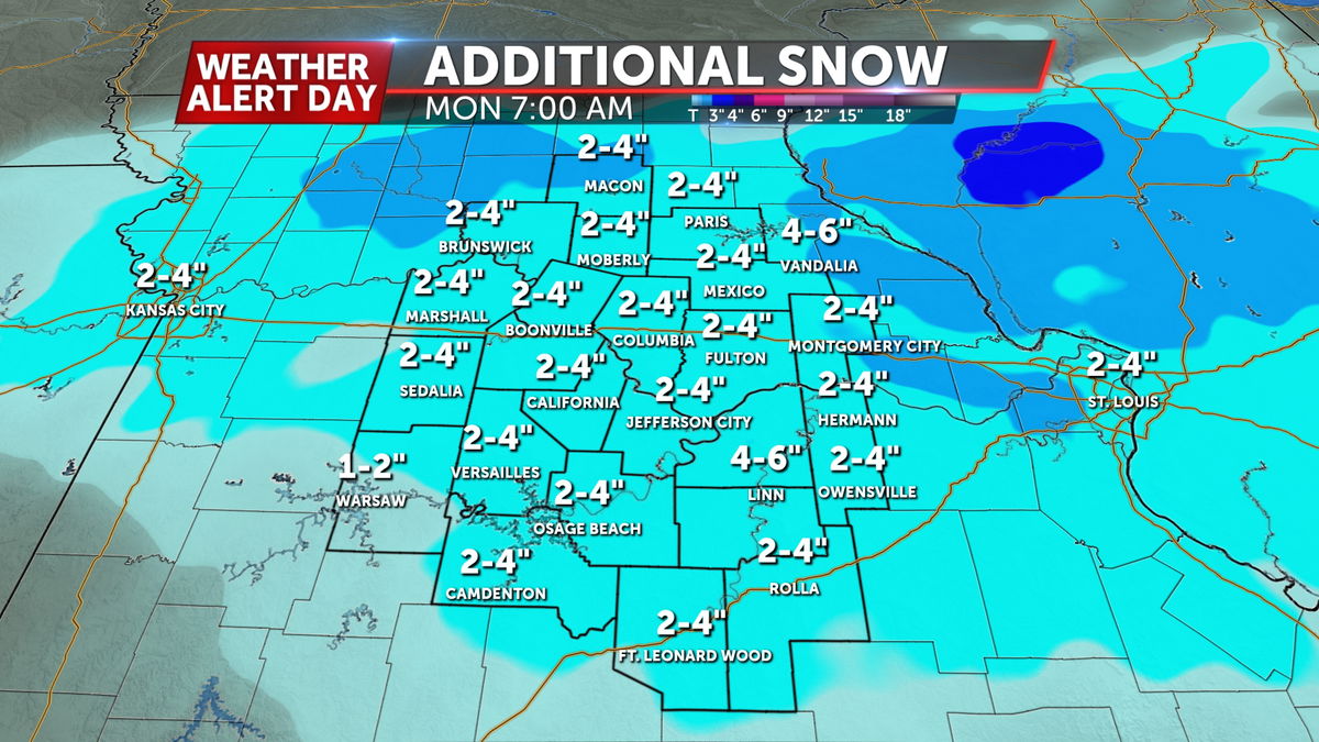
A widespread swath of snow has started to push back into Mid-Missouri, with moderate to heavy snow possible at times, especially across northwest portions of Mid-Missouri. Road conditions will continue to deteriorate as visibility drops due to gusty winds. An additional 2-4" of snow is possible through early tomorrow morning, with much of the precipitation ending shortly after midnight to our east.
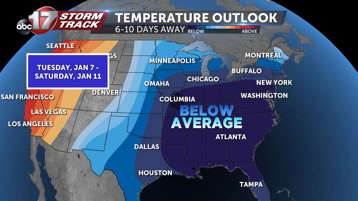
Road temperatures only briefly get to near or above freezing Monday afternoon before dropping below 30 degrees for a few days due bitterly cold air settling in. This could leave untreated roads icy for the next few days, and hard to treat due to the extreme low temperatures.
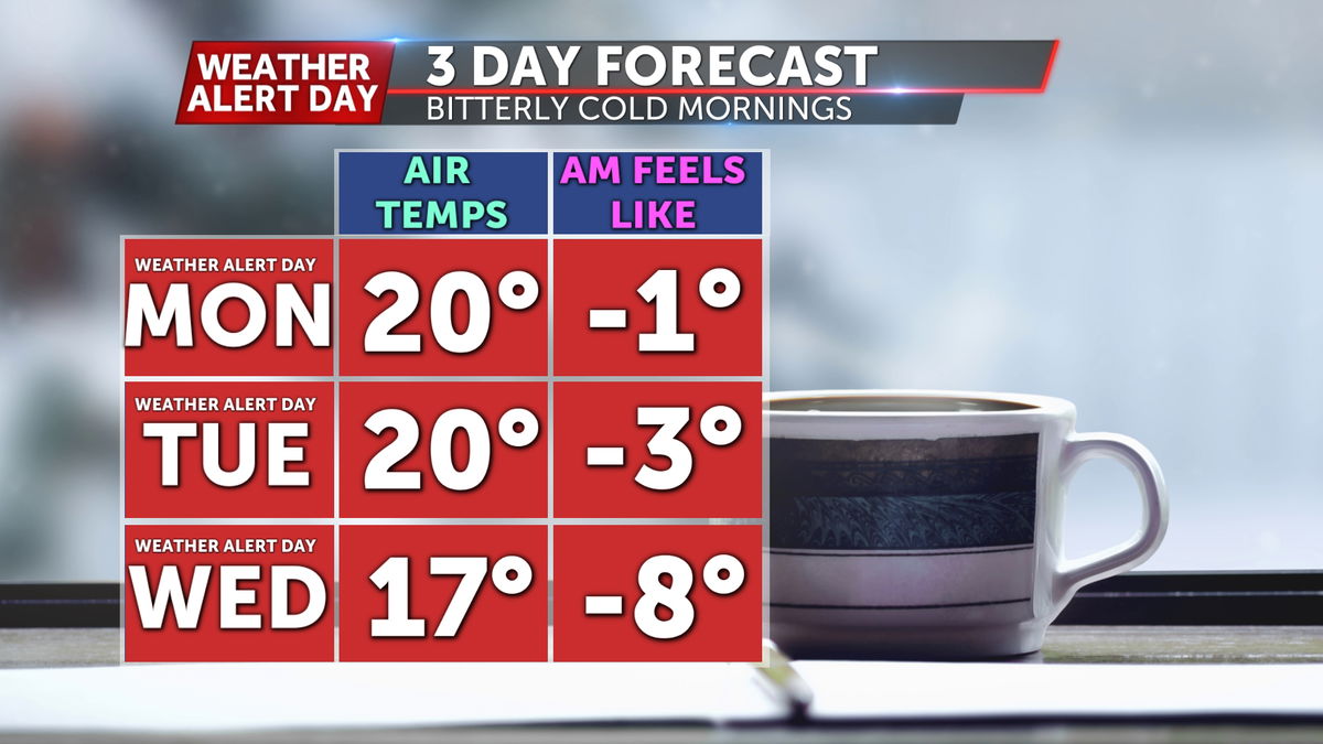
In addition to the road impacts, a Weather Alert Day will likely be extended through Thursday morning for morning low temperatures dropping to near zero, with negative wind chills expected.
See the below updated Futuretrack with the timing of snow and sleet through Monday morning.
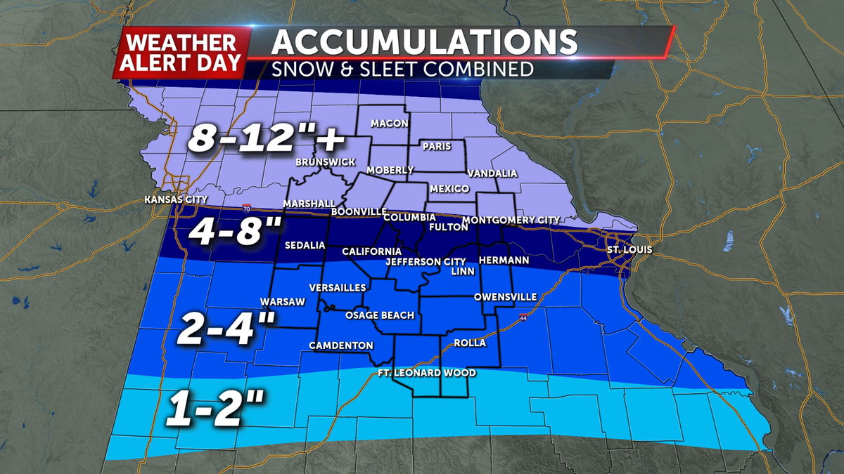
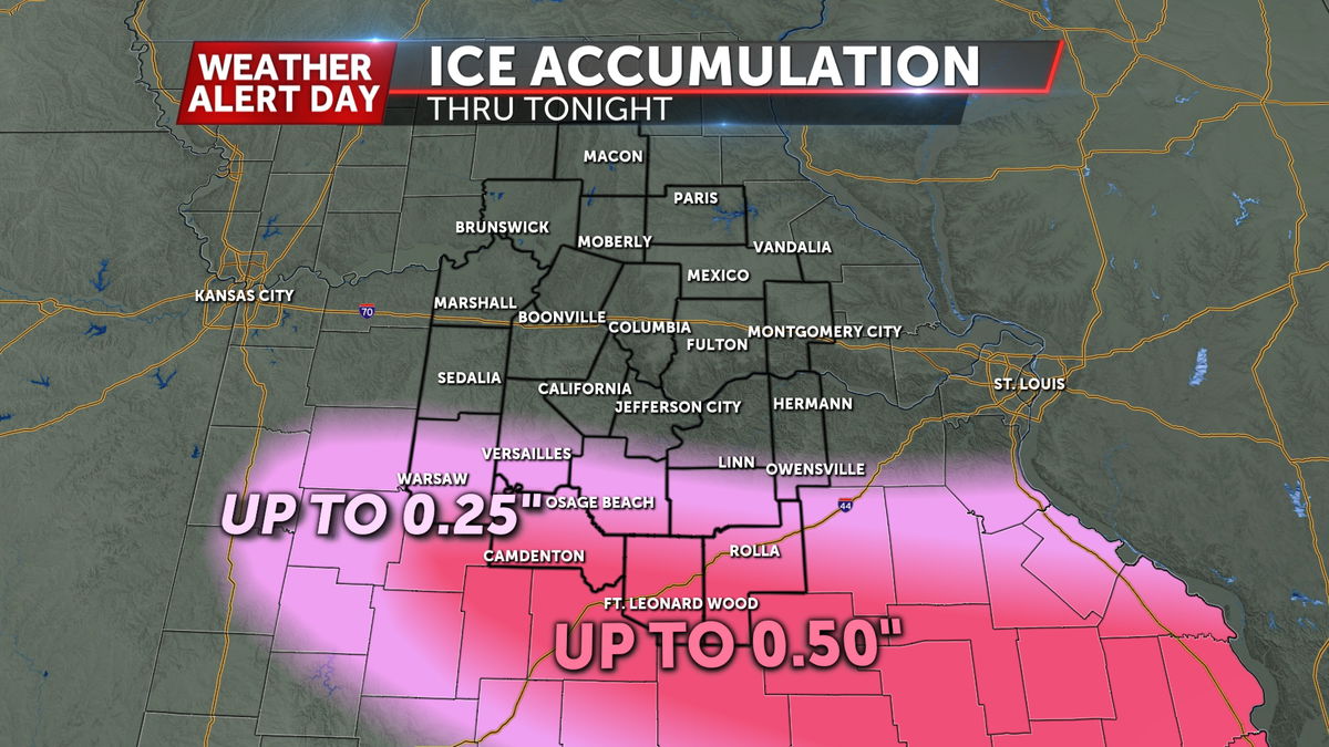

Regardless of precipitation type or amount, travel will be hazardous or nearly impossible across the area, with a particular concern for power outages where ice accumulates. Plan for closings and delays to continue through at least early Monday.
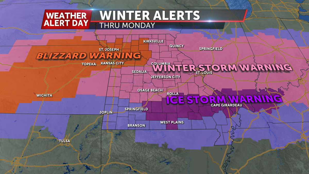
Along with consistent snow and ice throughout Sunday, winds will also become stronger throughout the day. Chariton and Saline counties are under a Blizzard Warning because of this, but gusty winds could cause visibility issues for the rest of central Missouri through Sunday.
SETUP:
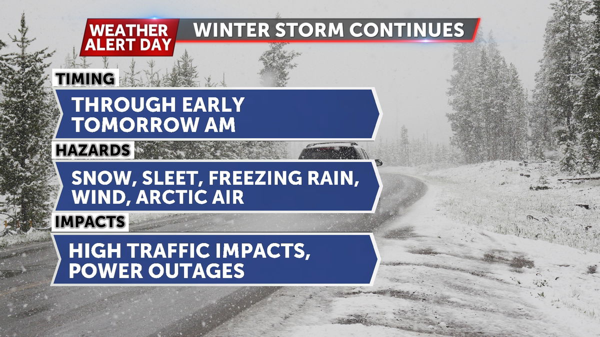
The track of this winter storm through southern Missouri is a textbook setup for wintry precipitation in our area. Arctic air on its heels will usher in the coldest air of the season early this week.
TIMING:
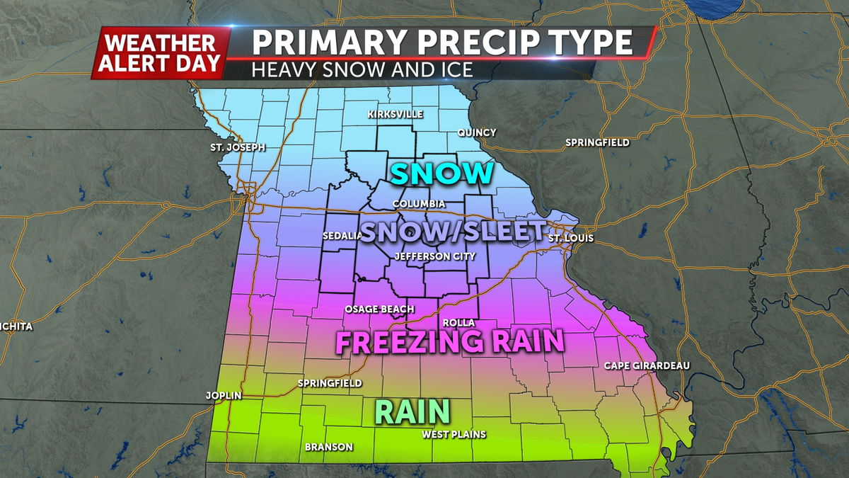
Precipitation has been very mixed in southern Missouri early Sunday, and will mostly fall as freezing rain in Camden, Pulaski, and Phelps counties today. This transitions to sleet as you head north, and begins to mix with snow from Jefferson City up to I-70. Snow takes over in northern Missouri just north of the interstate.
Precipitation switches to sleet and then snow areawide tonight into Monday as the system departs, with flurries ending just after sunrise Monday morning.
HAZARDS
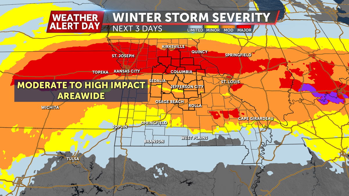
Heavy snow is favored near and north of I-70 with the highest totals possibly reaching a foot or more. At least a half foot of snow and sleet combined is expected from I-70 south to Jefferson City. Precipitation switches to predominantly freezing rain at the Lake and over to I-44; while totals look shallower here, it takes very little ice to cause problems.
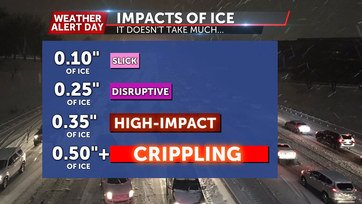
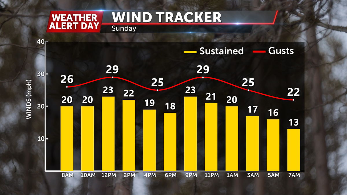
Moderate to major travel impacts and extensive power outages are expected across the region from the combination of snow and ice. High winds will compound this problem with wind gusts above 30 mph at times during the event. This will be especially concerning for icy power lines and drifting snow.
Behind all of this will be deep arctic cold that may push overnight lows below zero.
IMPACTS:
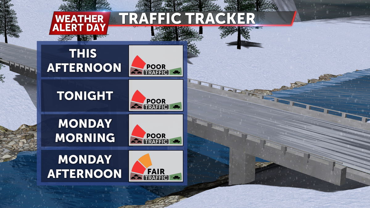
Conditions will be worst on with nearly impossible travel as precipitation outpaces road crews. Extreme cold will keep ice on the ground into Monday so have a plan in place for several days.
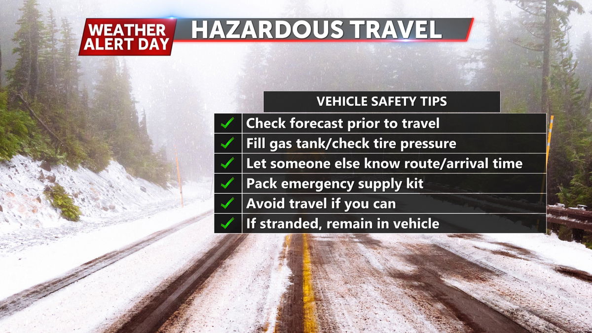
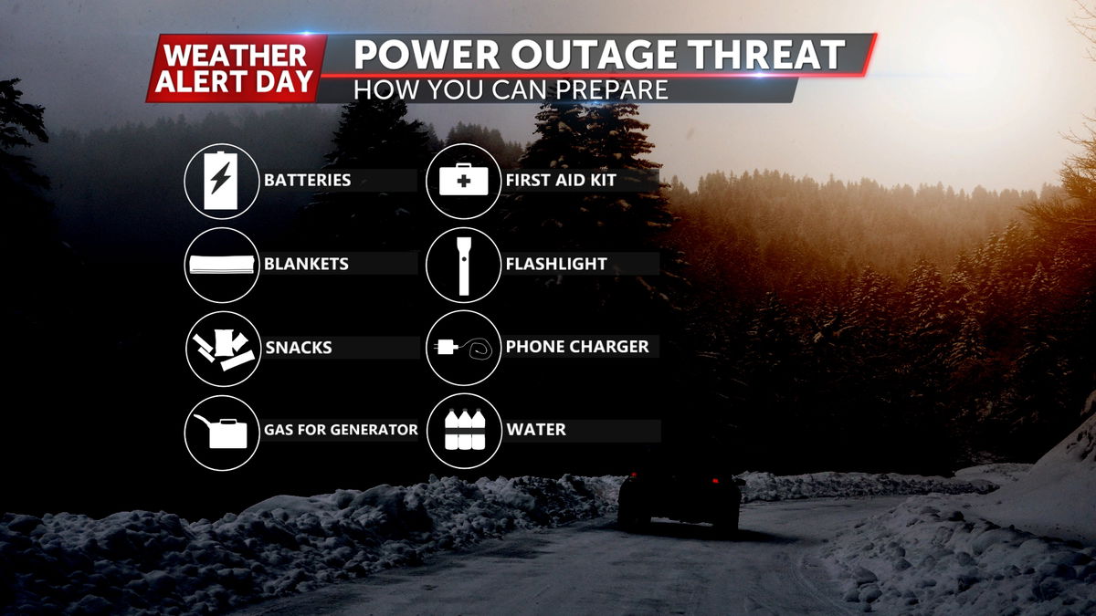
It is best to stay indoors all of Sunday and early Monday. If you absolutely need to head out, pack necessities for the car and do not leave your vehicle if stranded. Keep outside pipes covered from the extreme cold and leave taps dripping when lows plunge to single digits or worse. Always check back in for new updates ahead of and during the storm.
