Weather Alert Day: Tracking storms with damaging winds the 4th of July
BLOG:
The ABC 17 Stormtrack Weather Team has issued a Weather Alert Day for the potential of severe storms on Independence Day. The window for severe will be from 12 p.m. (noon) Thursday to 12 a.m. (midnight) Friday.
SETUP:
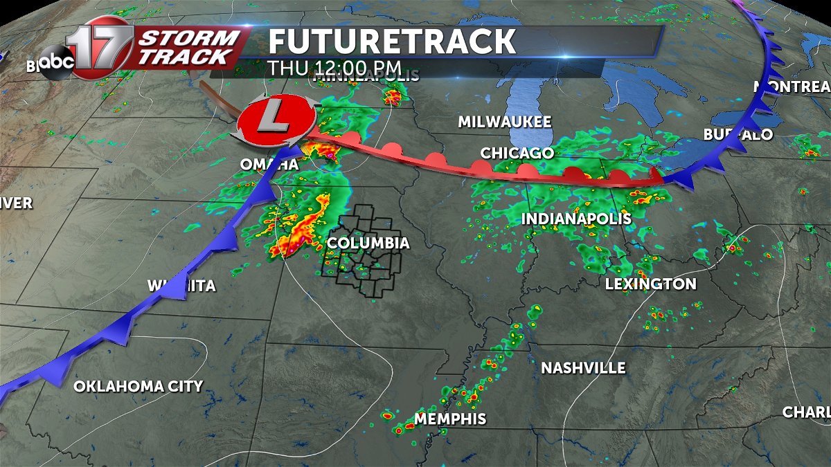
Thursday starts with showers and storms as a warm front lifts north through the region. This leaves to the north, allowing for more heat, moisture, and ultimately instability to build through the region.
There's uncertainty in exactly what plays out south of the warm front through the afternoon, but isolated to scattered showers and storms will be possible through the afternoon. These may be severe if they develop. Then, a cold front will approach from the west by the evening.
TIMING:
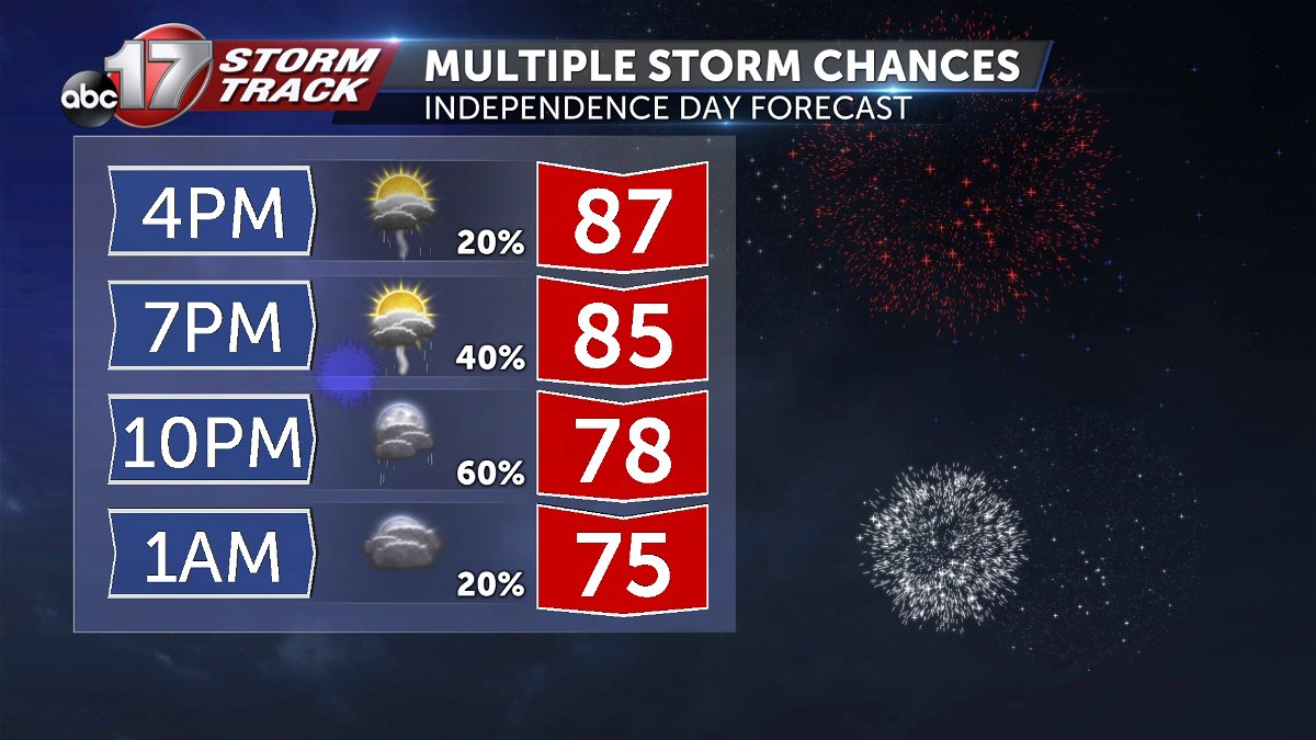
The rough timing brings the cold front to the western doorstep by 7-9 p.m. As you might imagine, this may be just in time to interrupt 4th celebrations. However, there will still be a chance that storms may hold off just long enough for many to enjoy a dry evening, as storms ahead of the cold front look to be quite isolated. However, widespread storms will arrive along the cold front from 7 p.m. to 9 p.m. near Marshall, Sedalia, and Warsaw.
The line is expected to be strongest in the south, before exiting in the east, near Hermann, Montgomery City, and Rolla by midnight to 2 a.m. The cold front looks to bring storms to Columbia and Jefferson City by 8-10 p.m. These ranges will narrow as confidence in timing increases.
IMPACTS:
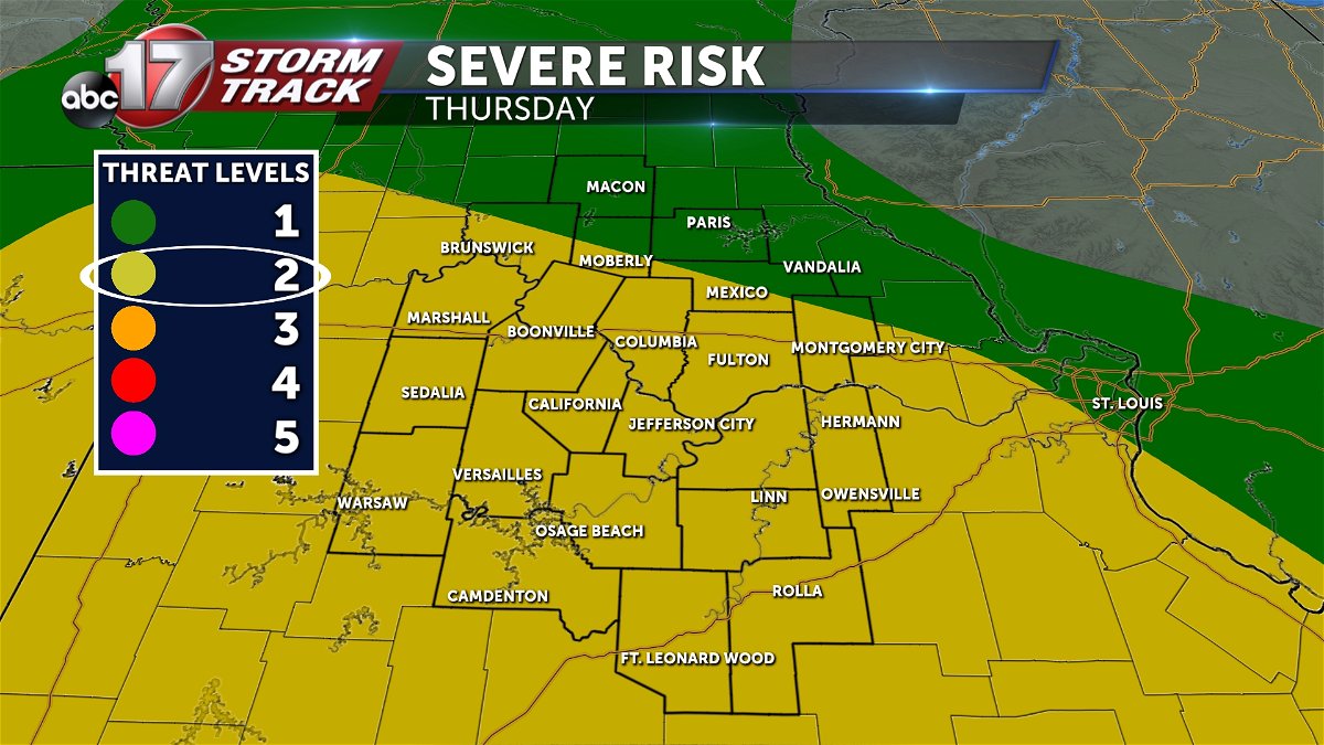
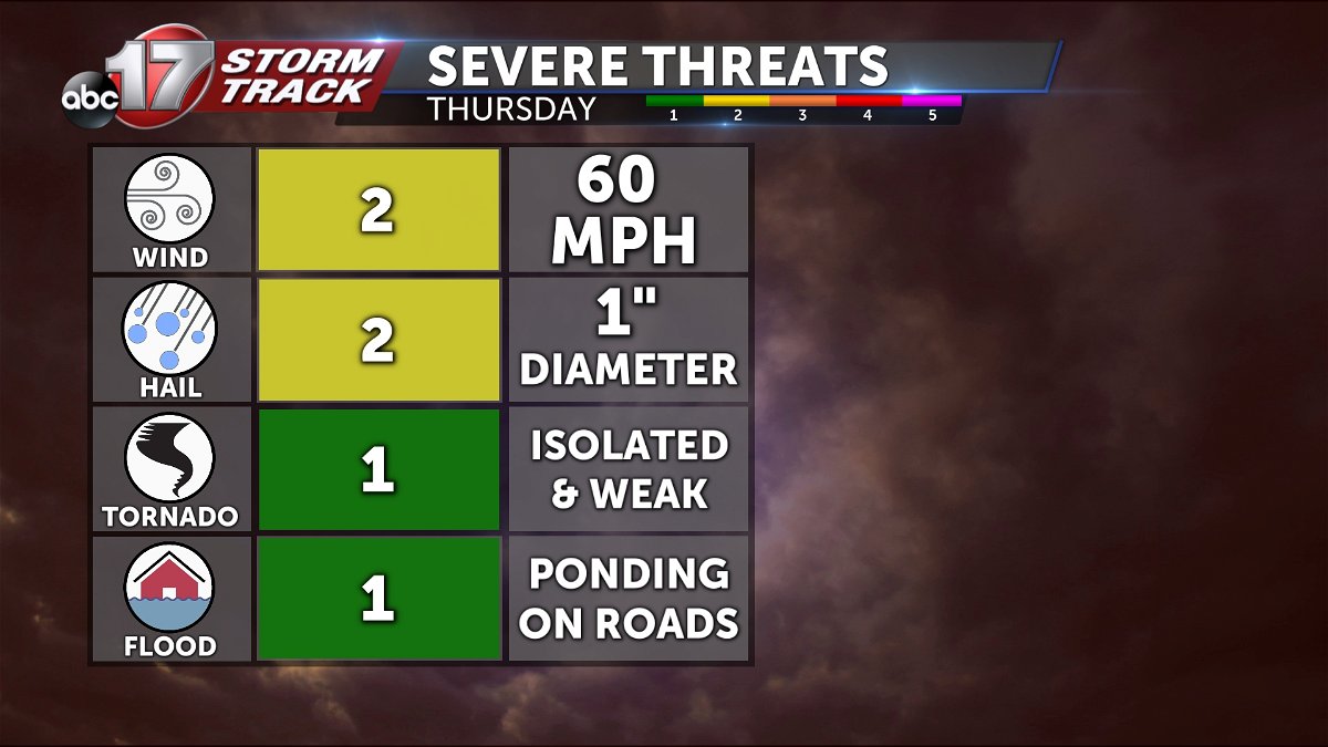
Our primary impacts are wind and hail with storms both ahead of the front and along it. A tornado threat exists but on the low end of the spectrum. Intensity of storms may somewhat hinge on what development occurs earlier in the day, but overall severe is expected to be a possibility with both rounds. Flooding may be a minor impact behind heavy rains.

Make sure you have a way to receive those severe weather alerts at night. The ABC 17 Stormtrack Weather app is free and will send severe weather watches and warnings along with lightning detection to your current and favorite locations.
