Insider Blog: Drought conditions improving in mid-Missouri, still far from fixed
DROUGHT MONITOR:
The drought monitor is a product collaboratively produced by various government agencies and other organizations, to keep tabs on how dry (or not) communities are around the country. The product is updated every Thursday morning based on data collected through Tuesday morning of the same week. This means the drought monitor is updated once a week, and doesn't always include the latest rainfall recorded.
Drought conditions are broken down into 5 main categories; Abnormally Dry, Moderate, Severe, Extreme, and Exceptional.
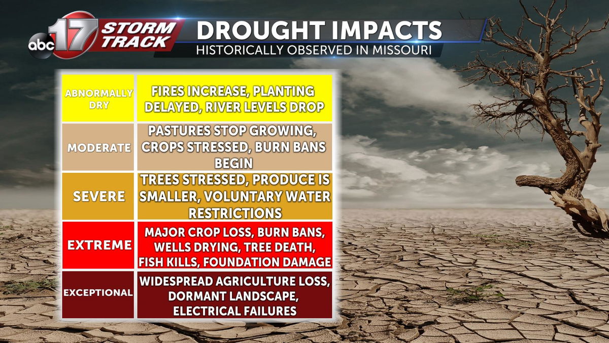
WHAT IT MEANS FOR US:
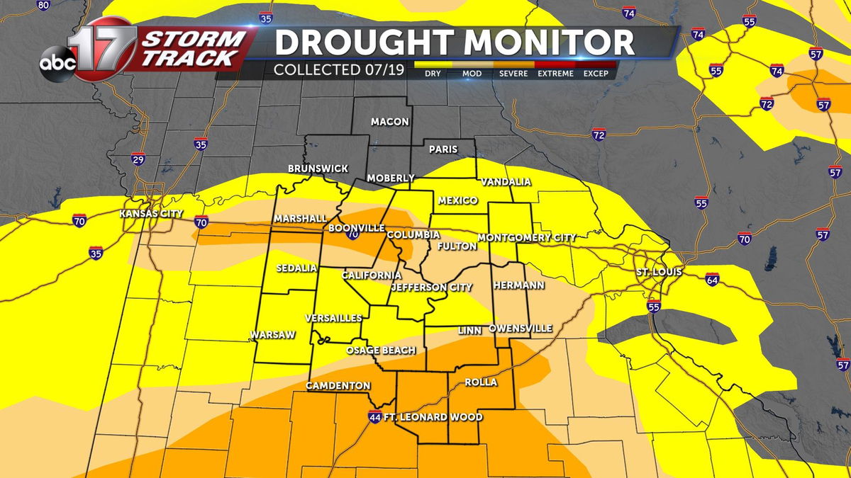
Three weeks ago, the drought monitor showed everything from abnormally dry (yellow) to extreme drought conditions (red) across Missouri, with mid-Missouri missing out on the extreme drought. Severe drought conditions spanning at least some portion of 11 counties represented the driest conditions locally. More than 73% of the state found itself in the midst of at least abnormally dry conditions, the peak for Missouri's drought so far this year.
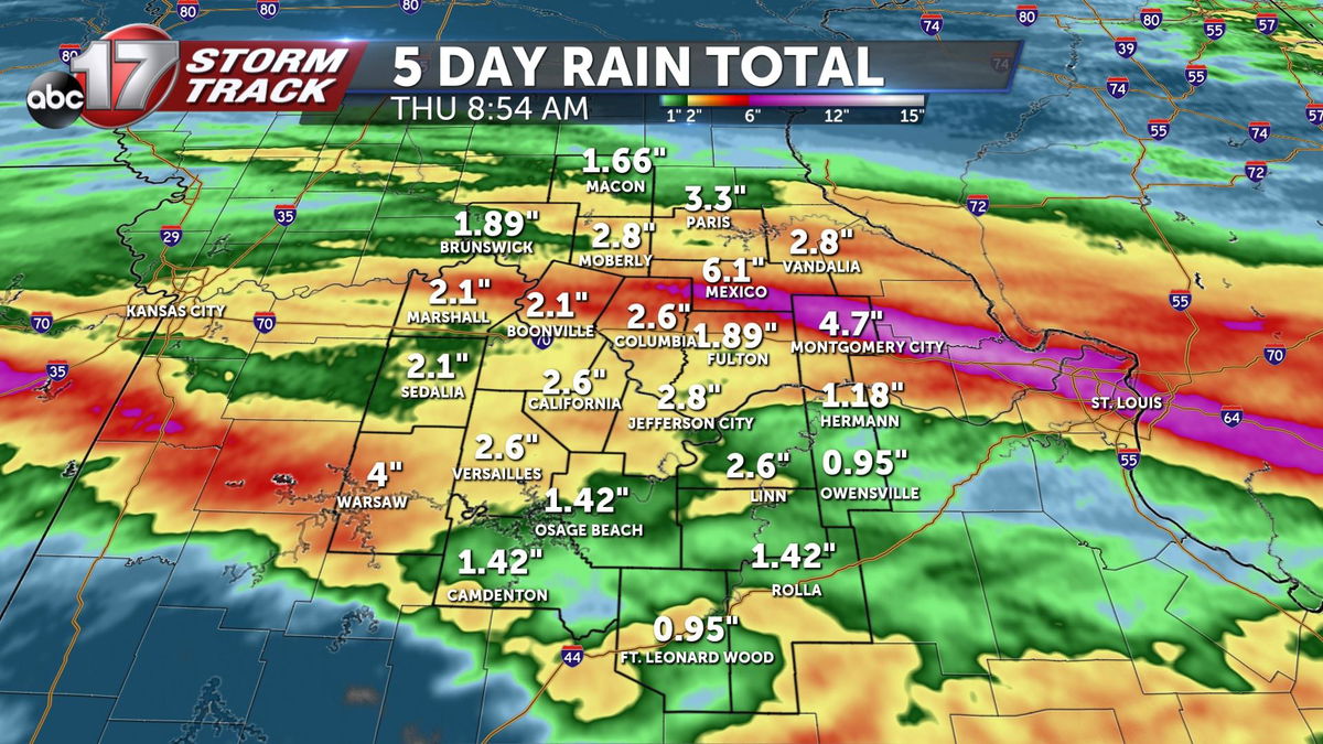
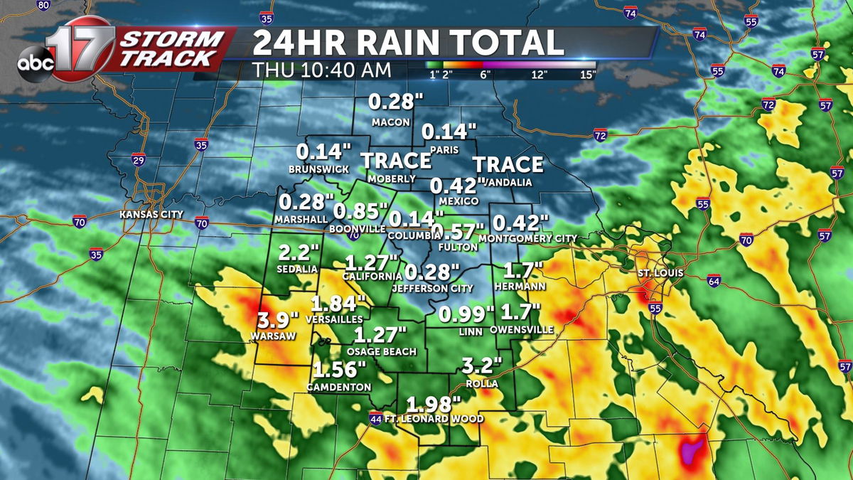
A week later, after several inches of rain area wide, a drought monitor was released on July 28th. Here's a look at some of the soaking rain leading up to this release.
Below is the map released on July 28th.
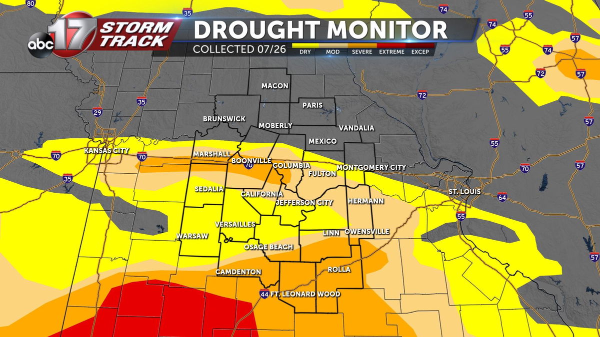
Because not all of this rain fell before Tuesday, July 26th at 7 am, only some of this rainfall was accounted for. This report highlighted narrowed drought conditions for some, especially where the axis of heaviest rain fell early that Tuesday morning in Montgomery and Audrain counties, but drought conditions south of I-70 are largely unchanged, with extreme drought coming closer to mid-Missouri in the south.
Notably, more rain fell south of I-70 on Tuesday, July 26th, and through the next week leading up to the next data cutoff on Tuesday, August 2nd. Below is the next week's drought monitor, compiled with data collected through Tuesday, August 2nd and released Thursday, August 4th.
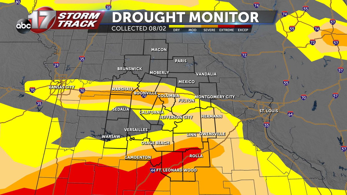
This map shows improved conditions in various places across mid-Missouri, but not for all. Where the drought is the worst, it holds on the strongest, and in some cases grows. Notable impacts are along I-70 west of Columbia, where severe drought conditions remain unchanged. Also, extreme drought has now expanded into mid-MO, up I-44 in Pulaski, Camden, Phelps, and Maries counties. It's not all bad, as portions of Benton, Pettis, Morgan, Moniteau, and Miller counties find themselves out of all drought classification, including the abnormally dry category. Still, many could use more rain, and that's why August 4th's rain is so helpful despite some already experiencing flooding with heavy rains over the last two weeks.
Rainfall between August 2nd and 9th made considerable progress in wearing down the drought across the state. Still, severe drought hangs on tight across the usual areas, with abnormally dry conditions expanding to the north.
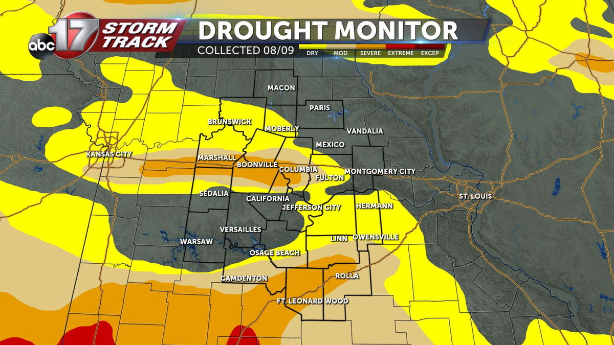
Since conditions in mid-Missouri peaked 3 weeks ago, drought coverage has generally, with some exception and fluctuation, improved. Overall, the state is down nearly 10% in overall drought coverage with the latest update, with the biggest improvement coming in some of the hardest hit areas in the past two weeks.
Rain this week has not been as widespread.
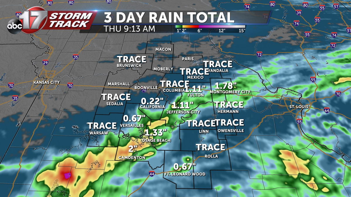
For a better understanding of what this week's rain (or lack thereof) means for the ongoing drought in our state, we'll have to wait until next Thursday. Stay tuned on air, web and social media for next week's update. For more detailed information on the Drought Monitor, and to dig through the data yourself, click here.
