Insider Blog: What fueled wild fires ahead of Wednesday’s severe threat in the south
Wednesday afternoon, wildfires were ongoing throughout parts of Alabama and Georgia.
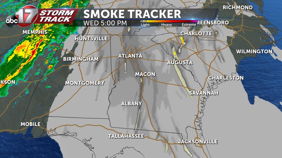
That was out ahead of rain and thunderstorms that eventually swept through the deep south yesterday afternoon and last night.
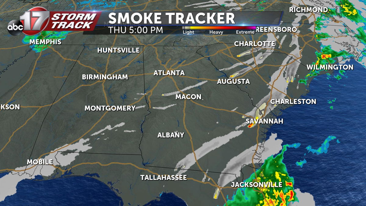
That rolled through and cleared out the smoke, but we still have wildfires ongoing there Thursday afternoon, so it wasn't enough to completely quell the fire threat.
Not only did we see wildfires, but we saw some severe weather with that line of showers and storms. We saw wind damage, hail and tornadoes.
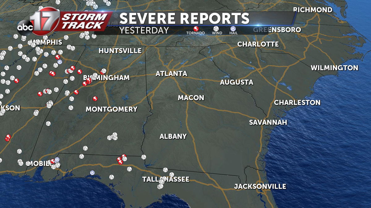
Everything you see in red is a reported tornado from Wednesday into early Thursday.
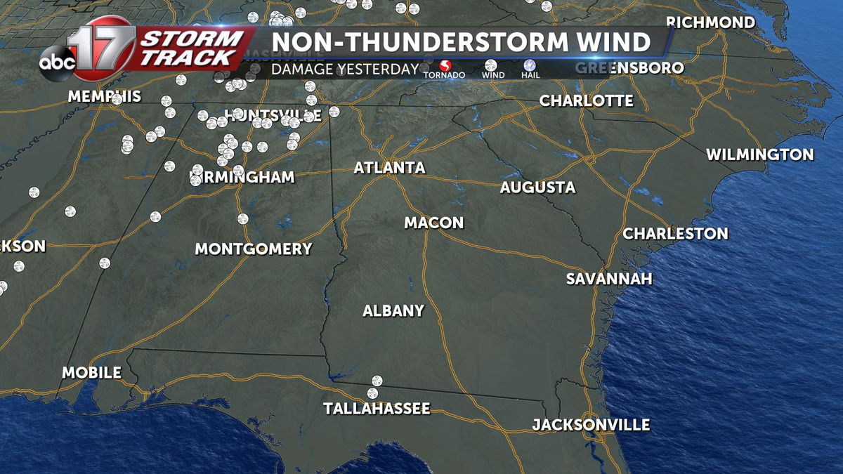
These are non-thunderstorm wind damage reports, these are wind gusts that came separate from the line of thunderstorms thanks to something called the pressure gradient force.
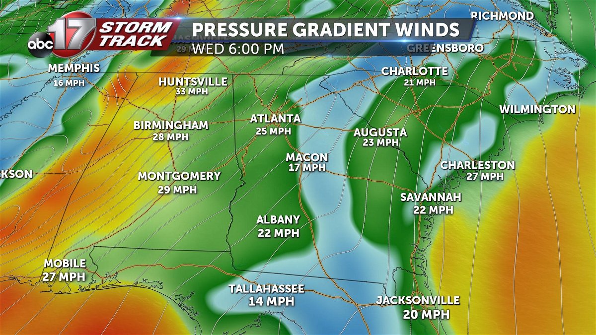
Whenever we get lines of equal pressure really close together, we'll likely see strong wind gusts, even outside of thunderstorms. Not only can that create damage at times, but it can also fuel things like wildfires, and that's what we saw Wednesday afternoon.
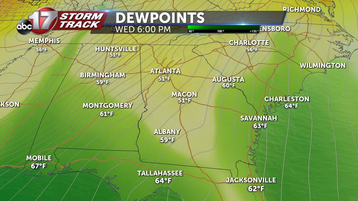
You may be thinking, "well wasn't that wind full of moisture as it was coming out of the gulf?"
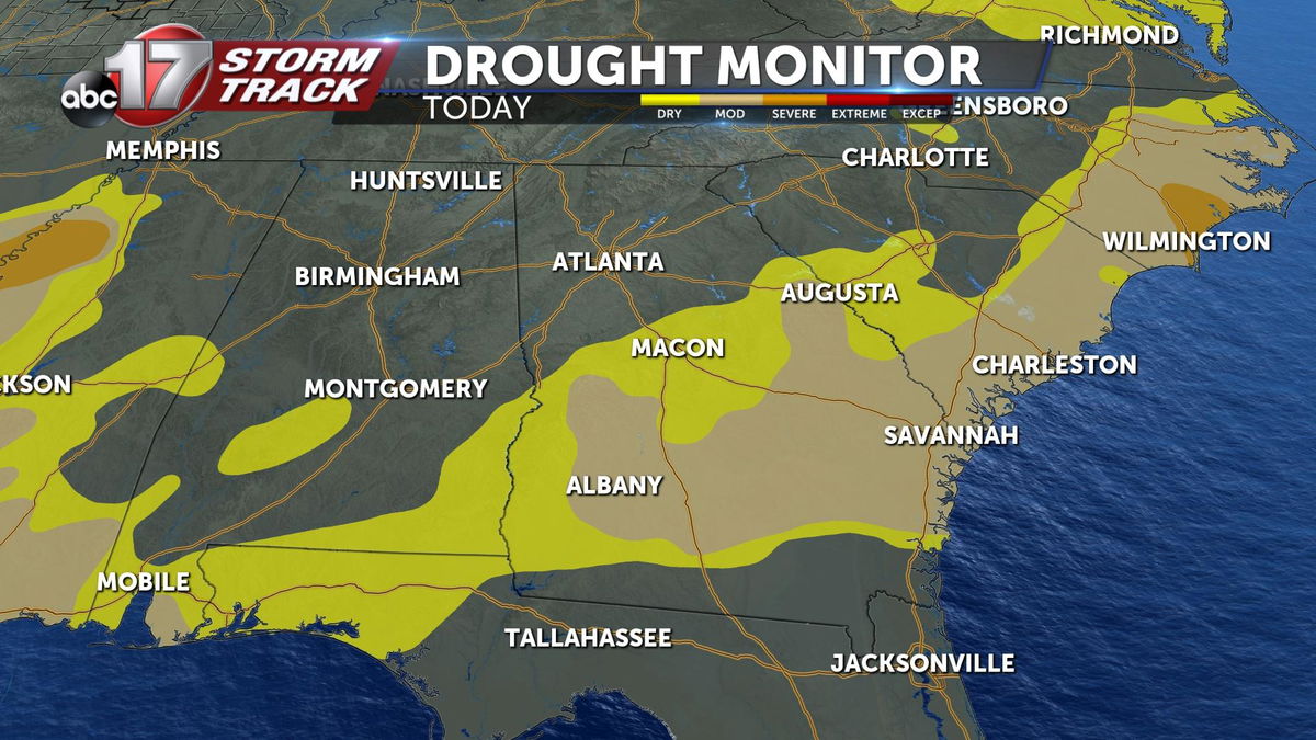
That was the case, we had decent dew points along the coast, but still, dry conditions were in place ahead of that wind meaning that even after the rain yesterday, we're still seeing dry conditions and of course that was enough for those wildfires to be a problem and still is enough to support wildfires Thursday afternoon.
