THE SCIENCE BEHIND: Why snow will change to freezing rain Friday
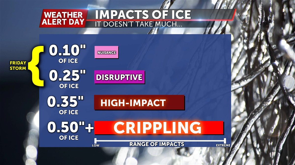
Freezing rain can be one of the most disruptive types of weather we can experience. It can cause havoc on roads and wipe out power over a widespread area. We're going to show you how freezing rain forms and the impacts we can expect for Friday's system.
How we typically illustrate freezing rain
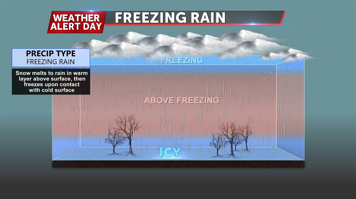
This is a great way to show how freezing rain occurs. But doesn't really tell us HOW the layer of above-freezing air forms. You may also wonder... why doesn't the warm air just sink to the ground?
Well, it eventually will, but a critical difference between warm and cold air is their density. They don't like to "mix" together.
Sort of like oil and water... if you've ever tried the mix the two together, it typically takes a lot of effort. Imagine that on a scale the size of our atmosphere.
That should put into perspective why this can be such a difficult forecast to pin down.
So what happens way up high in the atmosphere to cause temperatures to go up? It's all due to what we refer to in the weather community as the warm "nose" of air comes with the stream of moisture that will feed Friday's storm.
How freezing rain happens in "3D"
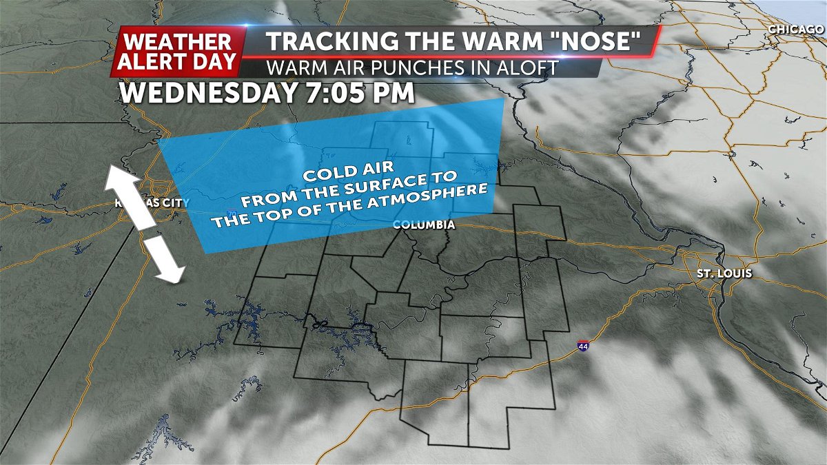
The atmospheric setup that we have tonight, into tomorrow will be cold air, all throughout the atmosphere. From the earth's surface, alllllllll the way up-- several thousands of feet into the atmosphere.
No big changes are expected in this forecast, and it's this cold air that will help in the freezing rain process by "pre-cooling" surfaces ahead of precipitation.
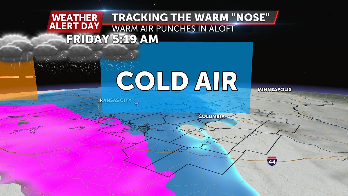
Initially, precipitation is expected to begin as snow early Friday. This is because we're expecting the entire atmosphere to be below freezing. From the surface to the very top.
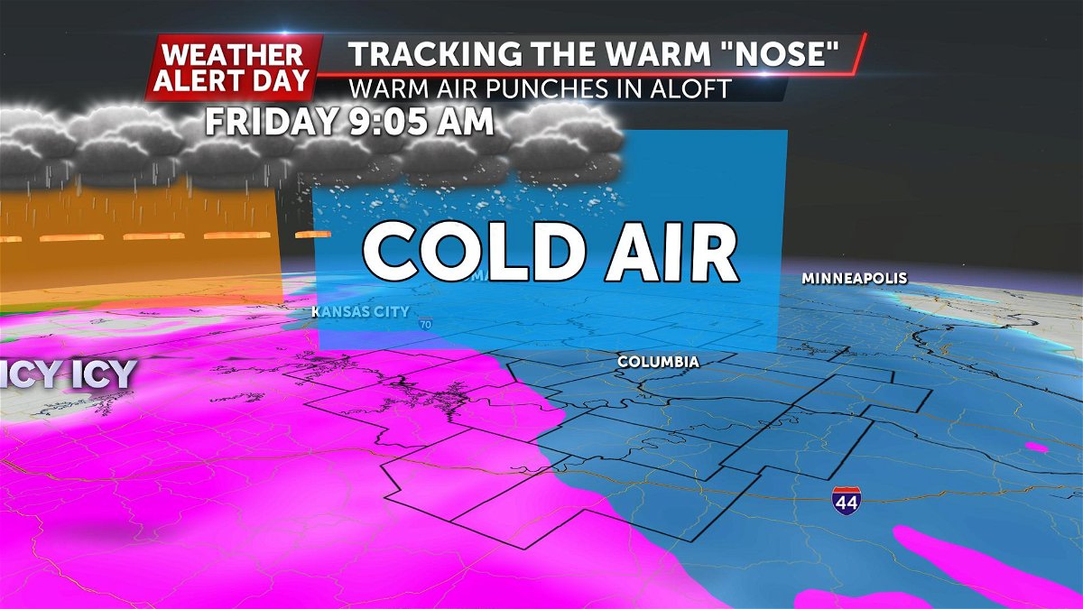
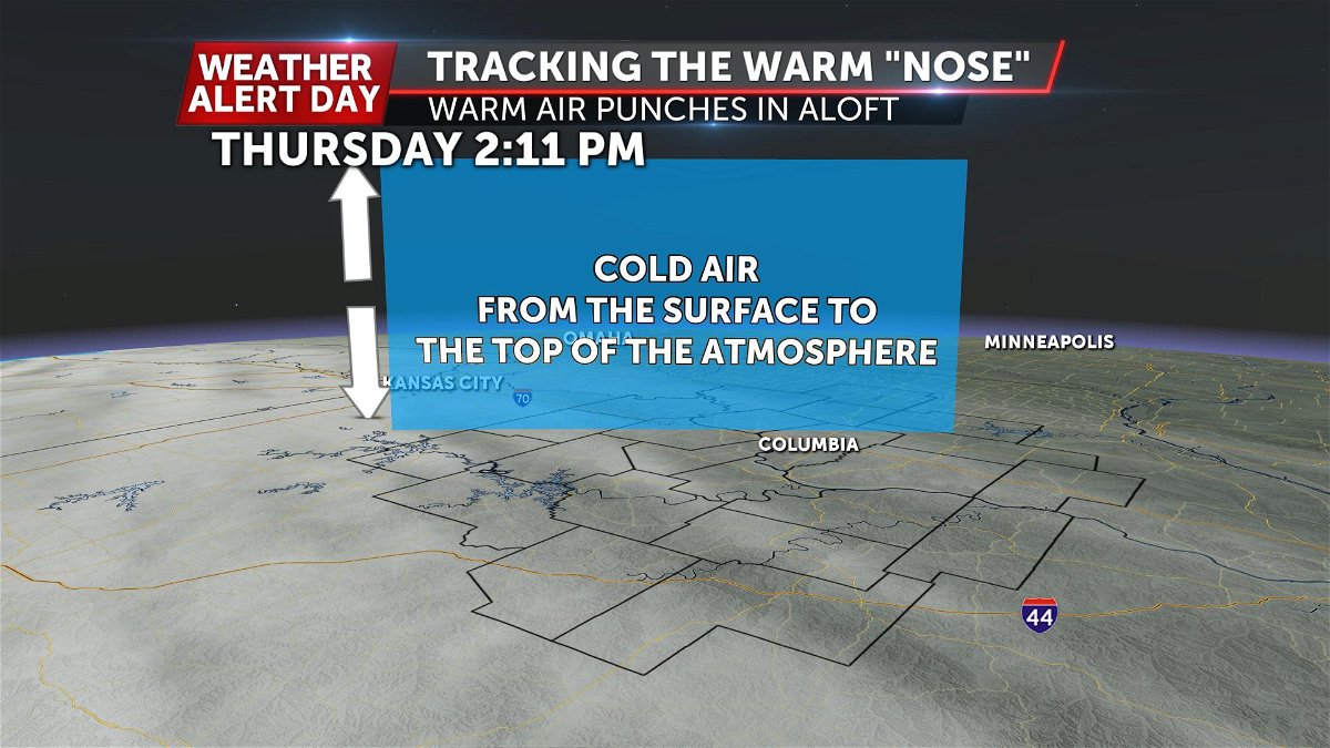
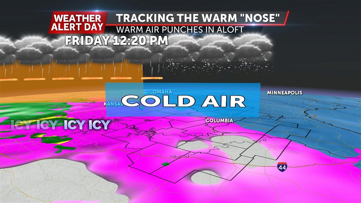
This stream of moisture is expected to bring a layer of warm, above freezing air with it... from about 3,000' all the way up to about 8,000'. That 5,000 ft layer of above-freezing air will melt any precipitation into raindrops. But, it will also act as a "seal" for the cold air.
As the elevated warm "nose" continues to push from southwest to northeast, it will literally "crush" the cold air and pack it down close to the surface... remember the oil analogy. Warm and cold air doesn't like to mix-- this will cause the warm air to squeeze the sub-freezing air closer to the surface initially... and as long as that cold air doesn't get "scrubbed" out, the raindrops will continue freezing at the surface, until the warm air finally overpowers.
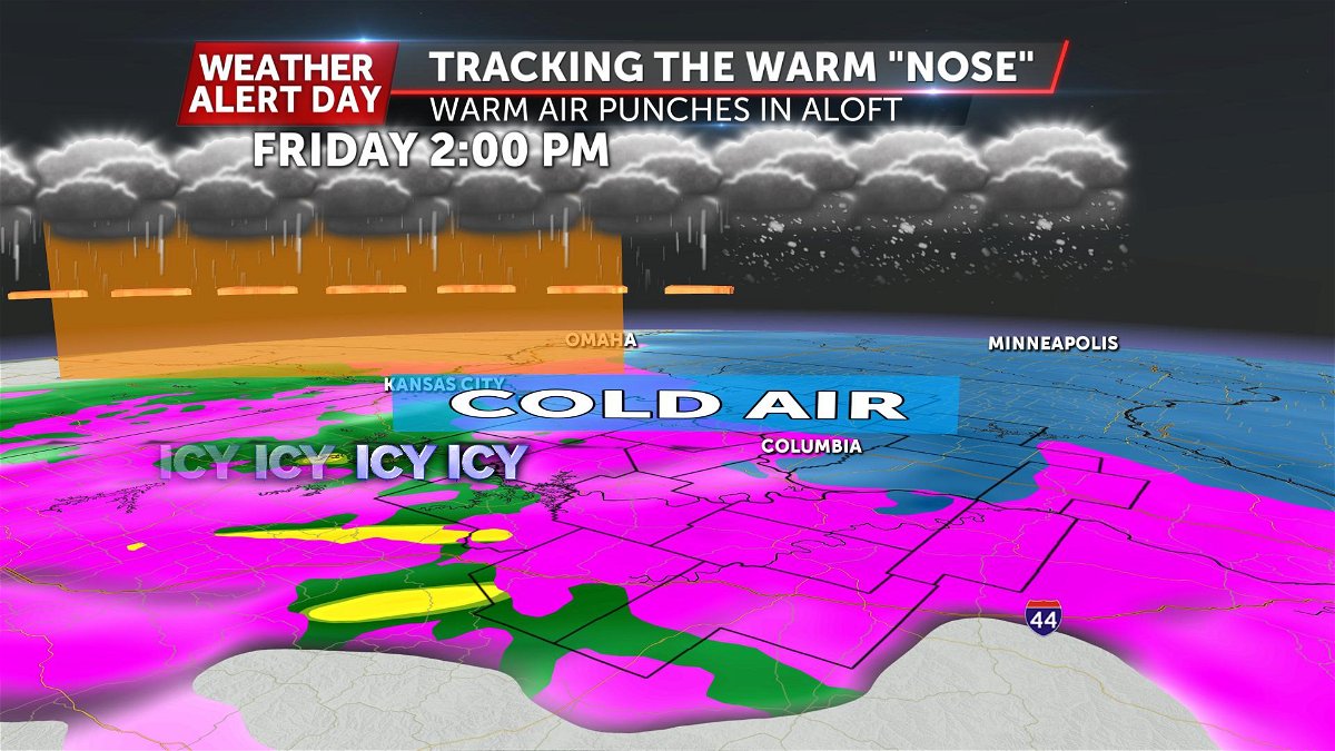
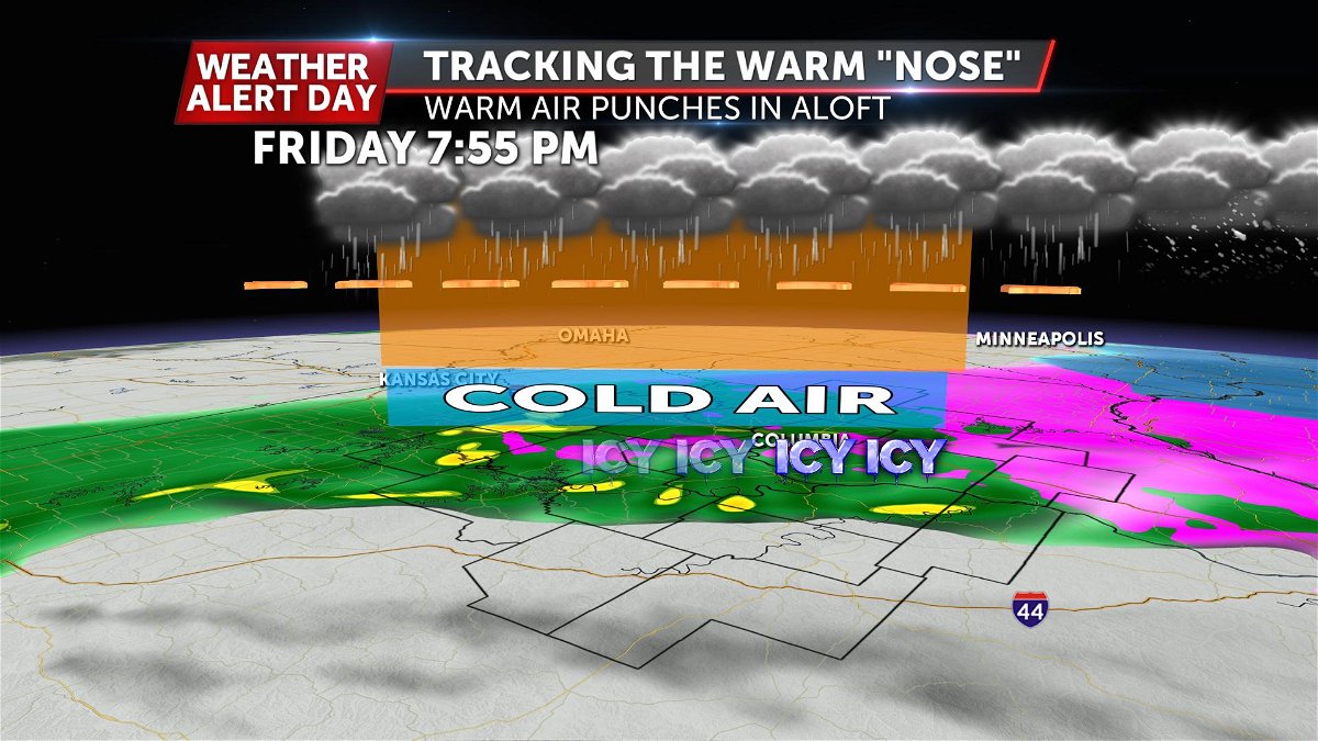
How fast that overpowering of the cold air occurs will be impossible to know, likely until the event, but we can give the best guess. It's also helpful that the EFFICIENCY at which ice accumulates dramatically decreases above ~27º. We're expected to be at or above that for the majority of the event.
-Luke
