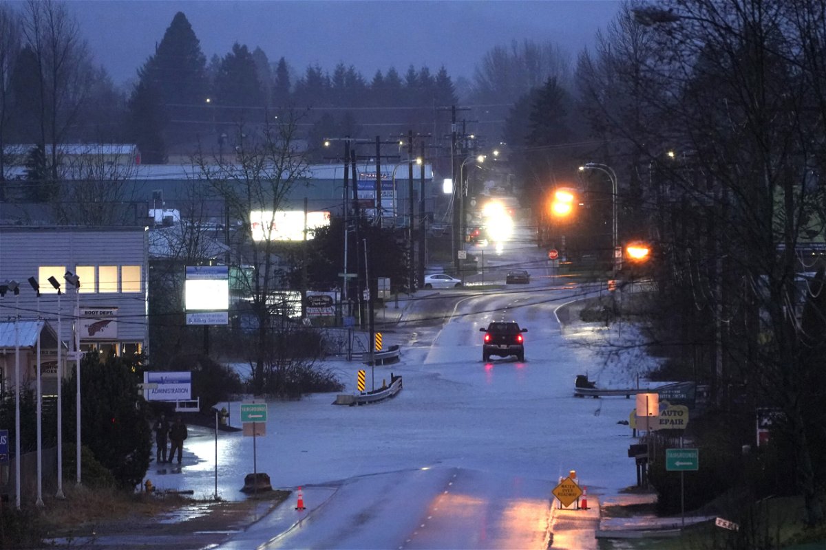
Evacuations ordered due to imminent flooding from heavy rain and snow in Washington state

Record rain and snow will cause floods
By Michelle Watson, Haley Brink and Allison Chinchar, CNN
Record rain and snow will cause floods, possible landslides, and higher avalanche risks across western Washington state, with more forecast to fall through the weekend.
Residents living in the Skokomish Valley area of Mason County are under an evacuation order due to rising water and “imminent flooding,” the county said in a news release.
The alert, issued Thursday, told people to “evacuate the area immediately or be prepared to shelter in place for at least 72 hours.”
More road closures on Friday are expected, the release added.
The mayor of Leavenworth, in central Washington state, declared a disaster in the city on Friday after record-breaking snowfall a day earlier, when the city totaled 36 inches of snow in less than 24 hours.
“Some microclimate pockets have now received up to 48 inches of snow in the last 48 hours, causing concern for life safety and structure stability in the community at large,” a news release from the city said.
The city will also ask for help from the National Guard with citizen welfare checks, food delivery, general snow cleanup, and private driveway snow removal, the release said.
Washington National Guard members were also deployed to Centralia in Lewis County, in southwestern Washington state. They began filling sandbags Friday evening to assist with the local flooding response, the national guard said on its official Facebook page.
Roadway briefly closed due to rising water
A 20-mile stretch of Interstate 5 was closed in both directions due to rising water from the Chehalis River, Trooper Will Finn with Washington State Patrol told CNN in a phone call. The state’s transportation department later announced crews were working to reopen that part of the roadway as flood waters receded.
It is a primary interstate into Seattle from the south.
Earlier, a video from CNN affiliate KPTV showed a rescue boat arriving to help people stranded and standing on top of a vehicle along the flooded roadway.
The Chehalis River gauge near Grand Mound is forecast to crest at over 145 feet early Saturday morning, which is at major flood stage and would be the second-highest crest ever recorded. The highest on record is 147.26 feet on December 4, 2007. The river is not forecast to be below flood stage until Monday morning.
Another gauge near I-5 and on the Skookumchuck River just before it merges with the Chehalis River is forecast to reach major flooding at 192.58 feet, a level it has never reached before. Not only will this flood I-5 but the NWS says at the level “the river will flood most residential areas and roads and cover most of the farmland in the Skookumchuck River valley.”
According to the National Weather Service (NWS) office in Seattle, several cities in Washington broke rainfall records Thursday, which likely triggered flooding.
A flood warning is in effect for the Skokomish River at Potlatch until Saturday evening.
“The river is cresting this morning around 17.8 feet. The river will begin slowly receding this afternoon but not fall below flood stage until Saturday afternoon,” the NWS office in Seattle said.
Above 17.5 feet, the flooding impacts for this area include “moderate flooding, with deep and quick flood waters inundating some residential areas, many roads, and much of the farm land in the Skokomish Valley.”
Too much snow and rain are leading to possible avalanches and landslides
The West has hardly seen a break over the past several weeks after being pummeled by record-breaking rain and snow from Washington down to California. The cumulative effect of all that rain and snow will increase the threat for river flooding and avalanches.
The rain and snow are helpful in mitigating drought conditions, but not when it’s too much in a short time.
Over the last several weeks, heavy rain has led to saturated soils across much of western Washington. Additional rainfall totals of 1 to 3 inches are forecast through Friday. In conjunction with melting snowfall over the last several days, this rain will exacerbate the ongoing flooding situation across the region. This will lead to an increased threat of landslides below 3,000 feet Friday.
“A few landslides have been reported in the last few days in western Washington and more landslides are possible,” the NWS said.
“All in all, this rain, combined with the snowmelt from the coastal mountains and to some degree, the lower slopes of the Cascades, will push many rivers upward, some potentially reaching near flood stage,” the NWS office in Portland, Oregon, said.
The Northwest Avalanche Center in Seattle is warning that large natural avalanches will occur at all elevations of the Cascades from the Canadian border down to and including the I-90 corridor. The center recommends against back-country travel.
Bookmark this site to check if snow is forecast for your region
“Extreme weather has created conditions so hazardous that it’s too dangerous for our crews to be in the mountain pass areas,” the Washington state Department of Transportation tweeted. “Because of that, Snoqualmie, Stevens, White & Blewett passes will not reopen until at least Friday & possibly not until Saturday. Additionally, SR 14 and Oregon’s I-84 in the Columbia River Gorge, are also closed to freight traffic, with I-84 closed to ALL vehicles.
“This means cross-state travel is almost completely impossible.”
The rain and snow will stick around for much of the Pacific Northwest through Saturday before the area gets a break on Sunday.
The-CNN-Wire
™ & © 2022 Cable News Network, Inc., a WarnerMedia Company. All rights reserved.