La Niña to batter Australia with rain over the summer in a wet and windy holiday period

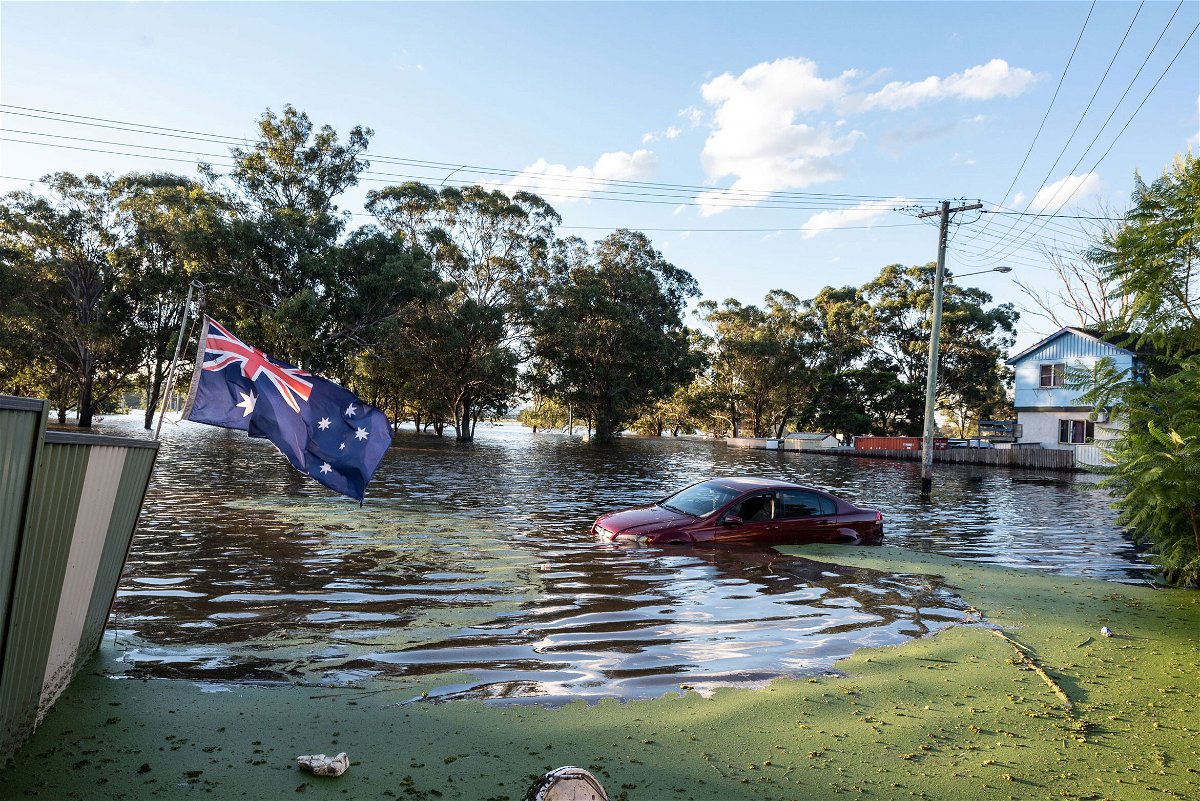
Australians are bracing for a wet and windy summer for a second year in a row as meteorologists said Tuesday that a La Niña weather event had formed in the Pacific Ocean. A car half submerged in a flood on March 24
By Angela Dewan, CNN
Australians are bracing for a wet and windy summer for a second year in a row as meteorologists said Tuesday that a La Niña weather event had formed in the Pacific Ocean.
La Niña is expected to impact the country’s north, center and east, including its biggest city, Sydney, during the Southern Hemisphere’s late spring and early summer, possibly even as late as autumn, the Australian Bureau of Meteorology (BOM) said.
Meteorologists around the world, including Australia, have warned for months that La Niña conditions were forming in the Pacific Ocean, and Tuesday’s announcement means parts of the country are on alert for potential flooding and an uptick in tropical cyclones.
“In terms of tropical cyclones, for La Niña, we do tend to see more than average — probably about a 65% chance of seeing more than the average number of 11 tropical cyclones,” the bureau’s head of operational climate services, Andrew Watkins, said at a press conference.
The same parts of the country already have wet soil, full rivers and high catchments from long spells of rain.
“Any further rainfall raises the risk of widespread flooding, typically in southeastern Australia,” he said.
The news puts a dampener on plans for millions of Australians planning local beach holidays over the Christmas summer period, many of whom have only recently emerged from lockdowns durung the pandemic.
But La Niña brings some advantages, including cooler temperatures over the summer, which can typically soar well above 30 degrees Celsius (86 degrees Fahrenheit).
“The good news about La Niña is it tends to reduce the bushfire risk,” Watkins said. “At least in terms of those big wildfires that we saw a few years ago, the risk is reduced.”
La Niña typically occurs at intervals somewhere between a few years and a decade, and generally lasts for a year or two, but this one has formed on the heels of another.
What is La Niña?
La Niña is part of a natural cycle called the El Niño Southern Oscillation — or ENSO — and occurs when cold water builds up on the west coast of the South American continent.
Pulled by strong easterly winds, the cold water surges west across the Pacific, creating a “cold tongue.” This pushes warmer waters and a consequent high-pressure system ahead of it. The resulting weather system — filled with warm, water-laden air — dumps unusually heavy rain when it makes landfall.
Its impacts vary in different parts of the world.
In the US, for example, La Niña typically brings wetter and cooler conditions to the Pacific Northwest and northern Plains, but it brings drier and warmer-than-average conditions to the southern states, which could exacerbate drought in some areas there.
In terms of Australia, cooler waters in the central and eastern tropical Pacific, along with stronger and persistent south-east to north-westerly winds, help shift clouds west, closer to the country, BOM explained.
“The last significant La Niña was 2010-12. This strong event saw large impacts across Australia, including Australia’s wettest two-year periods on record, and widespread flooding,” Watkins said.
A link to climate change?
The extent to which global warming might have contributed to the intensity of La Niña is still not known, with records of the event only stretching back 60 years.
El Niño and La Niña are events that occur naturally as part of the Earth’s weather systems, but research is beginning to show that increased global temperatures may temper or change their effects.
A 2018 study on atmospheric conditions ran simulations of climate conditions and found that climate change could increase the severity of weather events stemming from El Niño patterns.
Outside of any impact on hurricanes, climate change may mean that some older temperature patterns associated with El Niño and La Niña no longer apply.
While La Niña tends to cool temperatures, global warming is happening so rapidly, sometimes its impacts are muted.
Long-term weather patterns across Australia are notoriously difficult to forecast and the BOM has been collecting oral evidence from Aboriginal Australians to better understand the continent’s weather cycles.
The-CNN-Wire
™ & © 2021 Cable News Network, Inc., a WarnerMedia Company. All rights reserved.