Weather Alert Day: Temperatures plummet again Wednesday morning
The ABC 17 Stormtrack Weather Team has issued a Weather Alert Day for late tonight through Wednesday morning for expected wind chills in the single digits.
WEDNESDAY MORNING UPDATE:
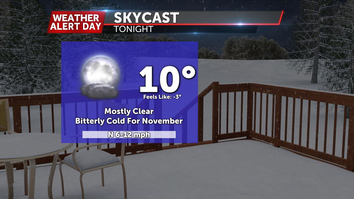
Temperatures have fallen back into the teens, but it seems like some of these southerly winds are doing a good job keeping us mixed up that we don't expect much more cooling before sunrise. Slick spots aren't as numerous this morning but are still present, so take it easy when heading to work or school--especially on parking lots and sidewalks.
Temperatures are slightly warmer starting off this morning, and will get back above freezing this afternoon, which should help clear up any leftover slick spots.
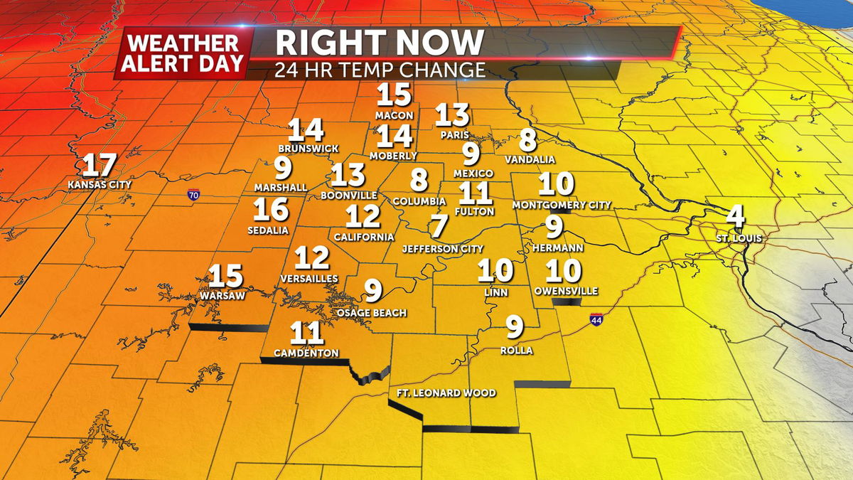
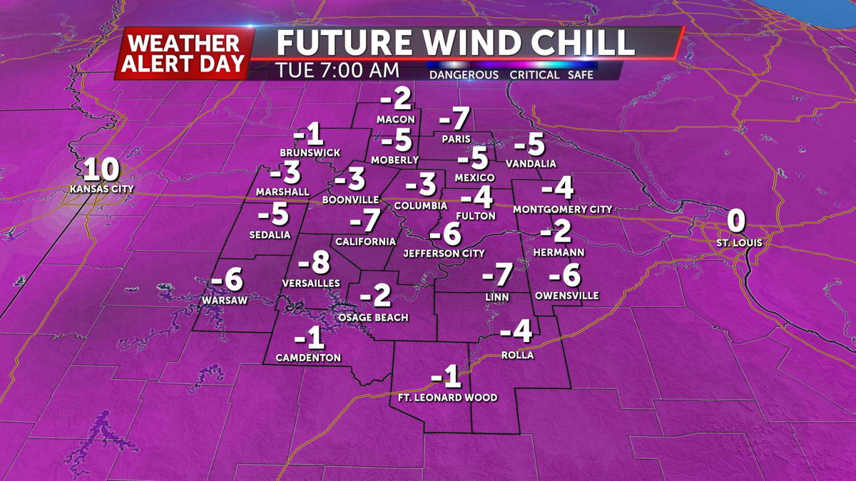
TUESDAY EVENING UPDATE:
Temperatures continue to fall into the teens tonight, and winds pick up from the southeast into Wednesday. Overnight wind chills will hover around zero, and only climb into the single digits by Wednesday morning. We gain about 20 degrees with breezy south winds Wednesday, bringing highs into the low 40s. Any leftover icy spots should melt during the day due to the warm up.
TUESDAY MORNING UPDATE:
Negative wind chills and record-breaking cold aside this morning, we're still looking at some slick roads heading out the door. The good news is we're seeing sunshine returning this morning and that's expected to stick around this afternoon. The bad news is it may not help those roadways as much with highs only expected to reach the low 20's. If you're going to be out and about, build in plenty of time and slow down on the roads today.
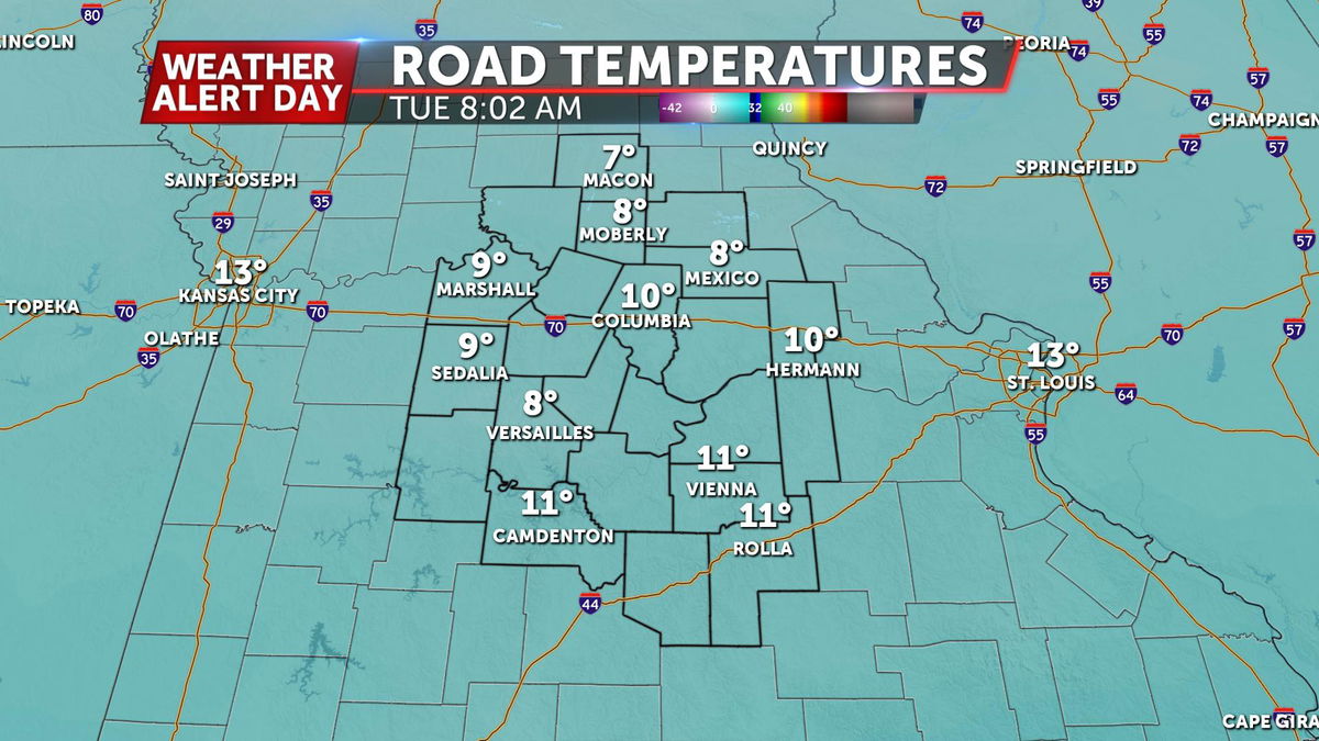
For a full breakdown on those roads and a livestream of what our crews are seeing this morning, you can find it here.
MONDAY EVENING UPDATE:
Bitterly cold air has settled into Mid-Missouri, making it hard for treatment to melt icy spots. Most main roads and highways are expected to be clear Tuesday morning, but side streets and neighborhood roads may still be icy. Elevated bridges and ramps that weren't completely cleared could be slick as well. Temperatures start out in the single digits to around 10 degrees, with wind chills dangerously low; near or below zero in most places. Temperatures only make it into the mid-20s on Tuesday, with afternoon wind chills in the teens.
MONDAY AFTERNOON UPDATE:
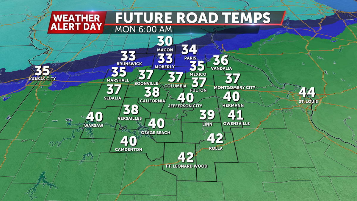
Snow has generally tapered off for much of the area today. Some sunshine is possible in western portions of mid-Missouri this evening, but quickly dropping temperatures will limit and melting on untreated roadways. As temperatures drop off tonight, we'll see untreated road conditions deteriorate into Tuesday morning. Along with that, temperatures are expected to drop into the low teens and upper single digits, with wind chills falling below zero.
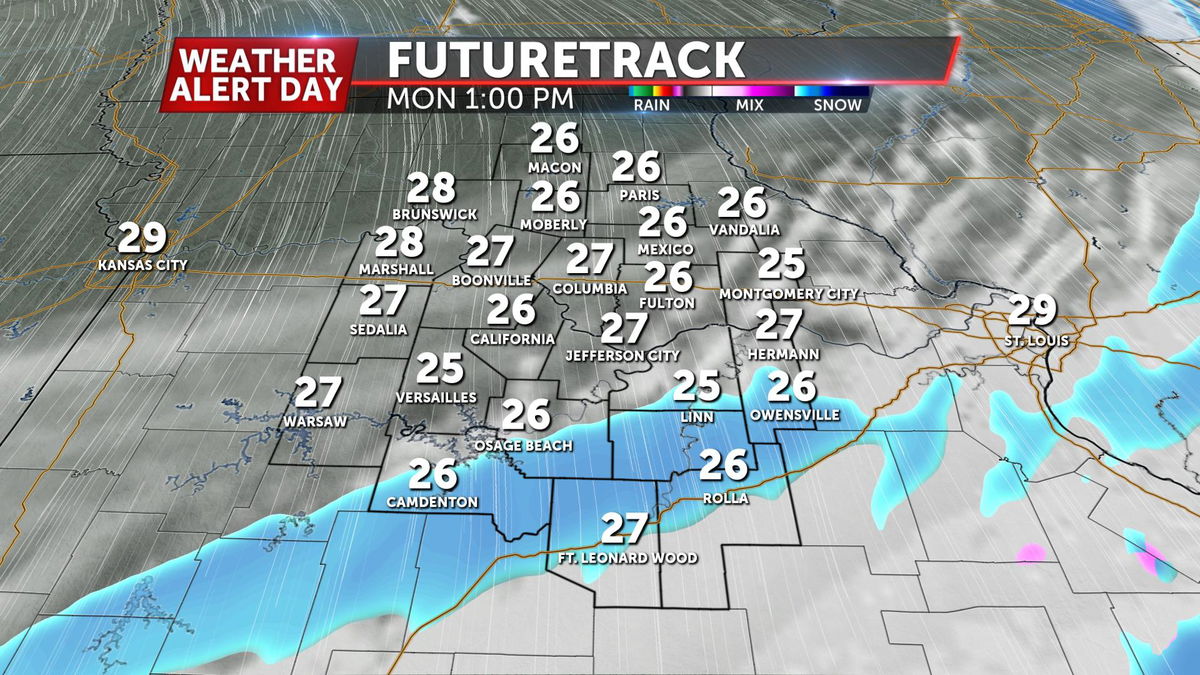
MONDAY MORNING UPDATE:
We were trying to pinpoint where we might see a band of heavier snow develop this morning. It looks like right along I-70 could be where we see some of the locally higher amounts. Here's a look at what has fallen through 10:00 AM according to radar:

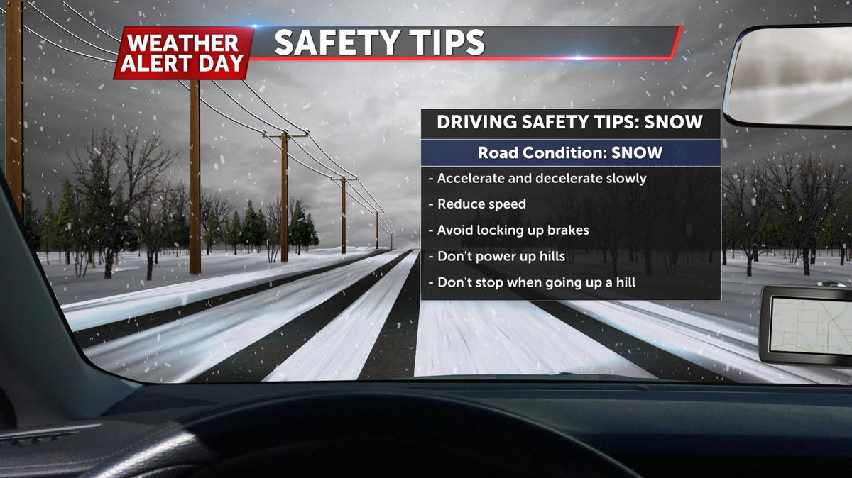
In some spots, this snow is coming down faster than the relatively warmer ground temperatures can get rid of it, leading to some roads with a light dusting on them. Don't be in a hurry if you're going to be out on the roadways today. With temperatures overnight falling to the low teens, could see these slick spots sticking around tomorrow morning as well.
WEEKEND UPDATE:
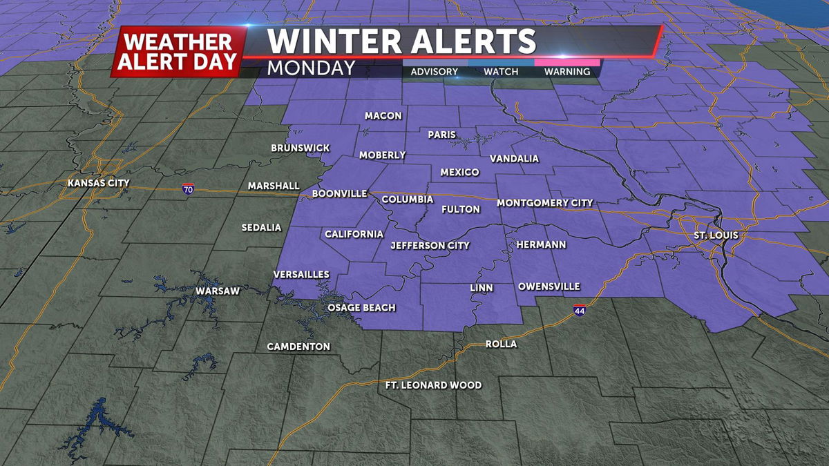
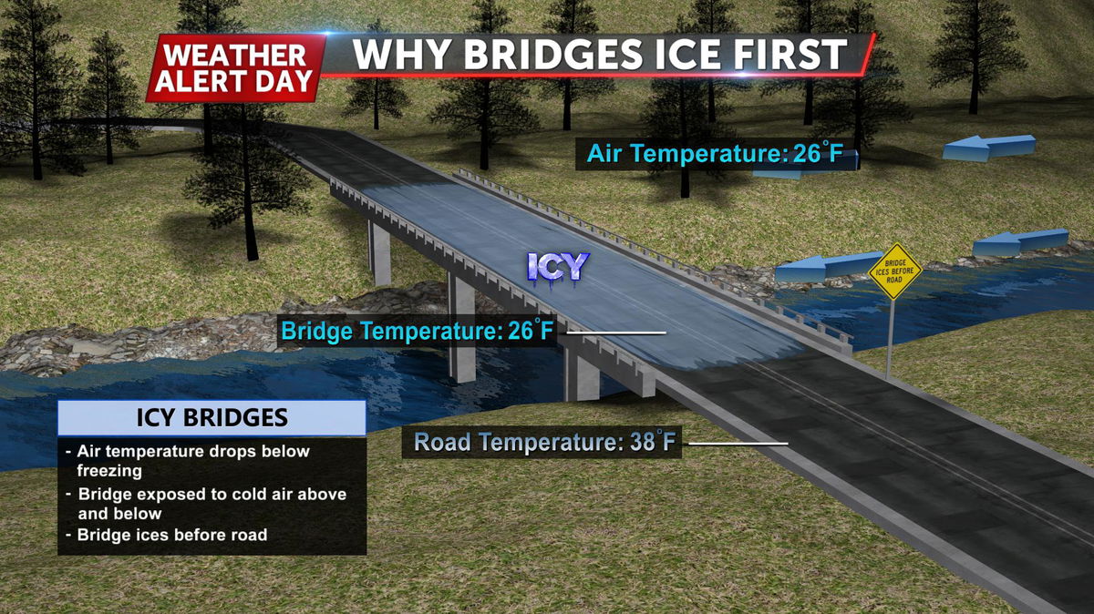
The National Weather Service has issued a Winter Weather Advisory for a healthy portion of the viewing area. It is looking like we could see some slippery conditions develop tomorrow morning around the morning commute. Rain will develop late tonight but as temperatures crash overnight, that's where the concern moves in. Any exposed roadway like bridges and overpasses could become slick as temperatures fall below freezing and moisture on those roads.
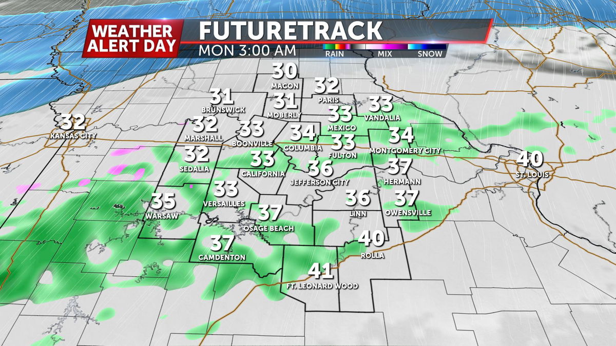
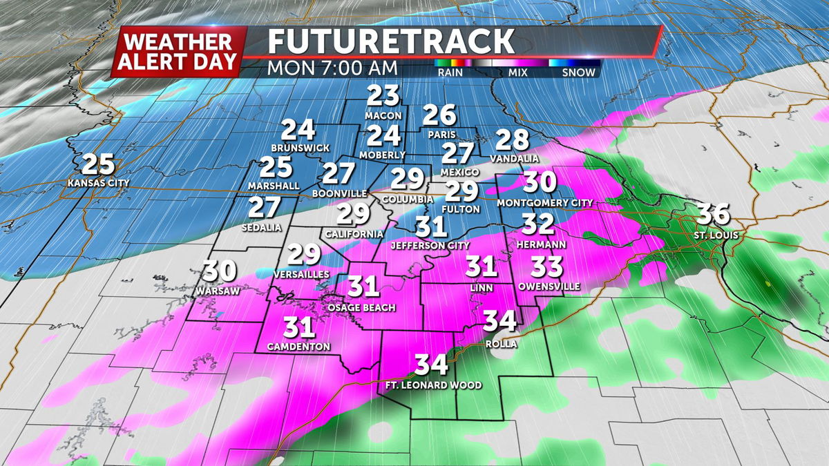
The latest timing has slid back a bit, with rain expected tonight, eventually transitioning over to a wintry mix close to the morning commute in the 6-8 time-frame before quickly sliding over to snow as temperatures cool off.
While snowfall amounts still look to be light in nature, the problem with the morning commute comes from the initial rain from the evening. We could see accumulations on grassy surfaces top out around 2" at most, but warm ground temperatures look to keep roadways from getting too slushy.
However, with moisture on the roads, temperatures look to fall below freezing before we can evaporate most of it off, which could lead to slick spots on those exposed roadways.
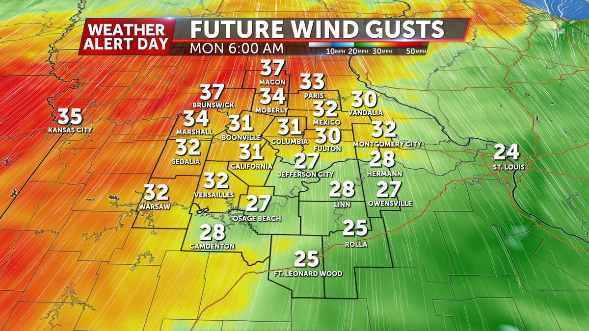
Making matters worse, a brutal wind out of the north will keep up throughout the afternoon, at times gusting up to 35 mph
OVERVIEW
The next arctic air mass will slide in as a strong cold front pushes through Mid-Missouri Sunday night into Monday. This will be the coldest air we have seen since early March when highs only topped out in the teens.
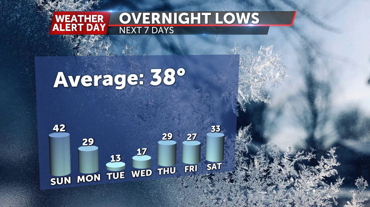
High temperatures are expected to range from the upper 20s to low 30s Monday and Tuesday, with overnight lows both nights in the low to mid-teens.
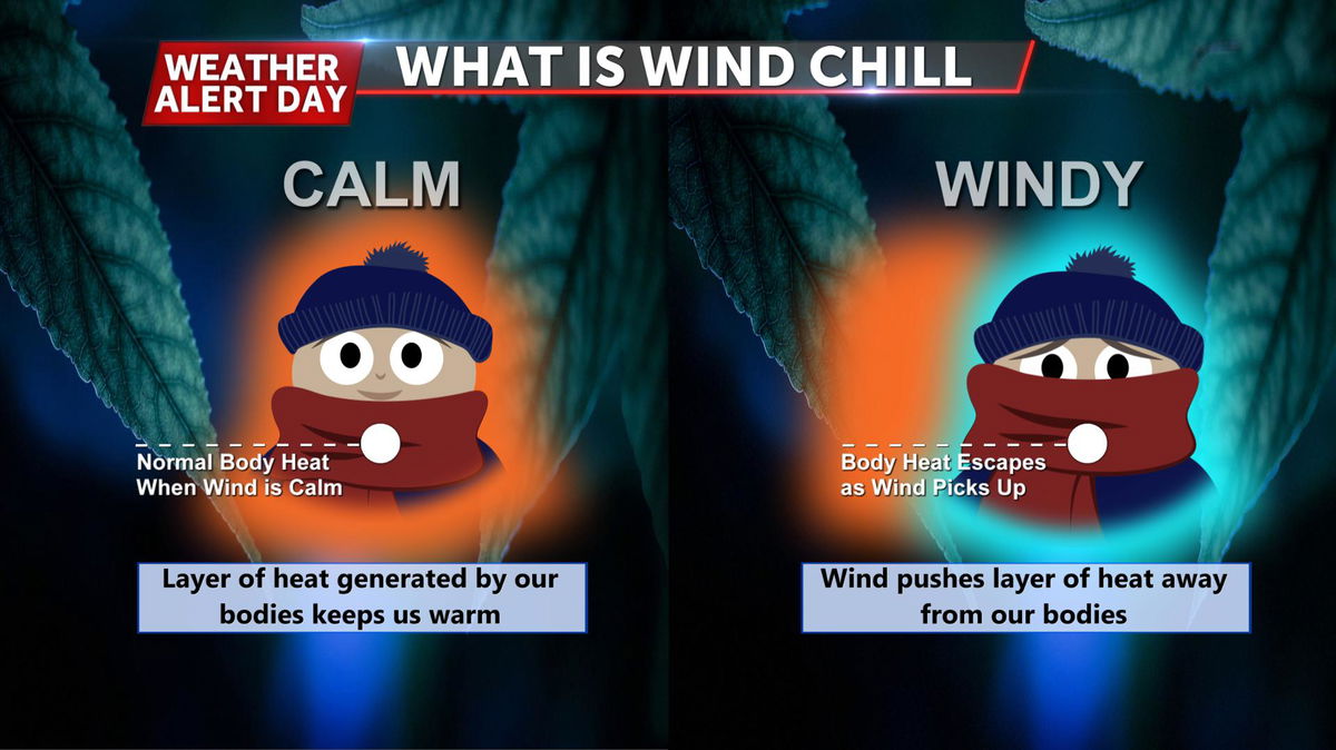
A strong breeze is expected as this cold front pushes across most of the country, leaving us with bitterly cold wind chills on Tuesday and Wednesday morning near zero or just above.
The jet stream continues to be in a northwest flow pattern, sending colder than normal temperatures and a few disturbances our way through next week. Highs only recover to the 40s by Thursday.
ABC 17 Stormtrack Meteorologist Luke Victor gave an update Friday morning of next week's weather pattern.
