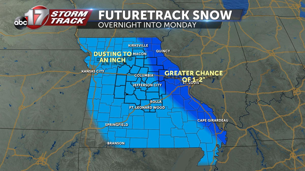
Dusting to an inch of snow overnight, some morning slick spots possible
After a brutally cold holiday weekend, Christmas Day will end with a quick hit of light snow across Mid-Missouri tonight into very early Monday morning.
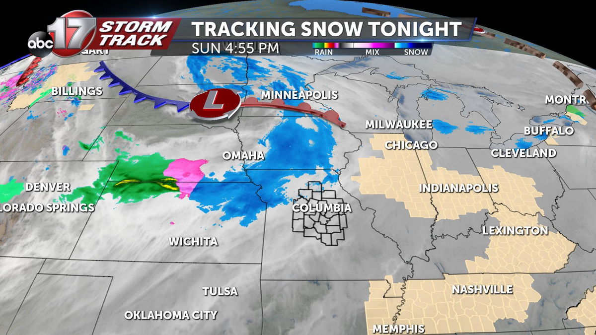
Precipitation is moving into northern Missouri this evening, with perhaps some freezing drizzle for western sections of the state before it all becomes snow area-wide. A Winter Weather Advisory is in effect for Pettis, Benton, Cooper, and Saline counties until midnight for this chance of a light glaze of ice on roads before light snow coats things overnight.
Snow showers will migrate from northwest to southeast from about 8:00 p.m. through 3:00 a.m. Snow will be done before sunrise, but with temperatures remaining in the mid-20s there could be some slick spots on the roads for any morning travelers.
A dusting to 1" of snow is likely for Mid-Missouri, with 1-2" possible for areas east of the Mississippi River. Give yourself some extra time if you have to hit the road early on Monday morning, and prepare for slow downs due to road crews applying treatment.
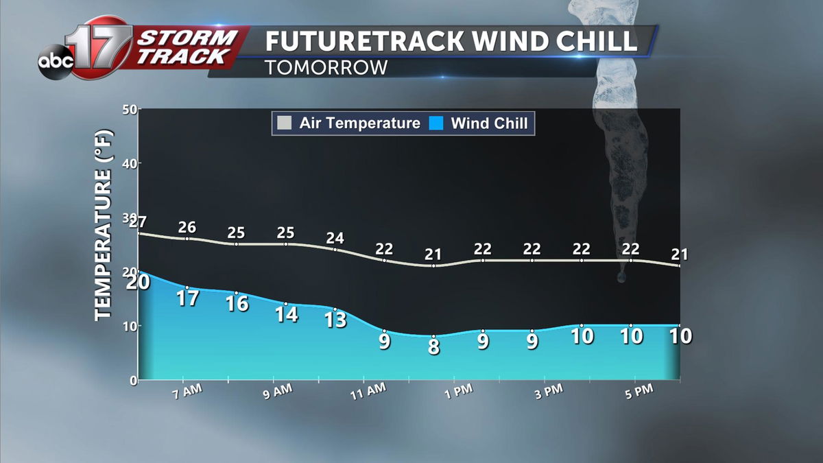
Road temperatures get to near freezing by late in the day, but air temperatures actually fall to about 20 degrees by late afternoon. Wind chills will be in the upper single digits to low teens through most of the day as northwest winds gust to 20 mph.
Conditions improve on Tuesday after a cold morning, with highs finally getting above freezing in the mid-30s.
