Cool Last Home Game; Tracking Warmer Temperatures
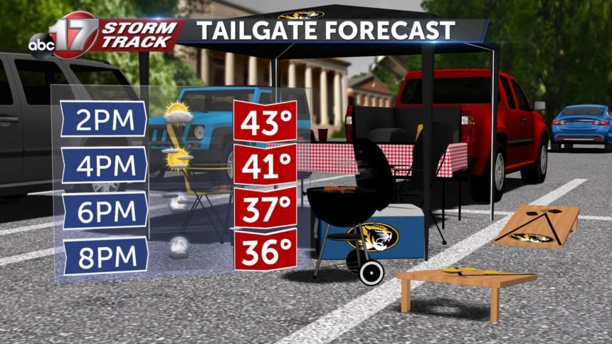
SATURDAY: We are starting the day off with a slight rain chance, some of us saw a glaze of ice on elevated surfaces from the overnight hours but that quickly melted away. Sky conditions will improve with gradually clearing clouds throughout the day. High is 43 degrees.
SATURDAY NIGHT: Mostly clear with a low near 30 degrees.
EXTENDED: The rest of the weekend will be much warmer thanks to a wind shift to be out of the southwest. Sunday we will get into the mid 50's staying above the seasonal average with mostly sunny skies. Those conditions will continue into the start of your work week with temperatures peaking in the upper 50's for Monday. A cold front will move through the area Tuesday bringing with it some rain chances and by Wednesday our temperatures will fall back down to the mid to upper 40's along with more cloudy conditions. These conditions will persist along with slight rain chances through the rest of the work week including Thanksgiving and Black Friday but the good news is that we should be staying above freezing during these times so frozen precipitation looks to stay away for the most part however, ruling out a stray flake or two is not out of the question.