WEATHER ALERT DAY: Dangerously cold for another morning
TUESDAY MORNING UPDATE: Try to avoid being on the roads, as conditions will struggle to improve and temperatures will be dangerously cold. If you need to venture out, know what you're going to do in case you slide off. Be prepared to survive the elements until help arrives.
The ABC 17 Stormtrack Weather Team has issued a Weather Alert Day with another round of snow and dangerously cold temperatures Monday and Monday night. Frostbite can occur in less than 30 minutes as cold as it will be.
SYNOPSIS
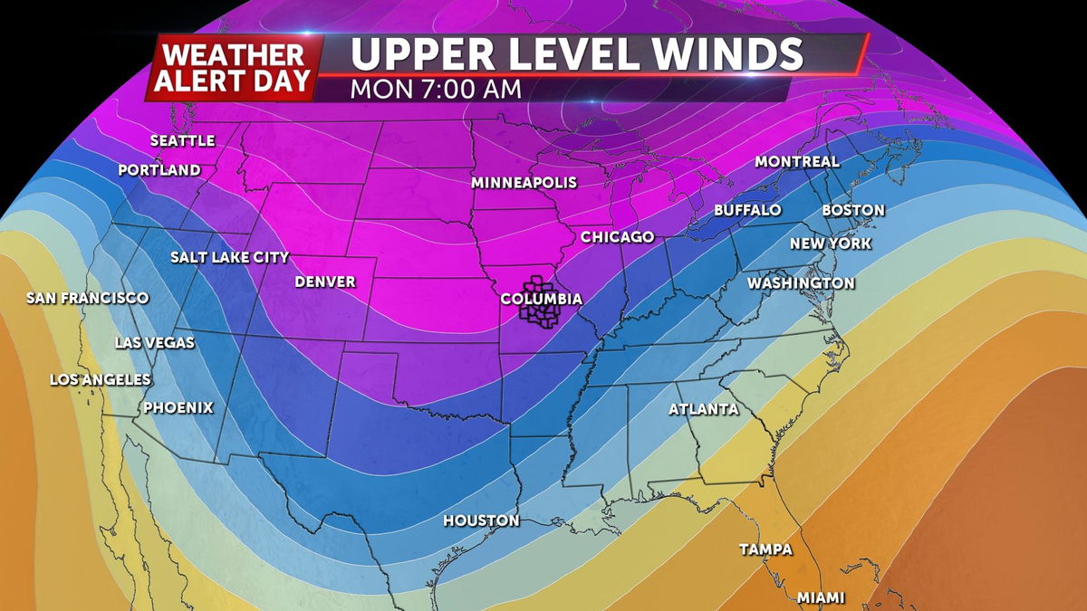
The Arctic air that invaded last weekend is getting some help. The Tropospheric Polar Vortex that keeps Polar air locked up around the Arctic Circle broke down last weekend and is going to rotate down some more of it. When the area of low pressure holding back the Arctic Air breaks down, that opens the gates for that air to move south.
TIMING
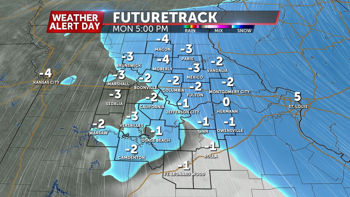
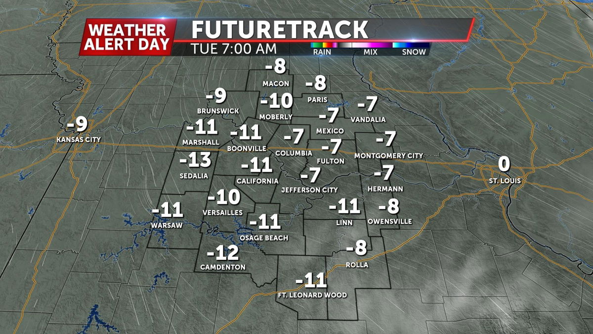
Despite light winds, the slight breeze continues to keep wind chills below zero Sunday afternoon as air temperatures are in the single digits. Overnight, wind chills drop to anywhere between 15-25 degrees below zero with air temperatures dropping to about -5. Frigid wind chills are expected through Tuesday.
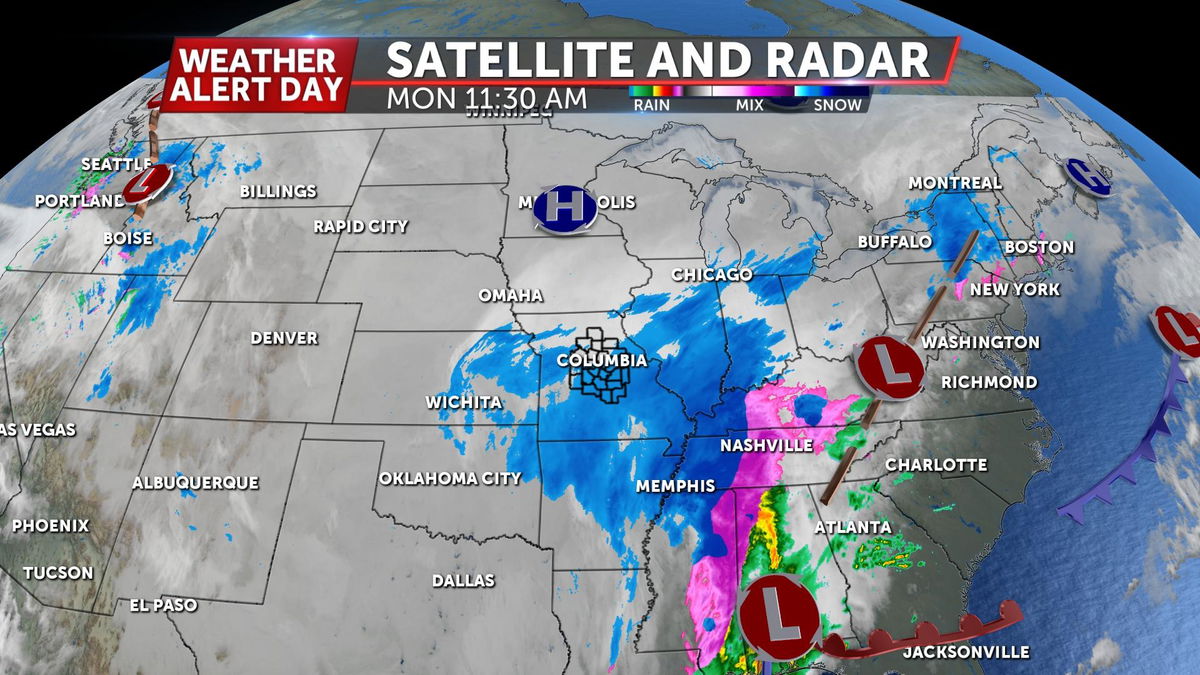
As far as our chances for snowfall, snow showers will come in multiple waves. The first wave has been diminishing as it loses energy over Mid-Missouri this afternoon. We'll have a break for a few hours until this evening as the second push of snow moves in from the south after sunset. Steady snowfall is expected overnight through early Monday morning. We could get a brief break through mid-late Monday morning before a third and final round of snow moves in by the lunch hour Monday and tapers off before the evening commute.
IMPACTS
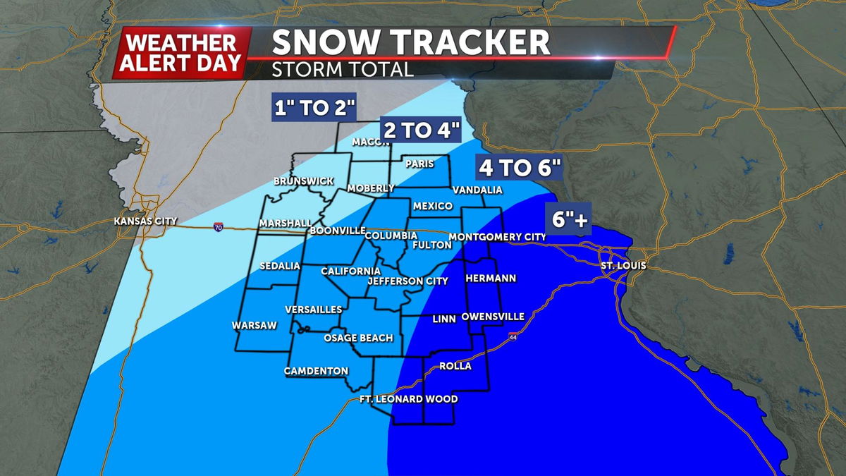
Accumulation will be highest for areas near the Lake of the Ozarks and I-44 where snow will be heavier and longer-lasting. Amounts will lessen the farther northwest you go, with Columbia in the 4-6" range, and potentially slightly higher amounts near and around Jefferson City. Amounts will range from about 2-4" from Moberly to Macon. Travel conditions will worsen throughout the day. Slick conditions are expected along with low visibility and dangerously cold temperatures. If you need to be out on the roads, have a backup plan in case you get stranded. These temperatures become deadly when stuck in them.
HOW TO PREPARE
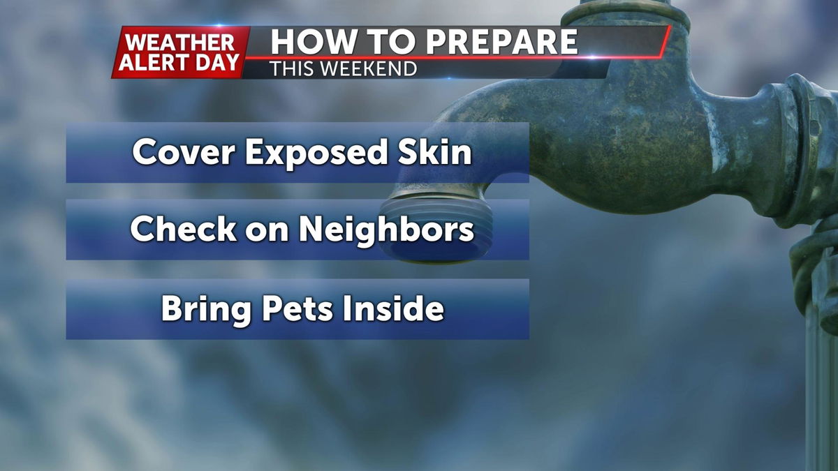
With wind chill values that low, frostbite can occur in less than 30 minutes on exposed skin. Hypothermia is also a real concern for those not properly dressed and exposed to the elements. Wearing multiple layers helps trap the body heat much more effectively. As always, check in on those that might be more susceptible to these extreme conditions.
Columbia's warming centers include:
- ARC (Activity and Recreation Center), 1701 W. Ash St.
- Boone County Government Center, 801 E. Walnut St.
- Columbia/Boone County Public Health and Human Services, 1005 W. Worley St.
Columbia's official shelters include:
- Room at the Inn, visit roomattheinncomo.org for dates and locations
- Salvation Army Harbor House (men, women and families), 602 N. Ann St.
- St. Francis House (for men), 901 Range Line St. - no availability at this time
- Lois Bryant House (women and families), 913 Range Line St. - no availability at this time
- Rainbow House (for children/youth), 1611 Towne Dr.
- True North (for domestic violence), please call 573.875.1370
- Welcome Home (for veterans), 2120 Business Loop 70 E.
WHEN WILL IT IMPROVE
Unfortunately, we won't be jumping out of the freezer quickly. In the short term, it's going to stay cold, but not as bad Tuesday and Wednesday. There's some sign that we could see the freezing mark finally towards the end of next week. Long term data looks like it should get back closer to normal, with the Arctic Air getting bottled back up.
Watch a replay of a 3 p.m. forecast and weather conditions update in the player below.
